1904 Map of Llano
USGS Topo · Published 1904About this map
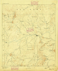
Llano serves as the hub of this Central Texas landscape, situated where the Llano River meets the Houston and Texas Central RR. Surveyed at the turn of the century, the topography reveals a transition from ranching operations like Kuykendall's Ranch and Atkinson's Ranch to early industrial ventures. The extraction of local resources is clearly marked at the Iron Mine, a Marble Quarry, and a Graphite deposit, indicating the mineral wealth of the Llano Uplift during this era.
Find a feature on this map
127 named features on this map. Tap any name to fly to it.
Don’t see what you’re looking for? This feature index may not catch every label — zoom into the map to look around manually.
Map Details
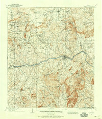
Editions of this 1904 Llano Map
This is the sole edition of this map. No revisions or reprints were ever made.
Historical Maps of Llano Through Time
10 maps found