1960s Maps of Milam County, Texas
Explore 28 historic maps of Milam County from the 1960s. These maps offer a rare glimpse into what life looked like during the 1960s — showing old roads, neighborhoods, homes, and landmarks that have changed or disappeared over time.
Whether you're researching your family's past, planning a metal detecting trip, or studying how Milam County's landscape evolved across the 1960s, these high-resolution maps are a powerful tool for exploring the history of this region.
- Focus on a specific era: All maps on this page are from the 1960s, giving you a focused view of this time period.
- See what’s changed: Compare century-old streets, trails, and buildings to today's modern landscape using overlays and satellite layers.
- Research with precision: Use these maps for genealogy, historical research, land use analysis, or educational projects.
- View, download, or print: Maps are fully viewable online in high resolution, and can be downloaded or printed for your own records.
Start exploring Milam County's history through authentic maps from the 1960s. This is your window into the past.
Milam County, TX maps
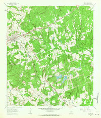
(28)- 1961 Map of Mumford, 1964 Print
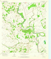
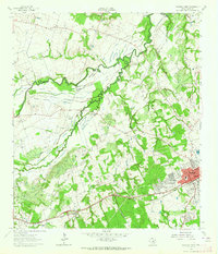
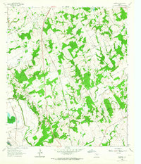
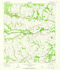
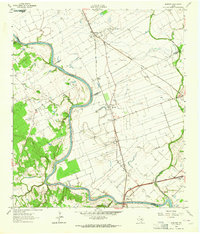 1961 Mumford1964 Print · USGSThe Brazos River valley in the early sixties is a landscape of rural junctions and historic outposts at the meeting point of four counties. Researchers can locate the Fort Tenoxtitlan (Site), the rail sidings at Mudville, and local landmarks like Smith Sch.3 unique versions available
 - 1961 Map of Hanover, 1964 Print
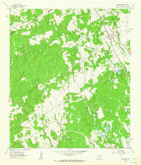
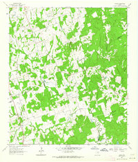
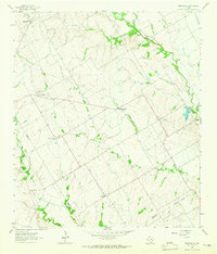
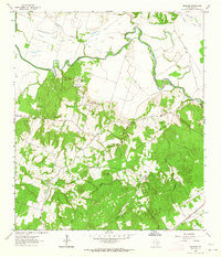 1961 Hanover1964 Print · USGSMilam County during the early sixties reveals a landscape of winding river bottoms and upland rural communities. Researchers can trace family history through sites like Oksheer-Smith Cem, the settlement of Hanover, and the White Oak Ridge Ch.2 unique versions available
 - 1961 Map of Cameron, 1964 Print
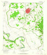
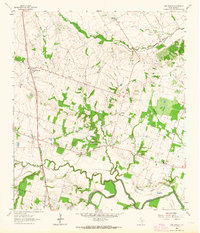
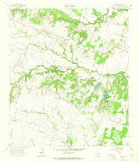
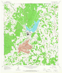
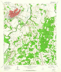 1961 Cameron1964 Print · USGSMilam County centers on the rail-and-river economy of the early sixties, where the Gulf Colorado and Santa Fe meets the winding Little River. Genealogists and local historians can trace family-named sites like Burnham-McCowen Cem or the rural settlement at Hoyte.3 unique versions available
 - 1961 Map of Rockdale East, 1964 Print
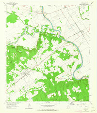
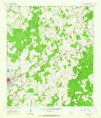 1961 Rockdale East1964 Print · USGSThe eastern edge of Rockdale and the surrounding Milam County prairie are captured in the early sixties, showing a landscape defined by rail lines and rural community centers. Family historians can trace local landmarks like Aycock Sch, San Jose Cem, and Mt Zion Ch.3 unique versions available
 - 1961 Map of Baileyville, 1964 Print
 1961 Baileyville1964 Print · USGSIn the early sixties, this rural intersection of Milam, Falls, and Robertson Counties was defined by its winding river bottomlands and family farmsteads. Researchers can locate family landmarks like Bozeman Cem, Morning Star Ch, and the Hooper Ranch.2 unique versions available
 - 1961 Map of Hearne South, 1964 Print
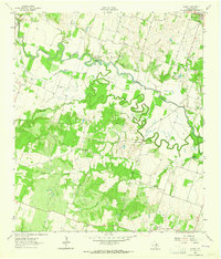
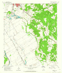 1961 Hearne South1964 Print · USGSRailroad operations in the Brazos Valley defined the early 1960s landscape near the Milam and Robertson County line. Genealogists and local historians can trace the footprint of rural communities through sites like Tatsie Crossing, St Luke Cem, and the Blackshear High Sch.3 unique versions available
 - 1962 Map of Goodwill, 1963 Print
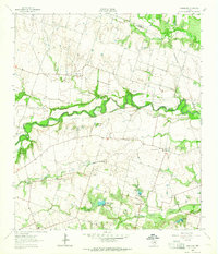
 1962 Goodwill1963 Print · USGSThe rural borderlands of Burleson and Milam counties are captured here in the early 1960s, centered on the community of Hix. Genealogists and local historians can trace the foundations of this area through St Mathews Ch, the Hix Cem, and family-named hollows like Bailey Hollow.2 unique versions available
 - 1962 Map of Calvert, 1964 Print
 1962 Calvert1964 Print · USGSCentral Robertson County's agricultural and rail heart is captured here in the early sixties. Researchers can trace family roots through the Calvert Cem, identify local schools like Spikes High Sch, and locate rural settlements near Marvin and Barton.3 unique versions available
 - 1962 Map of Rockdale West, 1964 Print
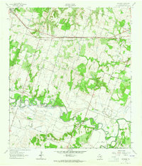
 1962 Rockdale West1964 Print · USGSMilam County in the early sixties shows the growth of Rockdale alongside traditional Texas river-bottom farming. Genealogists and historians can trace family locations through numerous sites like Hickory Grove Cem, Bushdale Cem, and Tracy.3 unique versions available
 - 1962 Map of Pettibone, 1964 Print
 1962 Pettibone1964 Print · USGSMilam County rural life in the early sixties centers on the rail lines and the winding river bottomlands. Family historians can trace ancestral sites like Dockery Cem, Hall Cem, and the community of Pettibone along the rail corridor.2 unique versions available
 - 1962 Map of Maysfield, 1964 Print
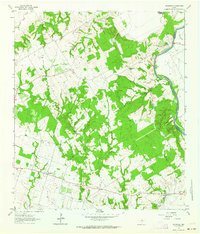 1962 Maysfield1964 Print · USGSMilam County farming communities and the Brazos River valley are captured here in the early sixties. Researchers can locate numerous family-history sites like Harlin Chapel Cem, the Maysfield Sch, and the riverside crossing at Black Bridge.2 unique versions available
 - 1962 Map of Rosebud, 1964 Print
 1962 Rosebud1964 Print · USGSCentral Texas farming and rail life are captured here in the early sixties, centered on the Rosebud area. Researchers can trace family sites at Powers Chapel, Burlington Cem, and St Michaels Cem, or locate the historic Southern Pacific rail line.2 unique versions available
 - 1962 Map of Hammond, 1964 Print
 1962 Hammond1964 Print · USGSThe rural Robertson County landscape comes alive in this early 1960s survey, showing a time when small communities were still centered around their country schools and churches. Genealogists and historians can trace family roots through landmarks like Hammond High Sch, Bethlehem Cem, and Mt Moriah Ch.3 unique versions available
 - 1962 Map of Chriesman, 1964 Print
 1962 Chriesman1964 Print · USGSSettled along the tracks in Burleson County during the early sixties, this area shows a landscape shaped by rail and creek. Genealogists can trace family landmarks like Chriesman Cem, Liberty Ch, and the old Shiloh Sch.3 unique versions available
 - 1962 Map of Ben Arnold, 1964 Print
 1962 Ben Arnold1964 Print · USGSMilam County in the early 1960s is shown here as a landscape of small rail-side settlements and family farms. Genealogists can trace local roots at Elm Grove Cem, Walkers Creek Sch, and the quiet crossing at Silver City.2 unique versions available
 - 1962 Map of Gause, 1964 Print
 1962 Gause1964 Print · USGSMilam and Robertson counties are captured here in the early sixties as the rail and river networks defined local life. Trace the old river port at Port Sullivan or locate ancestral sites like Nashville Cem and Stephen Chapel near the town of Gause.2 unique versions available
 - 1962 Map of Milano, 1964 Print
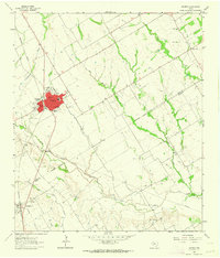
 1962 Milano1964 Print · USGSRailroad history and rural community life converge in early 1960s Texas at the busy junction of the Missouri Pacific and Santa Fe lines. Local researchers can trace family roots through landmarks like Sand Grove Ch, Hurt Cem, and the settlement at Elevation.2 unique versions available
 - 1962 Map of Hicks, 1964 Print
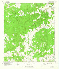
 1962 Hicks1964 Print · USGSThe tri-county junction of Milam, Lee, and Burleson counties is captured in the early sixties as a landscape of rural industry and community. Researchers can trace family history at Harmony Cem or locate the old Railroad Grade and Hicks Mine.2 unique versions available
 - 1963 Map of Sharp, 1964 Print
 1963 Sharp1964 Print · USGSMilam County in the early sixties was a landscape of meandering river bends and small community anchors. Genealogists can trace family roots at Sharp Cem and McFarland Cem, or locate landmarks like the GC & SF rail line and Hall Sch.3 unique versions available
 - 1963 Map of Friendship, 1964 Print
 1963 Friendship1964 Print · USGSWilliamson County rural life is captured here in the early sixties, as the river valley settlements were being prepared for controlled inundation. Local historians can trace family-named sites like Wuthrich Hill, the Allison Cem, and the communities of Friendship and Laneport.2 unique versions available
 - 1963 Map of San Gabriel, 1964 Print
 1963 San Gabriel1964 Print · USGSMilam and Williamson counties appear here in the early sixties as a landscape of river-bottom farms and small rural outposts. Genealogists and local historians can trace legacy sites like Hamilton Cem, Johns Ch, and the community at San Gabriel.2 unique versions available
 - 1963 Map of Yarrelton, 1965 Print
 1963 Yarrelton1965 Print · USGSCentral Texas farmland near the Milam and Bell county lines is captured here in the early sixties. Genealogists and local historians can trace family homesteads near Yarrelton, Marak, and the Cem at North Elm.2 unique versions available
 - 1963 Map of Westphalia, 1965 Print
 1963 Westphalia1965 Print · USGSTexas farming communities at the Falls and Bell County line come to life in this mid-century portrait of a rural landscape. Genealogists and researchers can trace local roots at St Marys Cem, the settlement of Zipperlandville, and St Joseph Cem.2 unique versions available
 - 1963 Map of Davilla, 1965 Print
 1963 Davilla1965 Print · USGSBell and Milam counties in the early sixties remained a landscape of quiet rural settlements and family-named landmarks. Genealogists can trace family footprints at Davilla Cem, locate the former Donahoe Sch, or find the springs that fed Stigall Lake No 1.2 unique versions available
 - 1963 Map of Alcoa Lake, 1966 Print
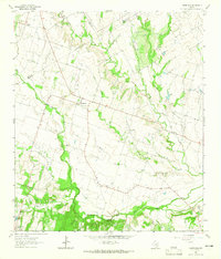
 1963 Alcoa Lake1966 Print · USGSThe Milam and Lee County border undergoes an industrial shift in the early sixties. Researchers can trace the massive Strip Mine operations at Sandow or locate rural family sites like Richards Cem and Holliman Cem.2 unique versions available
Showing maps 1-25 of 28
Top cities of Milam County
- Rockdale historical maps
- Cameron historical maps
- Thorndale historical maps
- Buckholts historical maps
- Milano historical maps
Frequently asked questions
- What are the different types of historical maps available for Milam County?
- What is the oldest map of Milam County?
- Where can I purchase historical maps of Milam County for my home or office?
- Where can I download high-res historical maps of Milam County?
- Are there historical topographic maps available for Milam County?
- Is there historical aerial imagery available for Milam County?
- Where are historical maps of Milam County sourced from?