1900s (20th Century) Maps of Mitchell County, Texas
Explore 32 historic maps of Mitchell County from the 1900s (20th Century). These maps offer a rare glimpse into what life looked like during the 1900s — showing old roads, neighborhoods, homes, and landmarks that have changed or disappeared over time.
Whether you're researching your family's past, planning a metal detecting trip, or studying how Mitchell County's landscape evolved across the 1900s, these high-resolution maps are a powerful tool for exploring the history of this region.
- Focus on a specific era: All maps on this page are from the 1900s, giving you a focused view of this time period.
- See what’s changed: Compare century-old streets, trails, and buildings to today's modern landscape using overlays and satellite layers.
- Research with precision: Use these maps for genealogy, historical research, land use analysis, or educational projects.
- View, download, or print: Maps are fully viewable online in high resolution, and can be downloaded or printed for your own records.
Start exploring Mitchell County's history through authentic maps from the 1900s. This is your window into the past.
Mitchell County, TX maps
(32)- 1950 Map of Cedar Bend
 1950 Cedar Bend1950 Print · USGSThe Colorado River valley north of Colorado City reveals a mid-century landscape of oil extraction and rural settlement. Researchers can trace family history at Handley Cem or locate industrial landmarks like the Colo-Tex Refinery and the Texas and Pacific rail line.3 unique versions available
 - 1950 Map of Lake Colorado City, 1952 Print
 1950 Lake Colorado City1952 Print · USGSTexas ranching and utility infrastructure intersect at Lake Colorado City during the early fifties. Researchers can trace family sites at Spade Cem, locate the Dorn Sch (Abandoned), or follow the winding Colorado River to Horseshoe Bend.3 unique versions available
 - 1950 Map of Colorado City SE, 1952 Print
 1950 Colorado City SE1952 Print · USGSMitchell County in the early fifties shows a rugged West Texas landscape shaped by the Colorado River and its complex creek systems. Researchers can trace rural landmarks including the Seven Wells Monument, Payne Ch, and the Looney Sch.
 - 1951 Map of Ira SW
 1951 Ira SW1951 Print · USGSTexas ranching and early petroleum development meet in the early 1950s where four counties converge. Trace the landscape of the Conrad Ranch, find the Colorado River, and locate industrial markers like the Oil Well and Oil Tanks.2 unique versions available
 - 1951 Map of Ira
 1951 Ira1951 Print · USGSScurry County's landscape in the early fifties was defined by the winding Colorado River and the expanding energy sector. Genealogists and historians can trace the settlement at Ira, find family markers at Ira Cem, and locate early Oil Wells across the Sharon Bluff Oil Field.2 unique versions available
 - 1951 Map of Dunn
 1951 Dunn1951 Print · USGSThe Scurry County oil fields take center stage in the early fifties, showing the industrial landscape along the Colorado River. Trace the development of Dunn and Ira alongside landmarks like Sharon Ridge and the local Cem.2 unique versions available
 - 1951 Map of Vincent, 1953 Print
 1951 Vincent1953 Print · USGSThe ranching and oil country of Howard and Mitchell Counties is captured here in the early fifties. Genealogists and local historians can locate Vincent and the Vincent Cem, or trace the path of Morgan Creek past various windmills and early oil wells.2 unique versions available
 - 1951 Map of Iatan, 1979 Print
 1951 Iatan1979 Print · USGSMid-century Howard County shows a landscape defined by the arrival of the railroad and the growth of the oil industry. Genealogists and historians can trace the Iatan Cem, the settlement of Iatan, and industrial features like the Tank Farm and Rattlesnake Gap.
 - 1952 Map of Iatan
 1952 Iatan1952 Print · USGSHoward County's petroleum and ranching landscape is captured here in the early fifties, as the oil industry expanded across the West Texas plains. Researchers can trace the mid-century infrastructure of the East Field, the Iatan Cem, and the path of the Texas and Pacific railroad.
 - 1952 Map of Cuthbert
 1952 Cuthbert1952 Print · USGSMid-century Mitchell County is captured here during a period of industrial and agricultural expansion. Local historians can trace the development of the OIL FIELD alongside community landmarks like Carr Sch, Butler Camp, and Butler Lake.
 - 1952 Map of Westbrook
 1952 Westbrook1952 Print · USGSWestbrook and its surrounding Mitchell County oil fields are captured here during the post-war energy boom. Researchers can trace family history at Westbrook Cem or locate industrial landmarks like the Abandoned Tank Farm and Conaway Sch.
 - 1952 Map of China Grove, 1953 Print
 1952 China Grove1953 Print · USGSScurry County ranching and rural life are preserved here in the early fifties, just as petroleum infrastructure began to mark the land. Genealogists can locate China Grove, German Sch, and the Roscoe Snyder and Pacific rail line.3 unique versions available
 - 1952 Map of Colorado City, 1953 Print
 1952 Colorado City1953 Print · USGSColorado City and the surrounding Mitchell County plains are captured here in the early fifties, showing a landscape defined by the Texas and Pacific railroad. Genealogists can locate family landmarks like Zions Rest Cem, Faith Chapel, and the Longfellow Sch.2 unique versions available
 - 1954 Map of Big Spring, 1965 Print
 1954 Big Spring1965 Print · USGSWest Texas in the mid-1950s shows a landscape of growing oil towns and vital rail links along the Texas and Pacific RR. Researchers can trace the development of Big Spring, find smaller settlements like Knott and Lomax, or locate landmarks such as Boyds Chapel and Signal Mountain.4 unique versions available
 - 1958 Map of Big Spring
 1958 Big Spring1958 Print · USGSThe West Texas oil boom was in full swing during the late fifties, transforming the landscape around Howard and Mitchell counties. Genealogists and historians can trace the growth of Big Spring and Snyder alongside industrial landmarks like the Kelly-Snyder Oil Field and the Santa Fe rail lines.
 - 1959 Map of Pecan Crossing, 1960 Print
 1959 Pecan Crossing1960 Print · USGSMitchell County ranch land and the winding Colorado River are captured here in the late fifties. Genealogists and local historians can trace family-named landmarks like Forrest Lowe Tank and the small settlement at Lowe.
 - 1959 Map of Dam Draw, 1960 Print
 1959 Dam Draw1960 Print · USGSMitchell County energy and ranching are captured here in the late fifties. Researchers can trace the McCabe Oil Field and Panhandle and Santa Fe rail line past landmarks like Wimberley and Six Tank.3 unique versions available
 - 1959 Map of Silver, 1960 Print
 1959 Silver1960 Print · USGSMid-century Coke County is defined here by the booming Jameson Strawn Oil Field and the community of Silver. Genealogists and researchers can trace local family landmarks like McKenzie Cem and the Panhandle and Santa Fe rail line.3 unique versions available
 - 1959 Map of Spade Ranch, 1960 Print
 1959 Spade Ranch1960 Print · USGSMitchell County ranching operations are captured here in the late fifties, centered on the historic Spade Ranch. Local researchers can trace family-named landmarks and water sources like Beals Mtn, Mud Spring Windmill, and Wildhorse Creek.2 unique versions available
 - 1959 Map of McWhorter Mountain, 1960 Print
 1959 McWhorter Mountain1960 Print · USGSThe Mitchell and Sterling County line was a landscape of remote sheep camps and critical water management in the late fifties. Genealogists and historians can trace ranching heritage through dozens of named stock tanks like Old Boatright Tank and the isolated Powell Sheep Camp.
 - 1959 Map of Dead Indian Mountain, 1960 Print
 1959 Dead Indian Mountain1960 Print · USGSThe West Texas oil boom is in full swing at the end of the fifties as petroleum pipelines and wells spread across the Coke County line. Trace family ranching roots and industrial history through landmarks like Perkins Plant, Dead Indian Mountain, and the Old McWhorter Tank.
 - 1962 Map of Hyman NE, 1964 Print
 1962 Hyman NE1964 Print · USGSMitchell County ranchlands are captured here in the early sixties, showing the vital water and transit network of West Texas. Researchers can find working landmarks like Spring Sta, family-named water features like Vowell Tank, and the winding path of Beals Creek.2 unique versions available
 - 1963 Map of Buffalo Draw, 1964 Print
 1963 Buffalo Draw1964 Print · USGSThe West Texas rangeland along the Mitchell and Sterling County line is captured here in the early sixties, showing a landscape defined by deep draws and cattle ranching. Trace early landmarks like Knobhill Cem and seasonal water sources like Hyman Tank and Mustang Creek.
 - 1963 Map of Hayrick Mountain, 1964 Print
 1963 Hayrick Mountain1964 Print · USGSWest Texas ranching and energy interests intersect at the turn of the sixties where Howard, Mitchell, and Sterling Counties meet. Trace the lineage of local landmarks like Dipping Vat Tank, Rockwater Hole, and Patsy Windmill.
 - 1963 Map of Hyman, 1965 Print
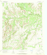 1963 Hyman1965 Print · USGSThe West Texas ranchlands and oil patches are captured here in the early 1960s as petroleum development expanded across the county line. Researchers can trace the infrastructure of the Hyman South Oil Field and locate family-named landmarks like Arrington Tank and Hamrick Tank.
Showing maps 1-25 of 32
Top cities of Mitchell County
Frequently asked questions
- What are the different types of historical maps available for Mitchell County?
- What is the oldest map of Mitchell County?
- Where can I purchase historical maps of Mitchell County for my home or office?
- Where can I download high-res historical maps of Mitchell County?
- Are there historical topographic maps available for Mitchell County?
- Is there historical aerial imagery available for Mitchell County?
- Where are historical maps of Mitchell County sourced from?