Old Maps of Dumas, Texas for Academic Research
Study the evolution of Dumas with 7 high-resolution historic maps. Whether you're teaching, researching, or modeling changes in land use, these maps provide essential visual documentation of urban, environmental, and geographic change.
- Analyze long-term change: Track patterns in development, transportation, and natural features.
- Ideal for environmental or urban studies: Support academic projects with primary historical map data.
- Use in the classroom or lab: Educators and researchers rely on these maps to bring historical context to life.
These maps are a powerful tool for teaching, research, and visualizing how Dumas has changed over the decades.
Dumas, TX maps
(7)- 1954 Map of Amarillo, 1966 Print
 1954 Amarillo1966 Print · USGSThe Texas Panhandle in the mid-1960s shows a landscape of rising industrial power and deep-rooted ranching tradition. Local historians can trace the paths of the Panhandle and Santa Fe railroad or locate sites like the Pantex Ordnance Plant and Mobeetie.2 unique versions available
 - 1958 Map of Amarillo
 1958 Amarillo1958 Print · USGSThe Texas Panhandle in the mid-1950s reveals a landscape of expanding military installations and oil-rich rail towns. Local historians can trace the development of Amarillo Air Force Base or locate smaller settlements like Magic City and New Mobeetie.
 - 1965 Map of Dumas South, 1966 Print
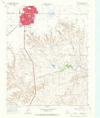 1965 Dumas South1966 Print · USGSMoore County ranching and civic life come into focus in the mid-1960s as the town of Dumas expands. Researchers can trace neighborhood schools like South Ward Sch or locate the sprawling Coon Ranch and Burnett Ranch to the south.
 - 1965 Map of Dumas North, 1966 Print
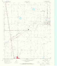 1965 Dumas North1966 Print · USGSMoore County industry and infrastructure are on full display in the mid-1960s as the energy sector reshapes the Panhandle. Trace the rail lines of the Atchison Topeka and Santa Fe past the Refinery, Smelter, and Dumas.
 - 1986 Map of Borger
 1986 Borger1986 Print · USGSThe Texas Panhandle's energy landscape is captured here in the mid-eighties, showing the intersection of industrial development and the Lake Meredith shoreline. Researchers can trace company-town heritage and rail history through sites like Signal Hill, Supreme Camp, and the Atchison Topeka and Santa Fe railroad line.2 unique versions available
 - 2022 Map of Dumas North, 2022 Print
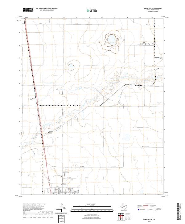 2022 Dumas North2022 Print · USGSNorthern Moore County in the early 2020s shows the expansion of Dumas and its surrounding agricultural network. Researchers can trace land use through named routes like Morton Elevator Rd and locate the Northlawn Memorial Gardens cemetery.
 - 2022 Map of Dumas South, 2022 Print
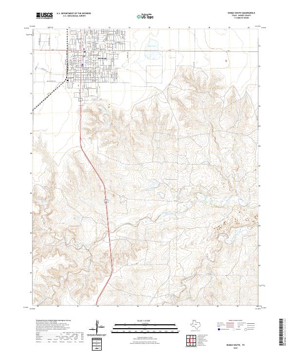 2022 Dumas South2022 Print · USGSDumas and the surrounding Moore County plains are captured in this recent survey, showcasing the city's modern street grid and drainage. Trace local history through Moore County Courthouse, Dumas Cem, and the reaches of Big Blue Creek.
End of results
Showing maps 1-7 of 7
Top cities near Dumas
Frequently asked questions
- What are the different types of historical maps available for Dumas?
- What is the oldest map of Dumas?
- Where can I purchase historical maps of Dumas for my home or office?
- Where can I download high-res historical maps of Dumas?
- Are there historical topographic maps available for Dumas?
- Is there historical aerial imagery available for Dumas?
- Where are historical maps of Dumas sourced from?