Old Maps of Moore County, Texas for Hiking & Exploration
Hike through history with 197 historic maps of Moore County. Explore old trails, ghost towns, and forgotten backroads — perfect for outdoor adventurers and local explorers.
- Rediscover forgotten places: Map out old mining camps, roads, and footpaths that no longer exist on modern maps.
- Layer with modern tools: Combine with LiDAR or satellite views to plan hikes through historical terrain.
- Made for exploration: Popular among hikers, overlanders, and local history lovers.
Use these maps to find adventure and explore the hidden past of Moore County.
Moore County, TX maps
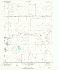
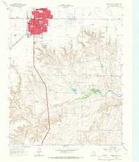
(197)- 1936 Map of Fourways
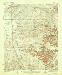 1936 Fourways1936 Print · USGSThe High Plains of the Texas Panhandle are captured here in the mid-1930s as a landscape of sprawling cattle ranches and emerging industrial sites. Researchers can locate specific family landmarks like Sneeds Ranch and Masterson Ranch or trace the early path of the Panhandle and Santa Fe railroad.2 unique versions available
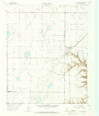
 - 1939 Map of Sanford
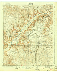 1939 Sanford1939 Print · USGSThe Texas Panhandle comes alive in the late 1930s as ranching and oil industries converge along the Canadian River. Researchers can trace the layout of Fritch and Sanford, or locate family landmarks like Deahl Ranch and Ingerton Ranch.2 unique versions available
 - 1953 Map of Sanford
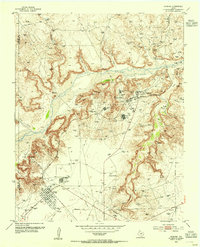 1953 Sanford1953 Print · USGSIn the early 1950s, the Texas Panhandle was a landscape of rapid energy growth centered on the Canadian River. Researchers can trace the industrial footprint of the Merchant Oil Field and find historic sites like Sanford Cemetery and the Oil City School (Aband).
 - 1953 Map of Marsh, 1954 Print
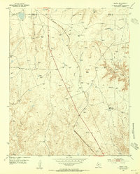 1953 Marsh1954 Print · USGSThe Texas Panhandle comes alive in the 1950s as a hub of energy and rail transport at the Potter and Moore county line. Trace the industrial footprint of the Panhandle and Santa Fe (At&Sf) Railway and the Fain Compressor Sta amid landmarks like John Ray Butte.2 unique versions available
 - 1953 Map of Alibates Ranch, 1954 Print
 1953 Alibates Ranch1954 Print · USGSPotter County ranching and the early energy industry come into focus in the early 1950s along the Canadian River. Researchers can trace the layout of the McBride Ranch, Bivins Camp, and the Turkey Creek Plant.
 - 1953 Map of Evans Canyon, 1954 Print
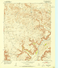 1953 Evans Canyon1954 Print · USGSMoore County ranching and early energy development are captured here during the early fifties. Genealogists and historians can locate family holdings like Record Ranch and Ozier Ranch or trace the rugged breaks of Evans Canyon.
 - 1953 Map of Deal, 1954 Print
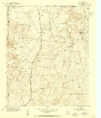 1953 Deal1954 Print · USGSThe Texas Panhandle in the early fifties was a landscape of expansive cattle spreads and critical rail infrastructure. Trace the Rock Island Line past Poling Ranch and Bennett Ranch, or locate industrial landmarks like the Huber Water Sta.
 - 1953 Map of Masterson, 1954 Print
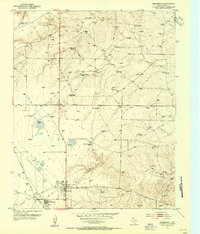 1953 Masterson1954 Print · USGSThe Texas Panhandle's mid-century energy boom comes alive in this survey of the high plains north of the Canadian River. Researchers can trace industrial genealogy at Masterson and Exell or locate family rangelands like Terry Thompson Ranch and Brent Ranch.2 unique versions available
 - 1953 Map of McDowell Creek, 1954 Print
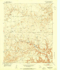
 1953 McDowell Creek1954 Print · USGSThe Texas Panhandle ranching country of the early fifties is defined here by the deep carved canyons of the Canadian River. Genealogists and researchers can locate remote outposts like Scott Headquarters Ranch and a solitary Grave along McDowell Creek.
 - 1953 Map of Spencer Draw, 1954 Print
 1953 Spencer Draw1954 Print · USGSMoore County in the early fifties is captured during a period of intense energy development and cattle ranching. Researchers can trace the network of Gas Well sites and Pipe Line corridors alongside family landmarks like Browns Ranch and Weymouth Ranch.2 unique versions available
 - 1954 Map of Tucumcari, 1965 Print
 1954 Tucumcari1965 Print · USGSThe high plains along the New Mexico and Texas border come alive in this mid-century survey, just as the regional highway network was maturing. Trace the historic route of U.S. 66 through Glenrio and San Jon or locate remote rail sidings like Rehm Station and Obar.2 unique versions available
 - 1954 Map of Perryton, 1966 Print
 1954 Perryton1966 Print · USGSThe High Plains of the Texas and Oklahoma panhandles are shown during a period of steady growth in the mid-1950s. Genealogists and researchers can trace rail history and local landmarks like Panhandle A & M College, Spurlock Chapel, and the isolated Lord Station.3 unique versions available
 - 1954 Map of Amarillo, 1966 Print
 1954 Amarillo1966 Print · USGSThe Texas Panhandle in the mid-1960s shows a landscape of rising industrial power and deep-rooted ranching tradition. Local historians can trace the paths of the Panhandle and Santa Fe railroad or locate sites like the Pantex Ordnance Plant and Mobeetie.2 unique versions available
 - 1954 Map of Dalhart, 1967 Print
 1954 Dalhart1967 Print · USGSThe High Plains at the junction of four states come alive in the mid-fifties, showing a landscape of rail-hub towns and cattle country. Trace the Old Santa Fe Trail or locate mid-century industrial sites like the Dry ice plant and Carbon Dioxide Works.2 unique versions available
 - 1958 Map of Perryton
 1958 Perryton1958 Print · USGSThe Oklahoma Panhandle and Texas borderlands come alive in this mid-century survey, showing the vital rail-and-ranch economy of the High Plains. Researchers can trace historic stops along the Chicago Rock Island and Pacific and locate rural landmarks like Bethel Church and Spurlock Chapel.
 - 1958 Map of Amarillo
 1958 Amarillo1958 Print · USGSThe Texas Panhandle in the mid-1950s reveals a landscape of expanding military installations and oil-rich rail towns. Local historians can trace the development of Amarillo Air Force Base or locate smaller settlements like Magic City and New Mobeetie.
 - 1958 Map of Tucumcari
 1958 Tucumcari1958 Print · USGSEastern New Mexico and the Texas Panhandle meet in this mid-century survey of the high plains ranching and rail corridor. Researchers can trace the path of Mother Road travelers through Tucumcari and Glenrio or locate remote rail stops like Nara Visa Station and Hartley Station.
 - 1958 Map of Dalhart
 1958 Dalhart1958 Print · USGSThe High Plains of the tri-state border region come alive in this mid-century survey of the ranching and rail territory around the Texas Panhandle. Genealogists and historians can trace the paths of the Atchison Topeka & Santa Fe Ry, military outposts like Dalhart Air Force No 1, and early settlements such as Pasamonte and Texline.2 unique versions available
 - 1962 Map of Dalhart
 1962 Dalhart1962 Print · USGSThe High Plains and volcanic peaks of the tri-state area are shown in detail during the early sixties. Genealogists and historians can trace the rail corridors of the Fort Worth and Denver and find industrial sites like the Cactus Ordnance Works or the Beaver Meade & Englewood Grain Elevator.
 - 1963 Map of Cactus East, 1966 Print
 1963 Cactus East1966 Print · USGSThe High Plains industry of the early sixties comes into focus at the intersection of Sherman and Moore counties. Trace the rail-and-oil economy through the Sunray Gas and Oil Field, the Etter settlement, and Sheerin Junction.
 - 1963 Map of Bird Ranch Store, 1966 Print
 1963 Bird Ranch Store1966 Print · USGSThe Texas Panhandle at the Hartley and Moore county line shows a specialized ranching and energy landscape in the early sixties. Researchers can trace the development of local resources through labeled landmarks like Bird Ranch Store and Oil Well 3825.
 - 1963 Map of Stallwitz Lake, 1966 Print
 1963 Stallwitz Lake1966 Print · USGSThe Moore County panhandle during the early sixties reveals a landscape shaped by energy production and rail transit. Researchers can trace the layout of the Oil and Gas Field and find landmarks like Middlewell and Stallwitz Lake.
 - 1963 Map of Moran Ranch, 1966 Print
 1963 Moran Ranch1966 Print · USGSThe high plains of the Texas Panhandle are captured here in the early sixties, showing the remote intersection of two counties. Researchers can trace the infrastructure of the local cattle and energy economy through the Moran Ranch, its Landing Strip, and a cross-country Pipeline.
 - 1965 Map of Dumas South, 1966 Print
 1965 Dumas South1966 Print · USGSMoore County ranching and civic life come into focus in the mid-1960s as the town of Dumas expands. Researchers can trace neighborhood schools like South Ward Sch or locate the sprawling Coon Ranch and Burnett Ranch to the south.
 - 1965 Map of Cactus West, 1966 Print
 1965 Cactus West1966 Print · USGSThe Texas Panhandle comes alive in the mid-sixties at the industrial junction of Cactus and Etter. Trace the intersection of the Atchison Topeka and Santa Fe railroad with early energy infrastructure like Gas Wells and the North Palo Duro Creek drainage.
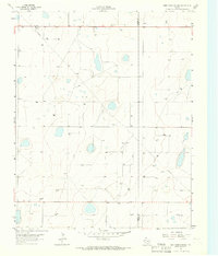
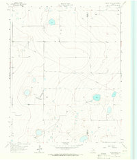
Showing maps 1-25 of 197
Top cities of Moore County
Frequently asked questions
- What are the different types of historical maps available for Moore County?
- What is the oldest map of Moore County?
- Where can I purchase historical maps of Moore County for my home or office?
- Where can I download high-res historical maps of Moore County?
- Are there historical topographic maps available for Moore County?
- Is there historical aerial imagery available for Moore County?
- Where are historical maps of Moore County sourced from?