
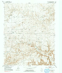
1953 Map of Spencer Draw
USGS Topo · Published 1954About this map
The Panhandle terrain of Moore County is defined here by the industrial infrastructure of the early 1950s natural gas boom. Numerous Gas Well sites pepper the landscape, connected by an extensive network of Pipe Line segments that converge at specialized facilities like the Fourway Booster Sta and Zofness Booster Sta. This era of energy development is mapped alongside established cattle operations, where family-named locations such as Browns Ranch (Akard) and Weymouth Ranch anchor the rural landscape.
Find a feature on this map
16 named features on this map. Tap any name to fly to it.
Don’t see what you’re looking for? This feature index may not catch every label — zoom into the map to look around manually.
Map Details
Editions of this 1953 Spencer Draw Map
2 editions found
Other maps of this area

1936 · Fourways
USGS Topo · 1:62,500

1939 · Sanford
USGS Topo · 1:62,500

1953 · Marsh
USGS Topo · 1:24,000

1953 · Alibates Ranch
USGS Topo · 1:24,000

1953 · Evans Canyon
USGS Topo · 1:24,000

1953 · Masterson
USGS Topo · 1:24,000

1953 · McDowell Creek
USGS Topo · 1:24,000

1954 · Amarillo
USGS Topo · 1:250,000

1958 · Amarillo
USGS Topo · 1:250,000

1965 · Dumas South
USGS Topo · 1:24,000