Old Maps of Morris County, Texas for Genealogy
Trace your family roots with 57 historic maps of Morris County. These high-res maps reveal old neighborhoods, homesites, landmarks, and streets — helping you uncover where your ancestors lived and how the area evolved over time.
- Explore historic neighborhoods: Identify where your relatives may have lived in the 1800s or 1900s.
- Compare maps over time: Trace the changes in streets, buildings, and landmarks for multi-generational research.
- Perfect for genealogy & ancestry research: Used by family historians and researchers to map out lineage and migration.
These maps are an incredible resource for exploring your personal connection to Morris County's past.
Morris County, TX maps
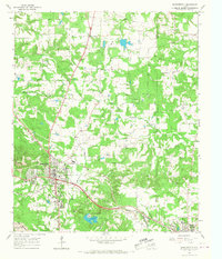
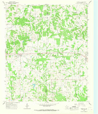
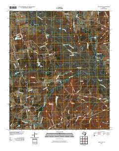
(57)- 1914 Map of Daingerfield
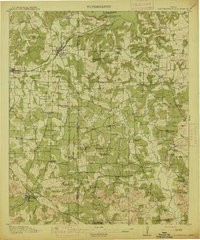 1914 Daingerfield1914 Print · USGSNortheast Texas before the Great War is captured here through its bustling rail towns and timber-rich creek bottoms. Genealogists can trace hundreds of family sites, from Walkers Chapel and Boon Hall to the busy Jennings Lake Switch.2 unique versions available
 - 1930 Map of Bassett
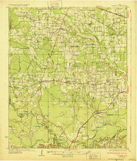 1930 Bassett1930 Print · USGSBowie and Cass Counties are captured here as the traditional rural landscape met the expanding reach of the railroad and early oil exploration. Genealogists can locate many namesake schools and churches like Big Woods Sch, Mt Zion Ch, and the settlement of White Cotton.2 unique versions available
 - 1953 Map of Texarkana, 1964 Print
 1953 Texarkana1964 Print · USGSThe Texas-Arkansas borderlands are captured here in the mid-fifties, during a decade of massive military and hydraulic engineering projects. Genealogists and researchers can locate family landmarks like Old Boston Cem, Siloam Ch, and the vast Red River Arsenal.4 unique versions available
 - 1956 Map of Texarkana
 1956 Texarkana1956 Print · USGSThe Ark-La-Tex borderlands come alive in the mid-fifties, showing the transition from a rail-dependent rural economy to a post-war industrial landscape. Researchers can trace the massive Red River Ordnance Depot and find towns like Talco, Bogata, and Naples.
 - 1956 Map of Tyler
 1956 Tyler1956 Print · USGSEast Texas was a powerhouse of oil production and rail transport during the mid-fifties, centered on the sprawling East Texas Oil Field. Researchers can trace the heritage of industrial hubs like Kilgore, military sites such as the Longhorn Ordnance Works, and many rural landmarks like Mount Enterprise.5 unique versions available
 - 1960 Map of La Fayette, 1962 Print
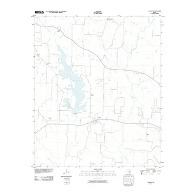
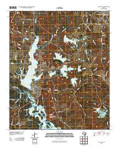
 1960 La Fayette1962 Print · USGSUpper East Texas is shown here at the dawn of the sixties, just as the rising waters of the newly formed Lake O' the Pines began to reshape the Big Cypress Creek basin. Researchers can pinpoint rural life at LaFayette and Holly Springs, or trace family sites like Pleasant Grove Cem and Slaton Cem.2 unique versions available
 - 1962 Map of Lone Star, 1964 Print
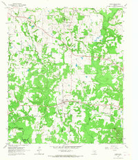
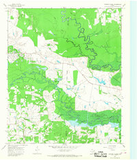
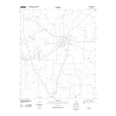
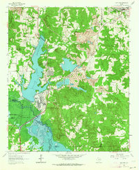 1962 Lone Star1964 Print · USGSMorris County in the early sixties was a hub of East Texas industry and rural life, from the growing town of Lone Star to the heavy iron works. Researchers can trace the massive Steel Plant, local landmarks like Hospital in the Pines, and old family burial grounds including South Union Cem.2 unique versions available
 - 1964 Map of Daingerfield, 1967 Print
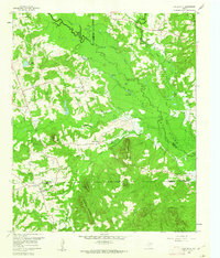
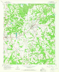
 1964 Daingerfield1967 Print · USGSMorris County was a hub of rail activity and iron-ore mining in the mid-sixties, centered on the growing town of Daingerfield. Genealogists and historians can trace the foundations of local life at Daingerfield State Park, the Black Mountain Mine, and several rural landmarks like Bradfield Ch.2 unique versions available
 - 1964 Map of Cason, 1967 Print
 1964 Cason1967 Print · USGSNortheast Texas in the mid-sixties reveals a landscape of family-owned ridges and bottomlands centered on Cason. Genealogists can locate several rural landmarks including Central Grove Sch, Justiss Cem, and Black Mtn Mine.2 unique versions available
 - 1965 Map of Dalby Springs, 1967 Print
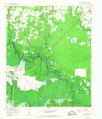 1965 Dalby Springs1967 Print · USGSBowie County and the Sulphur River bottomlands are captured here in the mid-1960s during a period of significant hydraulic change. Genealogists and local historians can trace family sites like Roberts Cem, the village of Dalby, and the rising shoreline of Lake Texarkana.2 unique versions available
 - 1965 Map of Naples, 1967 Print
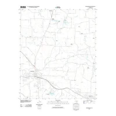
 1965 Naples1967 Print · USGSNortheast Texas in the mid-sixties reveals a landscape defined by the railroad and established country communities. Genealogists and historians can trace the foundations of Naples and Omaha, locating local landmarks like Pewitt Sch and Spring Hill Cem.2 unique versions available
 - 1965 Map of Cookville, 1968 Print
 1965 Cookville1968 Print · USGSMid-century East Texas comes into focus along the St Louis Southwestern rail line between Cookville and Omaha. Genealogists and local historians can trace family roots through numerous sites like Mt Moriah Ch, Concord Cem, and Center Grove.2 unique versions available
 - 1965 Map of Coopers Chapel, 1968 Print
 1965 Coopers Chapel1968 Print · USGSNortheast Texas in the 1960s was a landscape of winding river bottoms and small rural outposts. Genealogists and historians can trace family locations near Coopers Chapel, the Evergreen Cem, and the industry of the Pewitt Ranch Oil Field.2 unique versions available
 - 1984 Map of Tyler
 1984 Tyler1984 Print · USGSEast Texas at the peak of its reservoir-building era shows a landscape defined by new lakes and established rail corridors. Trace the path of the St Louis Southwestern RR or locate industrial sites like the Longhorn Ordnance Works.3 unique versions available
 - 1986 Map of Marshall
 1986 Marshall1986 Print · USGSEast Texas and the Louisiana borderlands are shown in the mid-1980s during a period of sustained industrial and energy production. Researchers can trace family roots through settlements like Ebenezer or study the impact of the Longhorn Army Ammunition Plant and Rodessa Oil Field.2 unique versions available
 - 1986 Map of Texarkana
 1986 Texarkana1986 Print · USGSThe Texas-Arkansas borderlands are captured here in the mid-eighties as a hub of military industry and river-basin geography. Genealogists and local historians can locate rural landmarks like Red Hill Cem, Coopers Chapel, and the Lone Star Army Ammunition Plant.
 - 1992 Map of Texarkana
 1992 Texarkana1992 Print · USGSThe Ark-La-Tex border region comes into focus in the early nineties, centered on the sprawling waters of Wright Patman Lake. Genealogists and historians can trace rail-town development and rural roots through Old Union Cem, the Red River Army Depot, and Dalby Springs Cem.
 - 2010 Map of Dalby Springs, 2010 Print
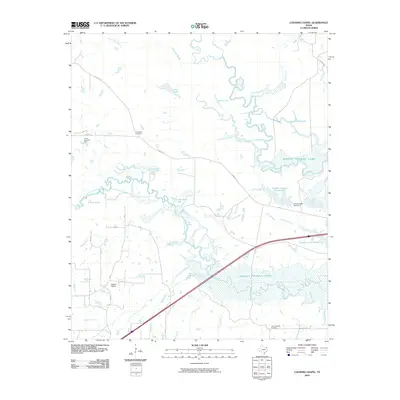
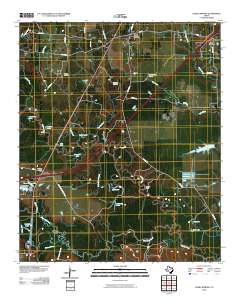 2010 Dalby Springs2010 Print · USGSCovers Morris County, including Dalby Springs, Ward Creek, and other nearby areas
 - 2010 Map of Cookville, 2010 Print
 2010 Cookville2010 Print · USGSCovers Morris County, including Omaha, Center Grove, and other nearby areas
 - 2010 Map of Naples, 2010 Print
 2010 Naples2010 Print · USGSCovers Morris County, including Naples, Omaha, and other nearby areas
 - 2010 Map of Cason, 2010 Print
 2010 Cason2010 Print · USGSCovers Morris County, including Roeder, Cason, and other nearby areas
 - 2010 Map of Lone Star, 2010 Print
 2010 Lone Star2010 Print · USGSCovers Morris County, including Hughes Springs, Lone Star, and other nearby areas
 - 2010 Map of Daingerfield, 2010 Print
 2010 Daingerfield2010 Print · USGSCovers Morris County, including Daingerfield, Hughes Springs, and other nearby areas
 - 2010 Map of Lafayette, 2010 Print
 2010 Lafayette2010 Print · USGSCovers Morris County, including LaFayette, Center Point, and other nearby areas
 - 2010 Map of Coopers Chapel, 2010 Print
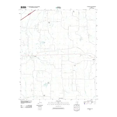
 2010 Coopers Chapel2010 Print · USGSCovers Morris County, including Titus County, Red River County, and other nearby areas
Showing maps 1-25 of 57
Top cities of Morris County
Frequently asked questions
- What are the different types of historical maps available for Morris County?
- What is the oldest map of Morris County?
- Where can I purchase historical maps of Morris County for my home or office?
- Where can I download high-res historical maps of Morris County?
- Are there historical topographic maps available for Morris County?
- Is there historical aerial imagery available for Morris County?
- Where are historical maps of Morris County sourced from?