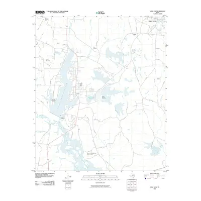
2010 Map of Lone Star
USGS Topo · Published 2010About this map
The industrial and natural character of Cass and Morris Counties converges near Lone Star, where the Lone Star Steel Company Airport and Black Mountain Mine highlight the region's resource-driven economy. Significant water management is evident through the massive Ellison Creek Reservoir, held by the Ellison Creek Dam, and the northern reaches of Lake O' the Pines. This 2010 survey also captures a deeply rooted local landscape, preserving the locations of numerous family and community sites such as Clark Cemetery, South Union Cemetery, and the Iron Bluff Cemetery. From the heights of Black Mountains and Buzzard Roose Mountain to the banks of Big Cypress Creek, the map details a terrain shaped by both heavy industry and significant hydroelectric and water-storage projects.
Find a feature on this map
77 named features on this map. Tap any name to fly to it.
Don’t see what you’re looking for? This feature index may not catch every label — zoom into the map to look around manually.
Map Details
Editions of this 2010 Lone Star Map
This is the sole edition of this map. No revisions or reprints were ever made.
Other maps of this area

1914 · Daingerfield
USGS Topo · 1:62,500

1953 · Texarkana
USGS Topo · 1:250,000

1956 · Texarkana
USGS Topo · 1:250,000

1956 · Tyler
USGS Topo · 1:250,000

1960 · Coffeeville
USGS Topo · 1:24,000

1960 · La Fayette
USGS Topo · 1:24,000

1961 · Lassater
USGS Topo · 1:24,000

1962 · Avinger
USGS Topo · 1:24,000

1962 · Ore City
USGS Topo · 1:24,000

1962 · Lone Star
USGS Topo · 1:24,000