Old Maps of Millsap, Texas for Metal Detecting
Plan your next treasure hunt with 34 historic maps of Millsap. Find old homesites, ghost towns, trails, and gathering spots that may be lost to time — perfect for identifying promising metal detecting locations.
- Locate forgotten sites: Uncover places like long-lost settlements, abandoned rail lines, or gathering spots.
- Plan better hunts: Use map overlays combined with LiDAR or satellite views to narrow in on historically rich areas.
- Made for detectorists: Thousands of hobbyists use these maps to discover relics, coins, and hidden history.
Use these historic maps to boost your research and find new opportunities beneath the surface of Millsap.
Millsap, TX maps
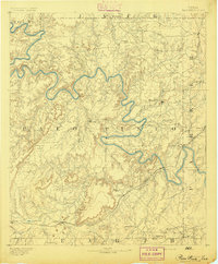
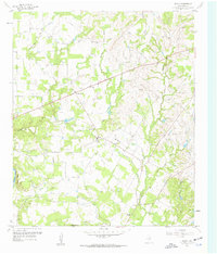
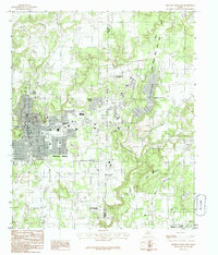
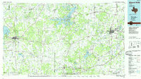
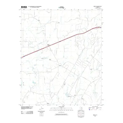
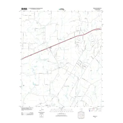
(34)- 1891 Map of Weatherford
 1891 Weatherford1891 Print · USGSParker County and the surrounding ranchlands are shown here in the 1890s as the rail network transformed the region. Researchers can trace early river transport at Powell Ferry or locate vanished sites like Veal Station, Center Mill, and the Bear Creek P.O.
 - 1891 Map of Palo Pinto
 1891 Palo Pinto1891 Print · USGSNorth Texas in the late nineteenth century was a landscape of winding river bends and emerging coal towns. Genealogists and historians can trace early river crossings at Oaks Ferry, the path of the Texas and Pacific Railroad, and the Coal Mines at Coalville.7 unique versions available
 - 1893 Map of Weatherford
 1893 Weatherford1893 Print · USGSParker County was at a pivotal turning point in the late nineteenth century as railroads began to stitch together the North Texas cattle country. Genealogists and local historians can trace early crossings like Powell Ferry and landmarks like Center Mill or Veal Station.5 unique versions available
 - 1918 Map of Palo Pinto
 1918 Palo Pinto1918 Print · USGSPalo Pinto County and the Brazos River valley appear here in the final year of the Great War, showing a landscape shaped by coal and steam. Genealogists and historians can locate defunct river crossings like Oaks Ferry, early rural education at Marsden School, and the extensive Coal Mines that once powered the regional economy.
 - 1927 Map of Mineral Wells
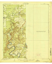 1927 Mineral Wells1927 Print · USGSThe Brazos River carves a winding path through Palo Pinto County in the mid-1920s, defining a landscape of deep hollows and sharp river bends. Researchers can trace early rural schools like Union Hill School and the route of the Weatherford Mineral Wells and Northwestern rail line.2 unique versions available
 - 1931 Map of Dennis
 1931 Dennis1931 Print · USGSThe Brazos River winds along the Parker and Hood County line in the 1920s, a landscape defined by riverside homesteads. Genealogists can trace family roots through rural landmarks like Walker Sch, Nightower Bridge, and the community of Robertson.
 - 1931 Map of Santo
 1931 Santo1931 Print · USGSPalo Pinto County in the mid-1920s was a land of winding river valleys and rural schoolhouse communities. Genealogists and historians can trace the early rail-and-river economy through the Texas and Pacific line and the Brazos River, while locating family homesteads near Village Bend Sch or New Hope Sch.3 unique versions available
 - 1954 Map of Dallas, 1963 Print
 1954 Dallas1963 Print · USGSNorth Texas in the mid-fifties and early sixties reveals a landscape of rapid urban growth and water management. Genealogists and historians can trace the evolution of the metroplex through landmarks like Hensley Field, Boles Orphan Home, and the Texas & Pacific RR.4 unique versions available
 - 1954 Map of Abilene, 1966 Print
 1954 Abilene1966 Print · USGSThe Texas Big Country comes into focus in the mid-1950s as petroleum and new water projects reshape the landscape. Local historians can trace the Butterfield Trail, find the Fort Phantom Hill Ruins, and locate numerous small communities along the Texas & Pacific line.2 unique versions available
 - 1958 Map of Dallas
 1958 Dallas1958 Print · USGSNorth Texas in the late fifties shows the dramatic expansion of the Metroplex as it absorbs surrounding farm towns. Genealogists and historians can trace old rail lines like the Missouri-Kansas-Texas and locate early lakefront developments at Eagle Mountain Lake and Lake Worth Village.
 - 1958 Map of Abilene
 1958 Abilene1958 Print · USGSMid-century West Texas comes alive in this survey of the Abilene and Stephenville region during a period of steady oil expansion and military growth. Genealogists and local historians can trace the paths of the Texas & Pacific RR through historic towns, locate the Fort Griffin Ruins, and find smaller settlements like Desdemona and Lueders.
 - 1959 Map of Mineral Wells, 1960 Print
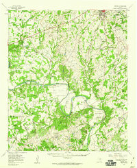
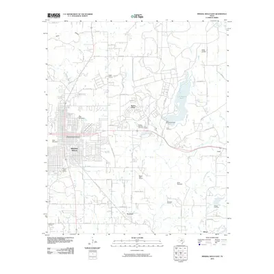
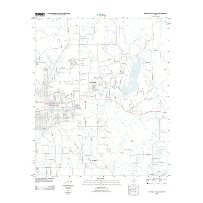
 1959 Mineral Wells1960 Print · USGSMineral Wells and the surrounding Palo Pinto ranch lands are captured here during the height of the Cold War helicopter training era. Researchers can trace the massive footprint of Camp Wolters, the winding Brazos River bends, and local landmarks like Staggs Prairie Cem.2 unique versions available
 - 1959 Map of Brock, 1960 Print
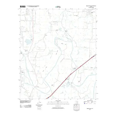
 1959 Brock1960 Print · USGSParker County in the late fifties was a landscape of creek-side settlements and emerging energy production. Researchers can trace historic family burial sites like Fairview Cem and Barnett Cem or follow the route of the World War II Veterans Highway.3 unique versions available
 - 1959 Map of Lipan, 1960 Print
 1959 Lipan1960 Print · USGSNear the intersection of four Texas counties in the late fifties, this survey captures the rural character and winding river bends of the Brazos valley. Researchers can locate family landmarks like Evergreen Cem, Dobbs Valley Ch, and the remote Progress Sch.3 unique versions available
 - 1959 Map of Dennis, 1960 Print
 1959 Dennis1960 Print · USGSParker and Hood Counties are shown in the late fifties as the Brazos River meanders through a landscape of historic crossings and valley settlements. Researchers can trace rural lineages through numerous sites like Tin Top Sch, Center Mill, and the Bethel Cem.
 - 1984 Map of Brazos East
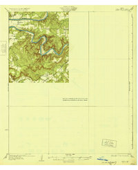
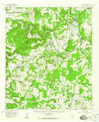
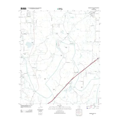
 1984 Brazos East1984 Print · USGSThe Brazos River valley at the Parker and Palo Pinto county line is captured here in the early 1980s, showing a landscape defined by deep river bends and high overlooks. Genealogists and local historians can trace the topography of Millsap, the small community of Bennett, and landmarks like Inspiration Point.
 - 1984 Map of Mineral Wells East, 1986 Print
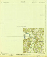
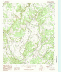
 1984 Mineral Wells East1986 Print · USGSMineral Wells and its eastern neighbors are shown in the early 1980s as the region transitioned from military influence to recreation and education. Genealogists can trace family connections in Wolters Village, Sturdivant, or Millsap and locate landmarks like Weatherford College.
 - 1985 Map of Fort Worth
 1985 Fort Worth1985 Print · USGSMid-1980s Tarrant County and Parker County emerge from a transition between urban sprawl and rural cattle country. Researchers can trace the expansion of Fort Worth and Arlington alongside older landmarks like Nebo Mtn and Kikapoo Falls.2 unique versions available
 - 1985 Map of Mineral Wells
 1985 Mineral Wells1985 Print · USGSNorth-central Texas in the mid-eighties shows a landscape of deep river valleys and massive reservoirs. Genealogists and historians can trace the Missouri Pacific rail line and locate rural settlements like Thurber, Necessity, and Palo Pinto.2 unique versions available
 - 2010 Map of Mineral Wells East, 2010 Print
 2010 Mineral Wells East2010 Print · USGSCovers Millsap, including Mineral Wells, Cool, and other nearby areas
 - 2010 Map of Brazos East, 2010 Print
 2010 Brazos East2010 Print · USGSCovers Millsap, including Brazos, Bennett, and other nearby areas
 - 2010 Map of Brock, 2010 Print
 2010 Brock2010 Print · USGSCovers Millsap, including Brock, Brock Junction, and other nearby areas
 - 2012 Map of Brazos East, 2012 Print
 2012 Brazos East2012 Print · USGSCovers Millsap, including Brazos, Bennett, and other nearby areas
 - 2012 Map of Mineral Wells East, 2012 Print
 2012 Mineral Wells East2012 Print · USGSCovers Millsap, including Mineral Wells, Cool, and other nearby areas
 - 2012 Map of Brock, 2012 Print
 2012 Brock2012 Print · USGSCovers Millsap, including Brock, Brock Junction, and other nearby areas
Showing maps 1-25 of 34
Top cities near Millsap
Frequently asked questions
- What are the different types of historical maps available for Millsap?
- What is the oldest map of Millsap?
- Where can I purchase historical maps of Millsap for my home or office?
- Where can I download high-res historical maps of Millsap?
- Are there historical topographic maps available for Millsap?
- Is there historical aerial imagery available for Millsap?
- Where are historical maps of Millsap sourced from?