1970s Maps of Potter County, Texas
Explore 4 historic maps of Potter County from the 1970s. These maps offer a rare glimpse into what life looked like during the 1970s — showing old roads, neighborhoods, homes, and landmarks that have changed or disappeared over time.
Whether you're researching your family's past, planning a metal detecting trip, or studying how Potter County's landscape evolved across the 1970s, these high-resolution maps are a powerful tool for exploring the history of this region.
- Focus on a specific era: All maps on this page are from the 1970s, giving you a focused view of this time period.
- See what’s changed: Compare century-old streets, trails, and buildings to today's modern landscape using overlays and satellite layers.
- Research with precision: Use these maps for genealogy, historical research, land use analysis, or educational projects.
- View, download, or print: Maps are fully viewable online in high resolution, and can be downloaded or printed for your own records.
Start exploring Potter County's history through authentic maps from the 1970s. This is your window into the past.
Potter County, TX maps
(4)- 1970 Map of McDowell Creek, 1973 Print
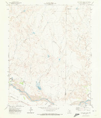
 1970 McDowell Creek1973 Print · USGSThe Texas Panhandle meets the waters of the Canadian River in the 1970s, showing a landscape defined by ranching terrain and energy extraction. Trace the shoreline of Lake Meredith or locate isolated landmarks like Lost Mesa and a remote Grave.
 - 1970 Map of Alibates Ranch, 1973 Print
 1970 Alibates Ranch1973 Print · USGSThe Texas Panhandle landscape was being reshaped by the waters of the Canadian River during the early seventies. Local researchers can trace ranching history and modern industry through labels like the McBride Ranch, Browns Camp, and dozens of Gas Wells.
 - 1971 Map of Little Indian Creek, 1974 Print
 1971 Little Indian Creek1974 Print · USGSThe Texas Panhandle cattle and energy landscape comes into focus during the early seventies. Genealogists and historians can trace the Bivins X L Ranch and numerous energy sites like Gas Wells and Drill Holes along the Little Indian Creek drainage.
 - 1971 Map of Boys Ranch East, 1974 Print
 1971 Boys Ranch East1974 Print · USGSThe Texas Panhandle comes into focus during the early 1970s as the Canadian River valley transitions between ranching and energy development. Researchers can trace the layout of Boys Ranch, locate the Tascosa Cem, and follow the Ft Worth and Denver rail line.
End of results
Showing maps 1-4 of 4
Top cities of Potter County
Frequently asked questions
- What are the different types of historical maps available for Potter County?
- What is the oldest map of Potter County?
- Where can I purchase historical maps of Potter County for my home or office?
- Where can I download high-res historical maps of Potter County?
- Are there historical topographic maps available for Potter County?
- Is there historical aerial imagery available for Potter County?
- Where are historical maps of Potter County sourced from?