1970s Maps of Roberts County, Texas
Explore 19 historic maps of Roberts County from the 1970s. These maps offer a rare glimpse into what life looked like during the 1970s — showing old roads, neighborhoods, homes, and landmarks that have changed or disappeared over time.
Whether you're researching your family's past, planning a metal detecting trip, or studying how Roberts County's landscape evolved across the 1970s, these high-resolution maps are a powerful tool for exploring the history of this region.
- Focus on a specific era: All maps on this page are from the 1970s, giving you a focused view of this time period.
- See what’s changed: Compare century-old streets, trails, and buildings to today's modern landscape using overlays and satellite layers.
- Research with precision: Use these maps for genealogy, historical research, land use analysis, or educational projects.
- View, download, or print: Maps are fully viewable online in high resolution, and can be downloaded or printed for your own records.
Start exploring Roberts County's history through authentic maps from the 1970s. This is your window into the past.
Roberts County, TX maps
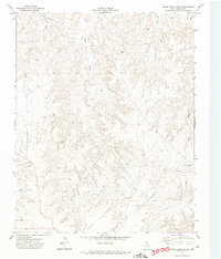
(19)- 1971 Map of Dry Creek South, 1974 Print
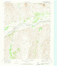
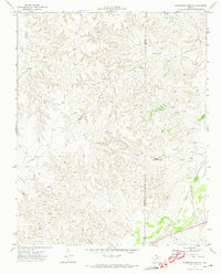
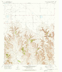
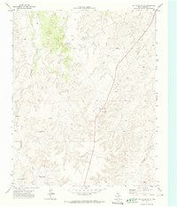 1971 Dry Creek South1974 Print · USGSRoberts County ranching and energy infrastructure are on display in the early seventies, just as modern industrial patterns were taking hold. Genealogists and historians can trace the locations of named landmarks like Reynolds, Five Tub Windmill, and Warley.
 - 1971 Map of Dry Creek SE, 1974 Print
 1971 Dry Creek SE1974 Print · USGSThe Texas Panhandle in the early seventies shows a landscape where ranching and the oil industry met in Roberts County. Trace the development of energy sites including an Oil Well and localized settlements like Willis and Ledrick.
 - 1971 Map of Skellytown NE, 1974 Print
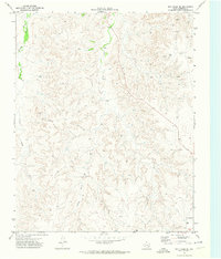
 1971 Skellytown NE1974 Print · USGSThe Texas Panhandle reveals its ranching and energy foundations in the early 1970s across this Roberts County landscape. Genealogists and historians can trace family land at Price Ranch and Hayhook Ranch, or locate water infrastructure like the Jog Section Windmill.
 - 1971 Map of Dry Creek NE, 1974 Print
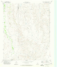
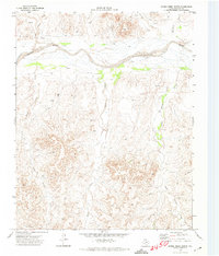
 1971 Dry Creek NE1974 Print · USGSThe Texas Panhandle north of Miami is captured here in the early 1970s, dominated by the wide bed of the Canadian River. Genealogists and historians can trace the paths of Picketts Ranch Creek and find rural landmarks like the Red Windmill.
 - 1971 Map of Dry Creek North, 1974 Print
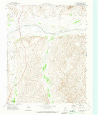
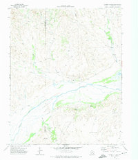
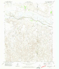
 1971 Dry Creek North1974 Print · USGSThe Canadian River valley in Roberts County is captured here in the early seventies, showing a landscape defined by water and resource extraction. Researchers can trace the braided Canadian River and locate industrial sites like the Oil Well and Gravel Pits.
 - 1971 Map of Pampa NW, 1974 Print
 1971 Pampa NW1974 Print · USGSThe Texas Panhandle reveals its deep-cut creek beds and energy infrastructure in the early seventies. Genealogists and local historians can locate the Wayside Community Center, Red School 2, and the networks of PIPELINE and water wells.
 - 1971 Map of Garden Springs, 1974 Print
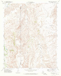
 1971 Garden Springs1974 Print · USGSThe Texas Panhandle breaks along the Canadian River are documented here in the early 1970s. Genealogists and historians can trace ranching legacies at Brainard Ranch and Morrison Ranch or locate early energy infrastructure and remote sites like Pats Creek Camp.
 - 1971 Map of Adobe Creek SE, 1974 Print
 1971 Adobe Creek SE1974 Print · USGSThe Texas Panhandle ranchlands are captured in the early 1970s as industrial pipelines began crossing the traditional cattle country. Researchers can trace old ranching boundaries and water infrastructure through labels like Morrison Ranch, Sandhill Windmill, and the Roberts Co line.
 - 1972 Map of Washburn Arroyo, 1974 Print
 1972 Washburn Arroyo1974 Print · USGSThe Texas Panhandle in the early seventies reveals a landscape defined by energy and rail. Trace the Pipeline networks and Gas Wells that dotted the plains, or follow the Atchison Topeka and Santa Fe railroad along Red Deer Creek.
 - 1972 Map of Horse Creek North, 1974 Print
 1972 Horse Creek North1974 Print · USGSIn the early seventies, the Roberts County landscape was a terrain of active energy extraction and deep-cut breaks along the Canadian River. Researchers can trace old resource networks including the Pipeline, remote Oil Wells, and the path of Horse Creek.
 - 1972 Map of East Dry Creek, 1974 Print
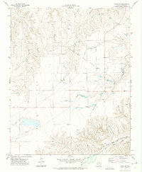
 1972 East Dry Creek1974 Print · USGSThe Texas Panhandle rangeland meets the wide Canadian River valley in the early 1970s. Researchers can trace the development of the local energy economy via numerous Oil Wells and a Pipeline, alongside landmarks like Home Ranch and a solitary Grave.
 - 1972 Map of Pampa NE, 1974 Print
 1972 Pampa NE1974 Print · USGSRoberts County in the early seventies reveals a landscape of energy production and rail transit. Trace the Atchison Topeka and Santa Fe line through Codman or explore the dense network of an Oil and Gas Field and Bluff Creek.
 - 1972 Map of Miami, 1974 Print
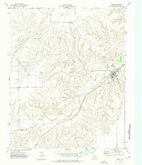 1972 Miami1974 Print · USGSMiami and the Roberts County breaks are captured in the early seventies during a period of steady energy and rail activity. Genealogists and local historians can locate the town Cem, the siding at Codman, and the extensive Quinpono Gas and Oil Field.
 - 1972 Map of Horse Creek South, 1974 Print
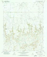
 1972 Horse Creek South1974 Print · USGSRoberts County ranching and energy lands are captured here during the early seventies, showing a landscape shaped by water and industry. Researchers can trace the path of Horse Creek, find the remote Landing Strip, and locate infrastructure like the Pumping Sta.
 - 1973 Map of Pickett Ranch Creek, 1975 Print
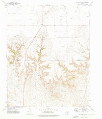
 1973 Pickett Ranch Creek1975 Print · USGSThe Texas Panhandle at the height of the 1970s energy boom reveals a landscape dominated by a vast Oil And Gas Field. Trace the network of Pipelines and Oil Wells crossing Pickett Ranch Creek and the Ochiltree Co border.
 - 1973 Map of Barton Creek, 1976 Print
 1973 Barton Creek1976 Print · USGSThe northern Panhandle at the height of the 1970s energy boom shows a landscape defined by cattle draws and resource extraction. Trace the industrial development of the four-county corner through Gas Wells, PIPELINES, and a local Pumping Sta along the banks of Barton Creek.
 - 1973 Map of Sourdough Creek SW, 1976 Print
 1973 Sourdough Creek SW1976 Print · USGSThe Texas Panhandle at the transition from the early seventies reveals a landscape of industrial extraction and complex drainage. Researchers can trace the network of Oil Well and Gas Well sites or follow the deep terrain of Government Canyon and Jacks Creek.
 - 1973 Map of Spearman SE, 1976 Print
 1973 Spearman SE1976 Print · USGSThe Texas Panhandle at the meeting of four counties shows a landscape transformed by the mid-century energy boom. Trace the industrial footprint of the Gasoline Plant and Gravel Pits or follow the deep draws of Pats Creek and Willow Creek.
 - 1973 Map of Sourdough Creek, 1976 Print
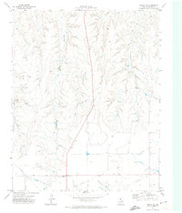
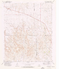
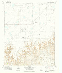
 1973 Sourdough Creek1976 Print · USGSThe Texas Panhandle energy landscape comes into focus during the early 1970s along the Ochiltree and Roberts County line. Trace the development of the Oil and Gas Field through features like McLain Airport, a Pumping Sta, and Sourdough Creek.
End of results
Showing maps 1-19 of 19
Top cities of Roberts County
Frequently asked questions
- What are the different types of historical maps available for Roberts County?
- What is the oldest map of Roberts County?
- Where can I purchase historical maps of Roberts County for my home or office?
- Where can I download high-res historical maps of Roberts County?
- Are there historical topographic maps available for Roberts County?
- Is there historical aerial imagery available for Roberts County?
- Where are historical maps of Roberts County sourced from?