Old Maps of Roberts County, Texas for Academic Research
Study the evolution of Roberts County with 158 high-resolution historic maps. Whether you're teaching, researching, or modeling changes in land use, these maps provide essential visual documentation of urban, environmental, and geographic change.
- Analyze long-term change: Track patterns in development, transportation, and natural features.
- Ideal for environmental or urban studies: Support academic projects with primary historical map data.
- Use in the classroom or lab: Educators and researchers rely on these maps to bring historical context to life.
These maps are a powerful tool for teaching, research, and visualizing how Roberts County has changed over the decades.
Roberts County, TX maps
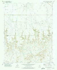
(158)- 1954 Map of Perryton, 1966 Print
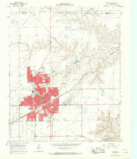
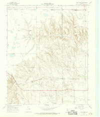
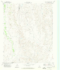
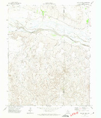
 1954 Perryton1966 Print · USGSThe High Plains of the Texas and Oklahoma panhandles are shown during a period of steady growth in the mid-1950s. Genealogists and researchers can trace rail history and local landmarks like Panhandle A & M College, Spurlock Chapel, and the isolated Lord Station.3 unique versions available
 - 1954 Map of Amarillo, 1966 Print
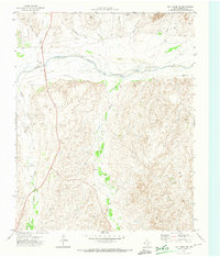
 1954 Amarillo1966 Print · USGSThe Texas Panhandle in the mid-1960s shows a landscape of rising industrial power and deep-rooted ranching tradition. Local historians can trace the paths of the Panhandle and Santa Fe railroad or locate sites like the Pantex Ordnance Plant and Mobeetie.2 unique versions available
 - 1958 Map of Perryton
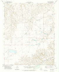
 1958 Perryton1958 Print · USGSThe Oklahoma Panhandle and Texas borderlands come alive in this mid-century survey, showing the vital rail-and-ranch economy of the High Plains. Researchers can trace historic stops along the Chicago Rock Island and Pacific and locate rural landmarks like Bethel Church and Spurlock Chapel.
 - 1958 Map of Amarillo
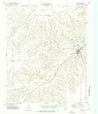
 1958 Amarillo1958 Print · USGSThe Texas Panhandle in the mid-1950s reveals a landscape of expanding military installations and oil-rich rail towns. Local historians can trace the development of Amarillo Air Force Base or locate smaller settlements like Magic City and New Mobeetie.
 - 1963 Map of Pampa, 1968 Print
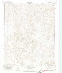
 1963 Pampa1968 Print · USGSMid-century Pampa and the nearby community of Mesilla Park are shown during a period of significant energy production and rail activity. Genealogists and local historians can trace neighborhood growth through dozens of named sites like Lee Jr High Sch, Fairview Cem, and Perry-Lefors Airfield.
 - 1965 Map of Lake Mc Connell, 1967 Print
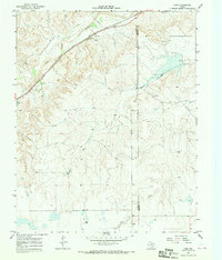
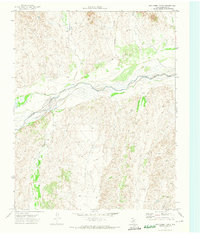
 1965 Lake Mc Connell1967 Print · USGSGray County, Texas, was a hub of energy and transport in the mid-1960s as petroleum infrastructure reshaped the Panhandle. Researchers can trace the industrial footprint of the Carbon Black Plant, the residential layout of Kingsmill Camp, and the rail lines of the Atchison Topeka and Santa Fe.
 - 1966 Map of Laketon, 1970 Print
 1966 Laketon1970 Print · USGSThe Texas Panhandle at the height of the mid-century oil boom is centered here on the railroad hamlet of Laketon. Genealogists and historians can trace the industrial footprint of the Laketon Grain Elevators and the Landing Field (Aban'd) alongside dozens of named gas wells.
 - 1967 Map of Hoover, 1969 Print
 1967 Hoover1969 Print · USGSGray County and the Roberts County line are captured in the late sixties as the Panhandle's rail and ranching economy thrived. Trace the tracks of the Atchison Topeka and Santa Fe through Hoover and locate the Grain Elevators at Heaton.
 - 1967 Map of Tody School, 1970 Print
 1967 Tody School1970 Print · USGSThe Texas Panhandle's rugged drainages and rail corridors are revealed here in the late sixties, where Gray and Wheeler counties meet. Genealogists and historians can locate the Tody Sch and trace the path of the Atchison Topeka and Santa Fe near Cowboy Creek.2 unique versions available
 - 1967 Map of Lora, 1970 Print
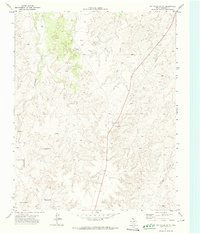
 1967 Lora1970 Print · USGSThe Texas Panhandle comes into focus in the late sixties as the rail-and-river economy defines Roberts and Hemphill counties. Genealogists and local historians can trace the Atchison Topeka and Santa Fe line past Lora and find the Miami Cem near the creek breaks.2 unique versions available
 - 1971 Map of Dry Creek South, 1974 Print
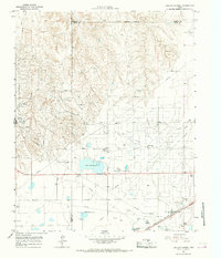
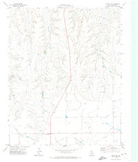
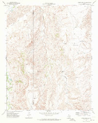
 1971 Dry Creek South1974 Print · USGSRoberts County ranching and energy infrastructure are on display in the early seventies, just as modern industrial patterns were taking hold. Genealogists and historians can trace the locations of named landmarks like Reynolds, Five Tub Windmill, and Warley.
 - 1971 Map of Dry Creek SE, 1974 Print
 1971 Dry Creek SE1974 Print · USGSThe Texas Panhandle in the early seventies shows a landscape where ranching and the oil industry met in Roberts County. Trace the development of energy sites including an Oil Well and localized settlements like Willis and Ledrick.
 - 1971 Map of Skellytown NE, 1974 Print
 1971 Skellytown NE1974 Print · USGSThe Texas Panhandle reveals its ranching and energy foundations in the early 1970s across this Roberts County landscape. Genealogists and historians can trace family land at Price Ranch and Hayhook Ranch, or locate water infrastructure like the Jog Section Windmill.
 - 1971 Map of Dry Creek NE, 1974 Print
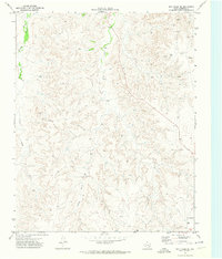
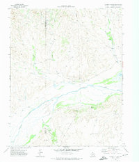
 1971 Dry Creek NE1974 Print · USGSThe Texas Panhandle north of Miami is captured here in the early 1970s, dominated by the wide bed of the Canadian River. Genealogists and historians can trace the paths of Picketts Ranch Creek and find rural landmarks like the Red Windmill.
 - 1971 Map of Dry Creek North, 1974 Print
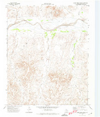
 1971 Dry Creek North1974 Print · USGSThe Canadian River valley in Roberts County is captured here in the early seventies, showing a landscape defined by water and resource extraction. Researchers can trace the braided Canadian River and locate industrial sites like the Oil Well and Gravel Pits.
 - 1971 Map of Pampa NW, 1974 Print
 1971 Pampa NW1974 Print · USGSThe Texas Panhandle reveals its deep-cut creek beds and energy infrastructure in the early seventies. Genealogists and local historians can locate the Wayside Community Center, Red School 2, and the networks of PIPELINE and water wells.
 - 1971 Map of Garden Springs, 1974 Print
 1971 Garden Springs1974 Print · USGSThe Texas Panhandle breaks along the Canadian River are documented here in the early 1970s. Genealogists and historians can trace ranching legacies at Brainard Ranch and Morrison Ranch or locate early energy infrastructure and remote sites like Pats Creek Camp.
 - 1971 Map of Adobe Creek SE, 1974 Print
 1971 Adobe Creek SE1974 Print · USGSThe Texas Panhandle ranchlands are captured in the early 1970s as industrial pipelines began crossing the traditional cattle country. Researchers can trace old ranching boundaries and water infrastructure through labels like Morrison Ranch, Sandhill Windmill, and the Roberts Co line.
 - 1972 Map of Washburn Arroyo, 1974 Print
 1972 Washburn Arroyo1974 Print · USGSThe Texas Panhandle in the early seventies reveals a landscape defined by energy and rail. Trace the Pipeline networks and Gas Wells that dotted the plains, or follow the Atchison Topeka and Santa Fe railroad along Red Deer Creek.
 - 1972 Map of Horse Creek North, 1974 Print
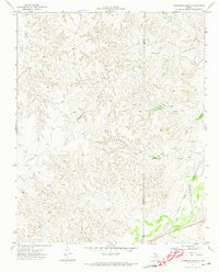
 1972 Horse Creek North1974 Print · USGSIn the early seventies, the Roberts County landscape was a terrain of active energy extraction and deep-cut breaks along the Canadian River. Researchers can trace old resource networks including the Pipeline, remote Oil Wells, and the path of Horse Creek.
 - 1972 Map of East Dry Creek, 1974 Print
 1972 East Dry Creek1974 Print · USGSThe Texas Panhandle rangeland meets the wide Canadian River valley in the early 1970s. Researchers can trace the development of the local energy economy via numerous Oil Wells and a Pipeline, alongside landmarks like Home Ranch and a solitary Grave.
 - 1972 Map of Pampa NE, 1974 Print
 1972 Pampa NE1974 Print · USGSRoberts County in the early seventies reveals a landscape of energy production and rail transit. Trace the Atchison Topeka and Santa Fe line through Codman or explore the dense network of an Oil and Gas Field and Bluff Creek.
 - 1972 Map of Miami, 1974 Print
 1972 Miami1974 Print · USGSMiami and the Roberts County breaks are captured in the early seventies during a period of steady energy and rail activity. Genealogists and local historians can locate the town Cem, the siding at Codman, and the extensive Quinpono Gas and Oil Field.
 - 1972 Map of Horse Creek South, 1974 Print
 1972 Horse Creek South1974 Print · USGSRoberts County ranching and energy lands are captured here during the early seventies, showing a landscape shaped by water and industry. Researchers can trace the path of Horse Creek, find the remote Landing Strip, and locate infrastructure like the Pumping Sta.
 - 1973 Map of Pickett Ranch Creek, 1975 Print
 1973 Pickett Ranch Creek1975 Print · USGSThe Texas Panhandle at the height of the 1970s energy boom reveals a landscape dominated by a vast Oil And Gas Field. Trace the network of Pipelines and Oil Wells crossing Pickett Ranch Creek and the Ochiltree Co border.
Showing maps 1-25 of 158
Top cities of Roberts County
Frequently asked questions
- What are the different types of historical maps available for Roberts County?
- What is the oldest map of Roberts County?
- Where can I purchase historical maps of Roberts County for my home or office?
- Where can I download high-res historical maps of Roberts County?
- Are there historical topographic maps available for Roberts County?
- Is there historical aerial imagery available for Roberts County?
- Where are historical maps of Roberts County sourced from?