1970s Maps of Rusk County, Texas
Explore 10 historic maps of Rusk County from the 1970s. These maps offer a rare glimpse into what life looked like during the 1970s — showing old roads, neighborhoods, homes, and landmarks that have changed or disappeared over time.
Whether you're researching your family's past, planning a metal detecting trip, or studying how Rusk County's landscape evolved across the 1970s, these high-resolution maps are a powerful tool for exploring the history of this region.
- Focus on a specific era: All maps on this page are from the 1970s, giving you a focused view of this time period.
- See what’s changed: Compare century-old streets, trails, and buildings to today's modern landscape using overlays and satellite layers.
- Research with precision: Use these maps for genealogy, historical research, land use analysis, or educational projects.
- View, download, or print: Maps are fully viewable online in high resolution, and can be downloaded or printed for your own records.
Start exploring Rusk County's history through authentic maps from the 1970s. This is your window into the past.
Rusk County, TX maps
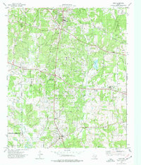
(10)- 1971 Map of Kilgore SW, 1974 Print
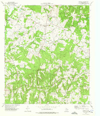
 1971 Kilgore SW1974 Print · USGSThe industrial and academic character of Rusk County is on full display in the early seventies, centered on the oil and research facilities near Overton. Researchers can trace old family burial sites at Mt Comfort Cem and Florey Cem, or locate the historic Lincoln Sch among the local rail lines.
 - 1971 Map of Kilgore SE, 1974 Print
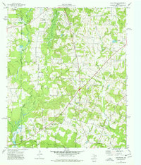
 1971 Kilgore SE1974 Print · USGSEast Texas oil country is in full production during the early seventies, with industrial infrastructure woven into the rural Rusk County landscape. Genealogists and local historians can locate Crims Chapel, the Harmony Cem, and several schools like Chandler Sch.
 - 1973 Map of Henderson, 1975 Print
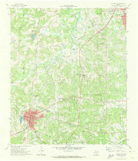
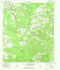
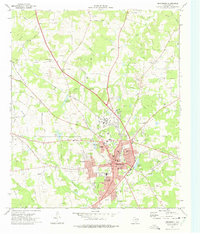 1973 Henderson1975 Print · USGSHenderson and its surrounding Rusk County suburbs are captured during a period of industrial and residential growth in the early seventies. Genealogists can locate several family burial grounds like Oberthier Cem and New Hope Cem while tracing the Missouri Pacific rail line.2 unique versions available
 - 1973 Map of Cushing, 1976 Print
 1973 Cushing1976 Print · USGSIn the early 1970s, the rural borderlands of Rusk and Nacogdoches counties centered on the rail-aligned town of Cushing. Local historians can trace family roots through sites like Old Pine Grove Cem, Looneyville, and the Shady Grove Ch.
 - 1973 Map of Laneville, 1976 Print
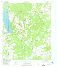
 1973 Laneville1976 Print · USGSRusk County’s rural landscape is captured here in the early 1970s, showing a network of creeks and small farming communities. Researchers can trace family sites like Lyles Sanders Cem, the community of Anadarko, and the terrain around Elkins Mountains.
 - 1973 Map of New Salem, 1976 Print
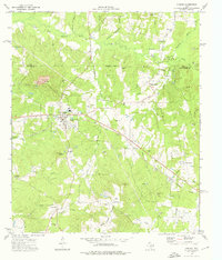
 1973 New Salem1976 Print · USGSThe border of Rusk and Cherokee counties in the early 1970s shows a landscape of East Texas timber and industry. Trace the legacy of rural communities at New Salem and Anadarko, alongside historic sites like Cool Springs Cem and the Southern Pacific railroad.
 - 1973 Map of Reklaw, 1976 Print
 1973 Reklaw1976 Print · USGSThe rural tri-county borderlands of East Texas are captured here in the 1970s, as the Southern Pacific rail line linked small timber and farming outposts. Genealogists can locate family landmarks like Looney Cem and McKnight Ch, or trace the old paths near Dextra.
 - 1973 Map of Berryhill Creek, 1977 Print
 1973 Berryhill Creek1977 Print · USGSRusk County is captured in the early seventies, showing a landscape of East Texas timberlands shaped by the oil industry and rural faith. Researchers can find old family-named sites like Crow Cem, Lockhart Cem, and Union Grove Ch.
 - 1973 Map of Price, 1977 Print
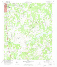
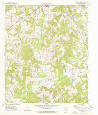
 1973 Price1977 Print · USGSRusk County entered the 1970s as a landscape defined by the machinery of the petroleum industry and old crossroads communities. Researchers can trace the legacy of the East Texas Oil Field alongside local landmarks like West Rusk High Sch, Old London, and the Black Jack Cem.
 - 1973 Map of Gum Springs, 1977 Print
 1973 Gum Springs1977 Print · USGSEast Texas petroleum production and rural life meet in the 1970s across this portion of Rusk and Cherokee Counties. Researchers can locate numerous family burial sites like Waggoner Cem and local centers including Good Springs and Macedonia Ch.
End of results
Showing maps 1-10 of 10
Top cities of Rusk County
- Henderson historical maps
- Overton historical maps
- New London historical maps
- Mount Enterprise historical maps
Frequently asked questions
- What are the different types of historical maps available for Rusk County?
- What is the oldest map of Rusk County?
- Where can I purchase historical maps of Rusk County for my home or office?
- Where can I download high-res historical maps of Rusk County?
- Are there historical topographic maps available for Rusk County?
- Is there historical aerial imagery available for Rusk County?
- Where are historical maps of Rusk County sourced from?