Old Maps of Rusk County, Texas for Metal Detecting
Plan your next treasure hunt with 169 historic maps of Rusk County. Find old homesites, ghost towns, trails, and gathering spots that may be lost to time — perfect for identifying promising metal detecting locations.
- Locate forgotten sites: Uncover places like long-lost settlements, abandoned rail lines, or gathering spots.
- Plan better hunts: Use map overlays combined with LiDAR or satellite views to narrow in on historically rich areas.
- Made for detectorists: Thousands of hobbyists use these maps to discover relics, coins, and hidden history.
Use these historic maps to boost your research and find new opportunities beneath the surface of Rusk County.
Rusk County, TX maps
(169)- 1935 Map of Henderson
 1935 Henderson1935 Print · USGSRusk County in the mid-1930s is a landscape defined by the East Texas oil boom and its sprawling rural communities. Researchers can trace early family sites like Old London Cemetery and Duncan Cemetery or locate industrial landmarks like the Lisbon Gasoline Company Plant.
 - 1936 Map of Kilgore
 1936 Kilgore1936 Print · USGSThe East Texas Oil Field era is in full swing here in the mid-1930s, showing a landscape of rapid industrial and rural development. Genealogists can trace family ties at Leveretts Chapel Sch or Kilgore Cem, and locate vanished landmarks like Swamp City or the Gregg County Prison Farm.2 unique versions available
 - 1939 Map of Henderson
 1939 Henderson1939 Print · USGSRusk County at the peak of the 1930s oil boom reveals a landscape of rapidly growing settlements and dense rural infrastructure. Researchers can trace the footprints of Joinerville, Old London, and Gaston School alongside the Missouri Pacific rail line.
 - 1940 Map of Kilgore
 1940 Kilgore1940 Print · USGSKilgore and the surrounding oil fields come to life in this mid-century survey of the East Texas boom. Researchers can trace the layout of early energy settlements like Oil City and Swamp City alongside rural landmarks like Laird Hill Sch and Rock Springs Mission.2 unique versions available
 - 1943 Map of Cushing, 1955 Print
 1943 Cushing1955 Print · USGSCushing and the rural crossroads of East Texas are seen here during the mid-forties as the railroad still anchored the local economy. Researchers can locate vanished rural landmarks like Freekeytown or trace the Southern Pacific line through Sacul and Reklaw.
 - 1945 Map of Cushing
 1945 Cushing1945 Print · USGSEast Texas farm and timber country thrives during the mid-forties along the borders of Nacogdoches, Rusk, and Cherokee counties. Genealogists can trace family roots through numerous rural landmarks like Mays Cem, Happy Valley Ch, and Glenwood Sch.
 - 1953 Map of Palestine, 1964 Print
 1953 Palestine1964 Print · USGSEast Texas was defined by its deep pine forests and burgeoning energy sector in the mid-1950s. Genealogists and historians can trace the rail-and-river economy through settlements like Tennessee Colony and Pollok or explore the early footprints of the Cayuga Oil Field and Davy Crockett National Forest.2 unique versions available
 - 1956 Map of Tyler
 1956 Tyler1956 Print · USGSEast Texas was a powerhouse of oil production and rail transport during the mid-fifties, centered on the sprawling East Texas Oil Field. Researchers can trace the heritage of industrial hubs like Kilgore, military sites such as the Longhorn Ordnance Works, and many rural landmarks like Mount Enterprise.5 unique versions available
 - 1957 Map of Palestine
 1957 Palestine1957 Print · USGSEast Texas in the mid-fifties reveals a landscape of deep pine forests and winding river valleys before the era of massive reservoir construction. Researchers can trace the legacy of the timber and rail industries through labels for the Missouri Pacific RR, Davy Crockett National Forest, and Nacogdoches.
 - 1958 Map of Timpson, 1959 Print
 1958 Timpson1959 Print · USGSShelby and Nacogdoches counties appear here during the late fifties, defined by a landscape of small timber-and-oil settlements and diverging rail lines. Genealogists can locate family landmarks such as Todd Spring Ch, Huber Sch, and Lake Timpson.2 unique versions available
 - 1958 Map of Darco, 1960 Print
 1958 Darco1960 Print · USGSThe Sabine River bottomlands of East Texas are captured here in the late fifties, showing a landscape defined by gas fields and lignite mining. Genealogists can locate family landmarks like the Rosenwald Vocational and Agriculture Sch, Harris Chapel, and the historical Boards Ferry.2 unique versions available
 - 1958 Map of Tatum, 1960 Print
 1958 Tatum1960 Print · USGSEast Texas in the late fifties is captured here as the industrial reach of Longview meets the rural landscapes of Rusk and Harrison counties. Genealogists and historians can trace the foundations of local communities at Lake Cherokee, Sweet Home Ch, and the Tatum Gas Field.4 unique versions available
 - 1960 Map of Minden, 1962 Print
 1960 Minden1962 Print · USGSRusk and Panola counties are shown at the start of the sixties, capturing the intricate network of country roads and family burial grounds. Researchers can find old rural schoolhouses like Willow Springs Sch and trace landmarks from Minden to Fair Play.
 - 1960 Map of Mount Enterprise, 1962 Print
 1960 Mount Enterprise1962 Print · USGSMount Enterprise and the surrounding Piney Woods of East Texas are captured here at the dawn of the 1960s. Genealogists and historians can trace family locations through numerous rural landmarks like Isabell Chapel, Caledonia, and the Helpenstell Cemetery.2 unique versions available
 - 1971 Map of Kilgore SW, 1974 Print
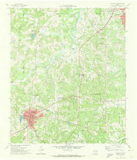 1971 Kilgore SW1974 Print · USGSThe industrial and academic character of Rusk County is on full display in the early seventies, centered on the oil and research facilities near Overton. Researchers can trace old family burial sites at Mt Comfort Cem and Florey Cem, or locate the historic Lincoln Sch among the local rail lines.
 - 1971 Map of Kilgore SE, 1974 Print
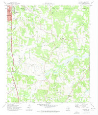 1971 Kilgore SE1974 Print · USGSEast Texas oil country is in full production during the early seventies, with industrial infrastructure woven into the rural Rusk County landscape. Genealogists and local historians can locate Crims Chapel, the Harmony Cem, and several schools like Chandler Sch.
 - 1973 Map of Henderson, 1975 Print
 1973 Henderson1975 Print · USGSHenderson and its surrounding Rusk County suburbs are captured during a period of industrial and residential growth in the early seventies. Genealogists can locate several family burial grounds like Oberthier Cem and New Hope Cem while tracing the Missouri Pacific rail line.2 unique versions available
 - 1973 Map of Cushing, 1976 Print
 1973 Cushing1976 Print · USGSIn the early 1970s, the rural borderlands of Rusk and Nacogdoches counties centered on the rail-aligned town of Cushing. Local historians can trace family roots through sites like Old Pine Grove Cem, Looneyville, and the Shady Grove Ch.
 - 1973 Map of Laneville, 1976 Print
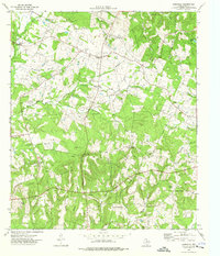 1973 Laneville1976 Print · USGSRusk County’s rural landscape is captured here in the early 1970s, showing a network of creeks and small farming communities. Researchers can trace family sites like Lyles Sanders Cem, the community of Anadarko, and the terrain around Elkins Mountains.
 - 1973 Map of New Salem, 1976 Print
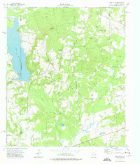 1973 New Salem1976 Print · USGSThe border of Rusk and Cherokee counties in the early 1970s shows a landscape of East Texas timber and industry. Trace the legacy of rural communities at New Salem and Anadarko, alongside historic sites like Cool Springs Cem and the Southern Pacific railroad.
 - 1973 Map of Reklaw, 1976 Print
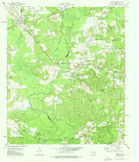 1973 Reklaw1976 Print · USGSThe rural tri-county borderlands of East Texas are captured here in the 1970s, as the Southern Pacific rail line linked small timber and farming outposts. Genealogists can locate family landmarks like Looney Cem and McKnight Ch, or trace the old paths near Dextra.
 - 1973 Map of Berryhill Creek, 1977 Print
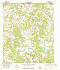 1973 Berryhill Creek1977 Print · USGSRusk County is captured in the early seventies, showing a landscape of East Texas timberlands shaped by the oil industry and rural faith. Researchers can find old family-named sites like Crow Cem, Lockhart Cem, and Union Grove Ch.
 - 1973 Map of Price, 1977 Print
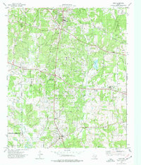 1973 Price1977 Print · USGSRusk County entered the 1970s as a landscape defined by the machinery of the petroleum industry and old crossroads communities. Researchers can trace the legacy of the East Texas Oil Field alongside local landmarks like West Rusk High Sch, Old London, and the Black Jack Cem.
 - 1973 Map of Gum Springs, 1977 Print
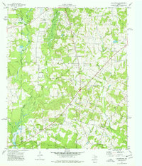 1973 Gum Springs1977 Print · USGSEast Texas petroleum production and rural life meet in the 1970s across this portion of Rusk and Cherokee Counties. Researchers can locate numerous family burial sites like Waggoner Cem and local centers including Good Springs and Macedonia Ch.
 - 1983 Map of Tatum
 1983 Tatum1983 Print · USGSEast Texas at the start of the 1980s reveals a landscape where timber and water resources meet growing recreation. Researchers can trace rural lineages through local settlements like Harmony Hill and Mayflower or explore the lakeside development of Martin Lake.2 unique versions available
Showing maps 1-25 of 169
Top cities of Rusk County
- Henderson historical maps
- Overton historical maps
- New London historical maps
- Mount Enterprise historical maps
Frequently asked questions
- What are the different types of historical maps available for Rusk County?
- What is the oldest map of Rusk County?
- Where can I purchase historical maps of Rusk County for my home or office?
- Where can I download high-res historical maps of Rusk County?
- Are there historical topographic maps available for Rusk County?
- Is there historical aerial imagery available for Rusk County?
- Where are historical maps of Rusk County sourced from?