2000s (21st Century) Maps of Powell, Texas
Explore 6 historic maps of Powell from the 2000s (21st Century). These maps offer a rare glimpse into what life looked like during the 2000s — showing old roads, neighborhoods, homes, and landmarks that have changed or disappeared over time.
Whether you're researching your family's past, planning a metal detecting trip, or studying how Powell's landscape evolved across the 2000s, these high-resolution maps are a powerful tool for exploring the history of this region.
- Focus on a specific era: All maps on this page are from the 2000s, giving you a focused view of this time period.
- See what’s changed: Compare century-old streets, trails, and buildings to today's modern landscape using overlays and satellite layers.
- Research with precision: Use these maps for genealogy, historical research, land use analysis, or educational projects.
- View, download, or print: Maps are fully viewable online in high resolution, and can be downloaded or printed for your own records.
Start exploring Powell's history through authentic maps from the 2000s. This is your window into the past.
Powell, TX maps
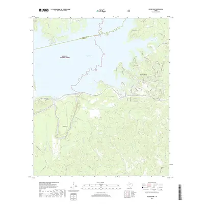
(6)- 2003 Map of McGee Bend, 2004 Print
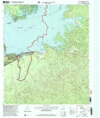 2003 McGee Bend2004 Print · USGSJasper County at the dawn of the new millennium shows a landscape defined by the waters of the Sam Rayburn Reservoir. Researchers can trace the developed shorelines near Rayburn Country and locate specific facilities like the McGee Bend Dam and Ebenezer Park (COE).
 - 2010 Map of McGee Bend, 2010 Print
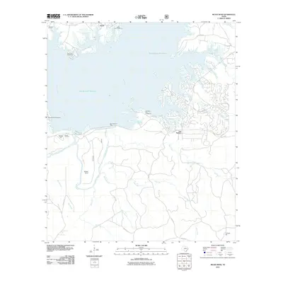 2010 McGee Bend2010 Print · USGSCovers Powell, including Sam Rayburn, San Augustine County, and other nearby areas
 - 2013 Map of McGee Bend, 2013 Print
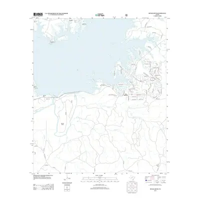 2013 McGee Bend2013 Print · USGSCovers Powell, including Sam Rayburn, San Augustine County, and other nearby areas
 - 2016 Map of McGee Bend, 2016 Print
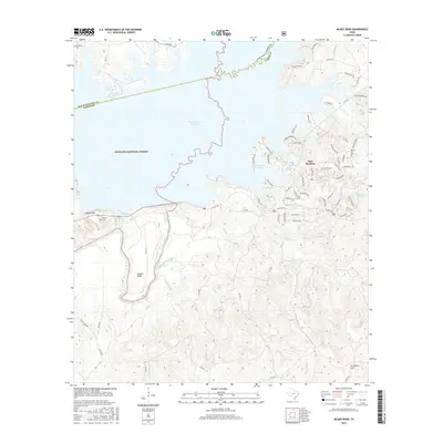 2016 McGee Bend2016 Print · USGSCovers Powell, including Sam Rayburn, San Augustine County, and other nearby areas
 - 2019 Map of McGee Bend, 2019 Print
 2019 McGee Bend2019 Print · USGSCovers Powell, including Sam Rayburn, San Augustine County, and other nearby areas
 - 2022 Map of McGee Bend, 2022 Print
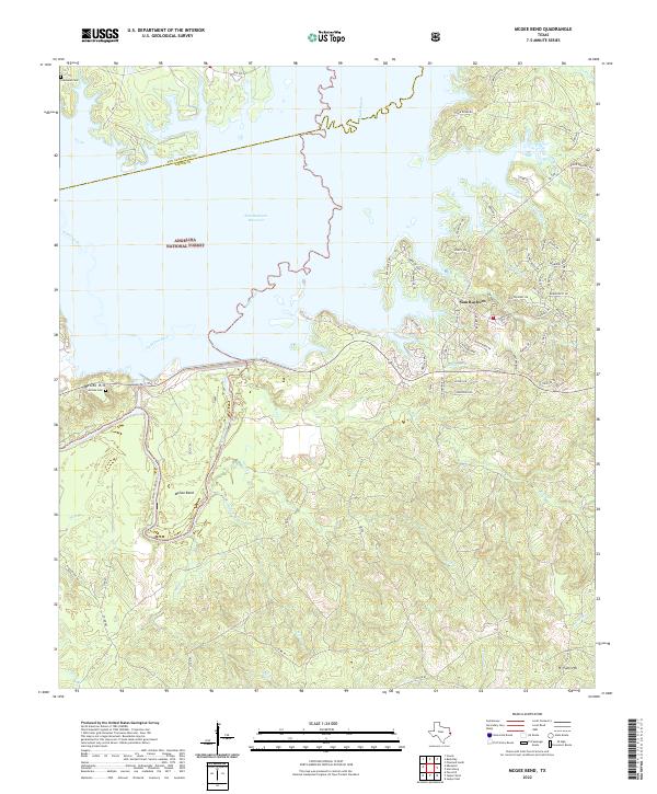 2022 McGee Bend2022 Print · USGSEast Texas river-bottom history meets the sprawling shoreline of the Sam Rayburn Reservoir in the 2020s. Genealogists and local historians can trace legacy sites like Townsend Cem, McGee Hill, and the namesake McGee Bend along the water's edge.
End of results
Showing maps 1-6 of 6
Top cities near Powell
- Jasper historical maps
- Hemphill historical maps
- Pineland historical maps
- Broaddus historical maps
- Browndell historical maps
Frequently asked questions
- What are the different types of historical maps available for Powell?
- What is the oldest map of Powell?
- Where can I purchase historical maps of Powell for my home or office?
- Where can I download high-res historical maps of Powell?
- Are there historical topographic maps available for Powell?
- Is there historical aerial imagery available for Powell?
- Where are historical maps of Powell sourced from?