Old Maps of Somervell County, Texas for Metal Detecting
Plan your next treasure hunt with 69 historic maps of Somervell County. Find old homesites, ghost towns, trails, and gathering spots that may be lost to time — perfect for identifying promising metal detecting locations.
- Locate forgotten sites: Uncover places like long-lost settlements, abandoned rail lines, or gathering spots.
- Plan better hunts: Use map overlays combined with LiDAR or satellite views to narrow in on historically rich areas.
- Made for detectorists: Thousands of hobbyists use these maps to discover relics, coins, and hidden history.
Use these historic maps to boost your research and find new opportunities beneath the surface of Somervell County.
Somervell County, TX maps
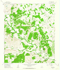
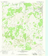
(69)- 1889 Map of Granbury
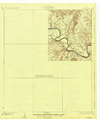
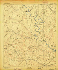 1889 Granbury1889 Print · USGSIn the late 1880s, the Brazos River dictated the life and travel of North Texas, carving deep bends through Hood and Somervell counties. Genealogists and historians can trace early settlements like Fort Spunky and Glenrose or the routes of the Texas Central Railroad.6 unique versions available
 - 1924 Map of Granbury 1-c
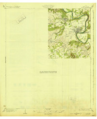
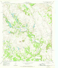
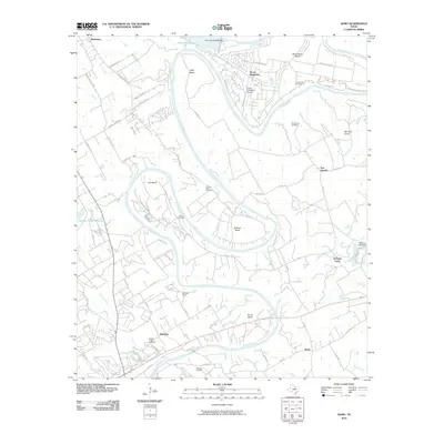
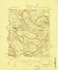 1924 Granbury 1-c1924 Print · USGSThe Brazos River creates a series of dramatic loops through Somervell and Hood Counties in the mid-1920s. Genealogists and local historians can trace the old community footprints of Mambrino, Nemo, and Georges Creek, alongside rural landmarks like Nubbin Ridge Church.
 - 1924 Map of Granbury 4-a
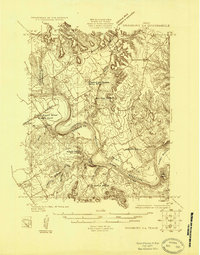 1924 Granbury 4-a1924 Print · USGSThe Brazos River landscape in the mid-1920s reveals a rural Texas community defined by its winding waterways and local schoolhouses. Genealogists can locate family landmarks like the Rohme Ranch, New Hope Church, and the Frog Hollow School.
 - 1928 Map of Godley
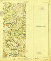 1928 Godley1928 Print · USGSThe Brazos River winds through Hood and Somervell Counties in the mid-1920s, defining a landscape of deep river bends and rural crossroads. Researchers can locate early educational landmarks like Cordova Bend School and Harmony School, or trace the site of Ft Spunky.2 unique versions available
 - 1931 Map of Morgan
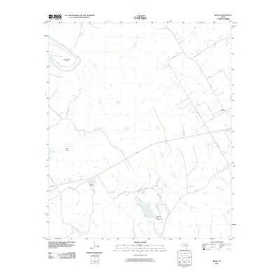
 1931 Morgan1931 Print · USGSThe Brazos River's dramatic winding oxbows define this rural Texas landscape in the 1920s where Somervell, Johnson, and Bosque Counties meet. Genealogists and local historians can trace family roots at Brazos Point or find old school sites like Frog Hollow Sch and Highland Sch.2 unique versions available
 - 1931 Map of Tolar
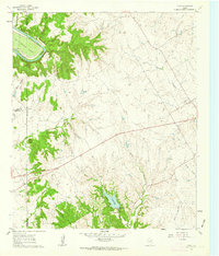
 1931 Tolar1931 Print · USGSThe Brazos River valley of Hood County comes alive in this early 1930s survey of the Granbury area. Trace the early layout of Granbury, the route of the Fort Worth and Rio Grande, and rural landmarks like Comanche Peak.2 unique versions available
 - 1954 Map of Dallas, 1963 Print
 1954 Dallas1963 Print · USGSNorth Texas in the mid-fifties and early sixties reveals a landscape of rapid urban growth and water management. Genealogists and historians can trace the evolution of the metroplex through landmarks like Hensley Field, Boles Orphan Home, and the Texas & Pacific RR.4 unique versions available
 - 1958 Map of Dallas
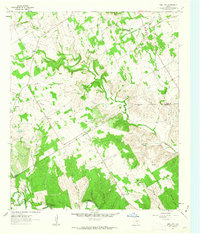
 1958 Dallas1958 Print · USGSNorth Texas in the late fifties shows the dramatic expansion of the Metroplex as it absorbs surrounding farm towns. Genealogists and historians can trace old rail lines like the Missouri-Kansas-Texas and locate early lakefront developments at Eagle Mountain Lake and Lake Worth Village.
 - 1961 Map of Hill City, 1963 Print
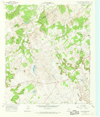
 1961 Hill City1963 Print · USGSCrossing the Hood and Somervell county line in the early sixties, this landscape shows a network of family farms and rural outposts. Researchers can locate the Mt Pleasant Cemetery, the Neri schoolhouse, and the Cedar Brake Girl Scout Camp along the Paluxy River.3 unique versions available
 - 1961 Map of Nemo, 1963 Print
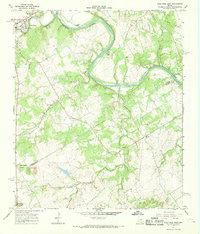
 1961 Nemo1963 Print · USGSThe Brazos River winds through the Hood and Somervell County border in the early sixties, creating a landscape of deep river bends and small rural communities. Genealogists can trace family roots at Mitchell Bend Cem or Oldham Cem, and locate landmarks like Fort Spunkey and Mambrino.3 unique versions available
 - 1961 Map of Paluxy, 1963 Print
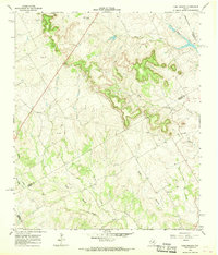
 1961 Paluxy1963 Print · USGSIn the early 1960s, the rural borderlands of Hood and Somervell Counties were defined by the winding Paluxy River and a network of family-named creeks. Genealogists can trace early homesteads and community hubs like Elm Grove Ch, Glenn Cem, and the settlement of Paluxy.2 unique versions available
 - 1961 Map of Bono, 1963 Print
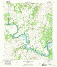
 1961 Bono1963 Print · USGSJohnson County and the surrounding ranch lands are captured here in the early sixties as the Brazos River winds through its massive oxbow. Researchers can locate the small settlement of Bono, the quiet Nemo Cem, and the early layout of Cleburne State Park.3 unique versions available
 - 1966 Map of Chalk Mountain, 1968 Print
 1966 Chalk Mountain1968 Print · USGSThe borderlands of Erath and Somervell counties come into focus during the mid-sixties, revealing a rural landscape of winding creeks and limestone hills. Genealogists can trace family landmarks and community centers like Chalk Mountain Ch, Plainview Ch, and Lesley Lake.2 unique versions available
 - 1966 Map of Camp Branch, 1968 Print
 1966 Camp Branch1968 Print · USGSThe Texas ranchlands at the Erath and Bosque county line are captured here in the mid-sixties, showing a landscape defined by cattle country and river forks. Genealogists and land researchers can locate the Flanary Cem, Surprise Valley Ranch, and the winding course of Duffau Creek.
 - 1966 Map of Glen Rose West, 1968 Print
 1966 Glen Rose West1968 Print · USGSGlen Rose and the surrounding river breaks are captured in the mid-1960s, showing a landscape defined by the winding Paluxy River and scattered rural communities. Genealogists can locate family landmarks like Lanham Mill Cem, Nancy Smith Cem, and the small settlement of Glass.2 unique versions available
 - 1966 Map of Walnut Springs West, 1968 Print
 1966 Walnut Springs West1968 Print · USGSNorthwest Bosque County in the mid-1960s shows a landscape of established cattle ranching and shifting transportation lines. You can trace the footprint of the Flat Top Ranch, locate the Fulton Cem, and see the abandoned rail line at Walnut Springs.
 - 1967 Map of Glen Rose East, 1968 Print
 1967 Glen Rose East1968 Print · USGSThe Brazos and Paluxy rivers meet in the Texas Hill Country during the late sixties, defining a landscape of riverside camps and rural outposts. Genealogists can trace the footprint of Glen Rose, locate White Ch, or explore the settlement at Eulogy.2 unique versions available
 - 1968 Map of Brazos Point, 1971 Print
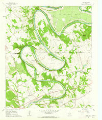
 1968 Brazos Point1971 Print · USGSThe Brazos River and Lake Whitney define this borderland of Johnson, Bosque, and Somervell counties in the late sixties. Trace family sites at Stanford Cem or Baker Lain Cem, and locate old river landmarks like Brazos Point and Kimball Bend.2 unique versions available
 - 1985 Map of Cleburne
 1985 Cleburne1985 Print · USGSThe Brazos River valley and its major mid-century reservoirs dominate this North Central Texas landscape during the 1980s. Local researchers can trace family roots through sites like Mt Carmel Ch, Oak Hill Sch, and the unique river bends near Glen Rose.2 unique versions available
 - 2010 Map of Glen Rose East, 2010 Print
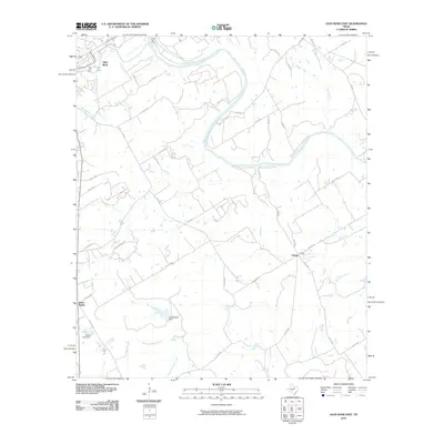 2010 Glen Rose East2010 Print · USGSCovers Somervell County, including Glen Rose, Seven Knobs, and other nearby areas
 - 2010 Map of Paluxy, 2010 Print
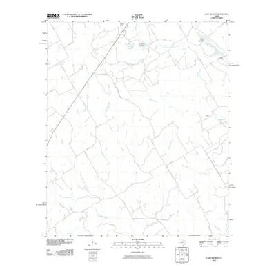
 2010 Paluxy2010 Print · USGSCovers Somervell County, including Paluxy, Hood County, and other nearby areas
 - 2010 Map of Camp Branch, 2010 Print
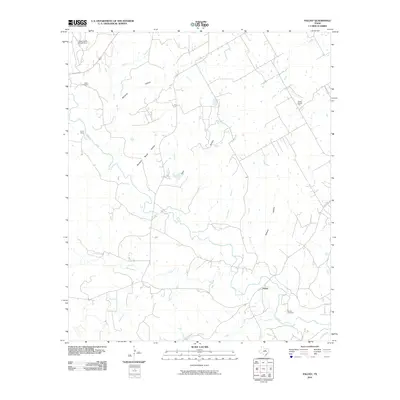
 2010 Camp Branch2010 Print · USGSCovers Somervell County, including Erath County, Bosque County, and other nearby areas
 - 2010 Map of Chalk Mountain, 2010 Print
 2010 Chalk Mountain2010 Print · USGSCovers Somervell County, including Chalk Mountain, Hood County, and other nearby areas
 - 2010 Map of Nemo, 2010 Print
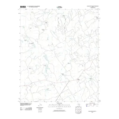
 2010 Nemo2010 Print · USGSCovers Somervell County, including Glen Rose, Mambrino, and other nearby areas
 - 2010 Map of Bono, 2010 Print
 2010 Bono2010 Print · USGSCovers Somervell County, including Cleburne, Bono, and other nearby areas
Showing maps 1-25 of 69
Top cities of Somervell County
Frequently asked questions
- What are the different types of historical maps available for Somervell County?
- What is the oldest map of Somervell County?
- Where can I purchase historical maps of Somervell County for my home or office?
- Where can I download high-res historical maps of Somervell County?
- Are there historical topographic maps available for Somervell County?
- Is there historical aerial imagery available for Somervell County?
- Where are historical maps of Somervell County sourced from?