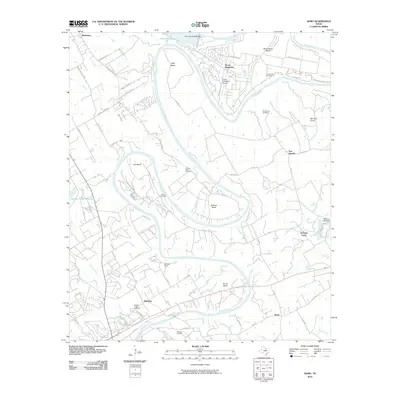
2010 Map of Nemo
USGS Topo · Published 2010About this map
The Brazos River creates a dramatic, winding course through this portion of Somervell and Hood Counties, defining a landscape shaped by sharp river bends and mid-stream peninsulas. Large geographic features such as Abby Bend, Mitchell Bend, and Cox Bend illustrate the meandering nature of the river as it flows southeast toward the community of Nemo. Development is concentrated near the northern boundary at Pecan Plantation, which includes the Pecan Plantation Airport, while the southern reaches remain more rural, dotted with family and community landmarks like Oldham Cemetery and Squaw Creek Cemetery. The map also captures significant water management features, including the De Cordova Bend Dam on Lake Granbury and a portion of the Squaw Creek Reservoir to the west, highlighting the area's transition into a managed water and recreation corridor.
Find a feature on this map
71 named features on this map. Tap any name to fly to it.
Don’t see what you’re looking for? This feature index may not catch every label — zoom into the map to look around manually.
Map Details
Editions of this 2010 Nemo Map
This is the sole edition of this map. No revisions or reprints were ever made.
Other maps of this area

1889 · Granbury
USGS Topo · 1:125,000

1923 · Granbury 2-a
USGS Topo · 1:48,000

1923 · Granbury 1-b
USGS Topo · 1:48,000

1924 · Granbury 1-c
USGS Topo · 1:48,000

1924 · Granbury 4-a
USGS Topo · 1:48,000

1928 · Godley
USGS Topo · 1:62,500

1931 · Morgan
USGS Topo · 1:62,500

1931 · Tolar
USGS Topo · 1:62,500

1954 · Dallas
USGS Topo · 1:250,000

1958 · Dallas
USGS Topo · 1:250,000