
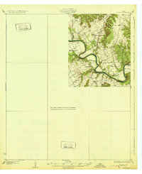
1931 Map of Morgan
USGS Topo · Published 1931About this map
The Brazos River carves a dramatic, winding path through this corner of Central Texas, forming the sharp oxbow of Kimball Bend and the distinctive peninsula known as Goat Neck. Surveyed in the mid-1920s, the landscape is defined by the rural intersections of Somervell, Johnson, and Bosque Counties. Small community life centers around the settlement at Brazos Point and several country schoolhouses, including Highland Sch and the uniquely named Frog Hollow Sch.
Find a feature on this map
15 named features on this map. Tap any name to fly to it.
Don’t see what you’re looking for? This feature index may not catch every label — zoom into the map to look around manually.
Map Details
Editions of this 1931 Morgan Map
2 editions found
Other maps of this area

1888 · Meridian
USGS Topo · 1:125,000

1889 · Granbury
USGS Topo · 1:125,000

1891 · Cleburne
USGS Topo · 1:125,000

1892 · Waco
USGS Topo · 1:125,000

1894 · Meridian
USGS Topo · 1:125,000

1894 · Cleburne
USGS Topo · 1:125,000

1920 · Waco
USGS Topo · 1:125,000

1924 · Cleburne 3-B
USGS Topo · 1:48,000

1924 · Waco 2-b
USGS Topo · 1:48,000

1924 · Granbury 1-c
USGS Topo · 1:48,000