Old Maps of Mount Pleasant, Texas for Genealogy
Trace your family roots with 24 historic maps of Mount Pleasant. These high-res maps reveal old neighborhoods, homesites, landmarks, and streets — helping you uncover where your ancestors lived and how the area evolved over time.
- Explore historic neighborhoods: Identify where your relatives may have lived in the 1800s or 1900s.
- Compare maps over time: Trace the changes in streets, buildings, and landmarks for multi-generational research.
- Perfect for genealogy & ancestry research: Used by family historians and researchers to map out lineage and migration.
These maps are an incredible resource for exploring your personal connection to Mount Pleasant's past.
Mount Pleasant, TX maps
(24)- 1953 Map of Texarkana, 1964 Print
 1953 Texarkana1964 Print · USGSThe Texas-Arkansas borderlands are captured here in the mid-fifties, during a decade of massive military and hydraulic engineering projects. Genealogists and researchers can locate family landmarks like Old Boston Cem, Siloam Ch, and the vast Red River Arsenal.4 unique versions available
 - 1956 Map of Texarkana
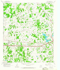
 1956 Texarkana1956 Print · USGSThe Ark-La-Tex borderlands come alive in the mid-fifties, showing the transition from a rail-dependent rural economy to a post-war industrial landscape. Researchers can trace the massive Red River Ordnance Depot and find towns like Talco, Bogata, and Naples.
 - 1964 Map of Harvard, 1967 Print
 1964 Harvard1967 Print · USGSIn the mid-1960s, the rural landscapes of Titus and Camp Counties were defined by the winding Big Cypress Creek and the intersection of major rail lines. Genealogists can trace family footprints at Concord Cem, North Chapel Cem, and old church sites like East New Hope Ch.
 - 1965 Map of Winfield, 1967 Print
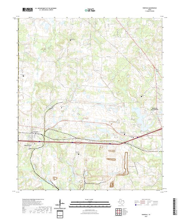
 1965 Winfield1967 Print · USGSThe Titus County landscape of the mid-sixties centers on the rail-side community of Winfield and its surrounding rural settlements. Genealogists and local historians can trace family locations near Marshall Springs Ch, Tranquil Cem, and the Farmers Academy district.
 - 1965 Map of Mount Pleasant, 1967 Print
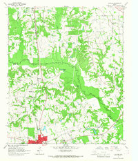
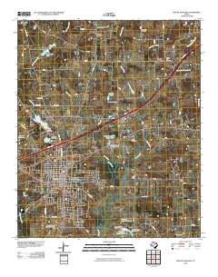
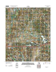
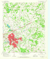 1965 Mount Pleasant1967 Print · USGSMount Pleasant and its surrounding Titus County communities appear here in the mid-sixties during a period of steady industrial and civic expansion. Local historians can trace the town's evolution through the St Louis Southwestern rail lines, old country landmarks like Harts Bluff Sch, and family cemeteries including Masonic Cem.3 unique versions available
 - 1985 Map of Sulphur Springs
 1985 Sulphur Springs1985 Print · USGSNortheast Texas in the mid-eighties shows a landscape transitioning between its deep-rooted rail towns and a new era of reservoir development. Genealogists and historians can trace family locations near Shooks Chapel, the rural Farmers Academy, and the banks of the South Sulphur River.
 - 1986 Map of Texarkana
 1986 Texarkana1986 Print · USGSThe Texas-Arkansas borderlands are captured here in the mid-eighties as a hub of military industry and river-basin geography. Genealogists and local historians can locate rural landmarks like Red Hill Cem, Coopers Chapel, and the Lone Star Army Ammunition Plant.
 - 1991 Map of Sulphur Springs
 1991 Sulphur Springs1991 Print · USGSNortheast Texas in the early nineties shows a transition from rail-dependent agriculture to a landscape defined by massive reservoirs. Researchers can trace rural lineages through sites like Gafford Chapel and the Forest Academy Cem, or follow the path of the St Louis Southwestern RR.
 - 1992 Map of Texarkana
 1992 Texarkana1992 Print · USGSThe Ark-La-Tex border region comes into focus in the early nineties, centered on the sprawling waters of Wright Patman Lake. Genealogists and historians can trace rail-town development and rural roots through Old Union Cem, the Red River Army Depot, and Dalby Springs Cem.
 - 2010 Map of Winfield, 2010 Print
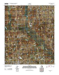
 2010 Winfield2010 Print · USGSCovers Mount Pleasant, including Winfield, Miller's Cove, and other nearby areas
 - 2010 Map of Mount Pleasant, 2010 Print
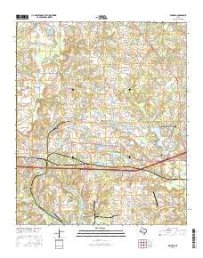
 2010 Mount Pleasant2010 Print · USGSCovers Mount Pleasant, including Old Union, Gladewater, and other nearby areas
 - 2010 Map of Harvard, 2010 Print
 2010 Harvard2010 Print · USGSCovers Mount Pleasant, including Pittsburg, Macedonia, and other nearby areas
 - 2013 Map of Mount Pleasant, 2013 Print
 2013 Mount Pleasant2013 Print · USGSCovers Mount Pleasant, including Old Union, Gladewater, and other nearby areas
 - 2013 Map of Harvard, 2013 Print
 2013 Harvard2013 Print · USGSCovers Mount Pleasant, including Pittsburg, Macedonia, and other nearby areas
 - 2013 Map of Winfield, 2013 Print
 2013 Winfield2013 Print · USGSCovers Mount Pleasant, including Winfield, Miller's Cove, and other nearby areas
 - 2016 Map of Mount Pleasant, 2016 Print
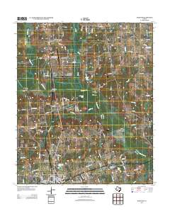
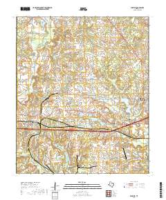
 2016 Mount Pleasant2016 Print · USGSCovers Mount Pleasant, including Old Union, Gladewater, and other nearby areas
 - 2016 Map of Winfield, 2016 Print
 2016 Winfield2016 Print · USGSCovers Mount Pleasant, including Winfield, Miller's Cove, and other nearby areas
 - 2016 Map of Harvard, 2016 Print
 2016 Harvard2016 Print · USGSCovers Mount Pleasant, including Pittsburg, Macedonia, and other nearby areas
 - 2019 Map of Harvard, 2019 Print
 2019 Harvard2019 Print · USGSCovers Mount Pleasant, including Pittsburg, Macedonia, and other nearby areas
 - 2019 Map of Mount Pleasant, 2019 Print
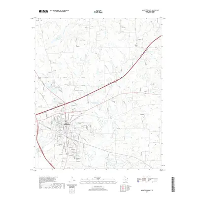 2019 Mount Pleasant2019 Print · USGSCovers Mount Pleasant, including Old Union, Gladewater, and other nearby areas
 - 2019 Map of Winfield, 2019 Print
 2019 Winfield2019 Print · USGSCovers Mount Pleasant, including Winfield, Miller's Cove, and other nearby areas
 - 2022 Map of Winfield, 2022 Print
 2022 Winfield2022 Print · USGSThe Titus County countryside near Winfield is shown here in the early 2020s, revealing a landscape shaped by rural industry and historic family sites. Genealogists and local historians can trace locations of several community markers like White Oak Springs Cem, Barrett Cem, and Miller's Cove.
 - 2022 Map of Harvard, 2022 Print
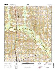
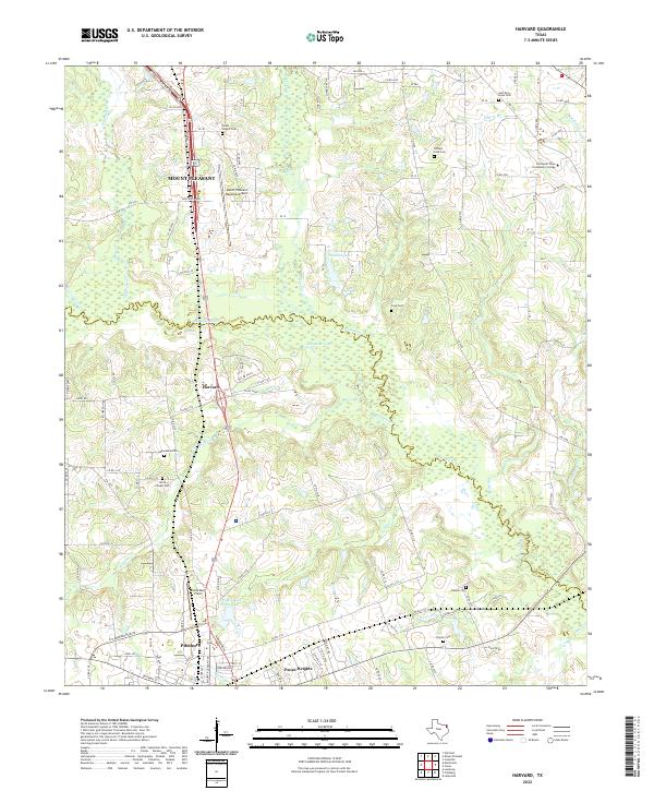 2022 Harvard2022 Print · USGSThis East Texas landscape spans the border of Titus and Camp Counties in 2022, centering on the corridor between Mount Pleasant and Pittsburg. Genealogists and local historians can trace family burial sites at Macedonia Cem or North Chapel Cem and explore landmarks like Harvard and Sandlin Lake.
 - 2022 Map of Mount Pleasant, 2022 Print
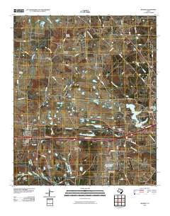
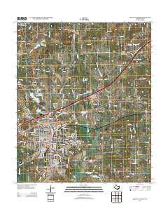
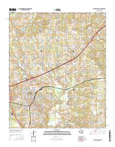
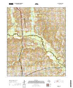
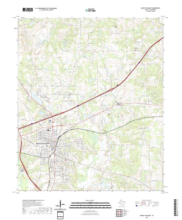 2022 Mount Pleasant2022 Print · USGSMount Pleasant and the surrounding Titus County landscape are captured here in the early twenty-first century, showing a mix of civic expansion and preserved local heritage. Researchers can trace numerous historic burial sites, including the Masonic Cem - East, Cortinez Cem, and Green Hill Cem.
End of results
Showing maps 1-24 of 24
Top cities near Mount Pleasant
- Pittsburg historical maps
- Omaha historical maps
- Talco historical maps
- Winfield historical maps
- Miller's Cove historical maps
- Rocky Mound historical maps
Frequently asked questions
- What are the different types of historical maps available for Mount Pleasant?
- What is the oldest map of Mount Pleasant?
- Where can I purchase historical maps of Mount Pleasant for my home or office?
- Where can I download high-res historical maps of Mount Pleasant?
- Are there historical topographic maps available for Mount Pleasant?
- Is there historical aerial imagery available for Mount Pleasant?
- Where are historical maps of Mount Pleasant sourced from?