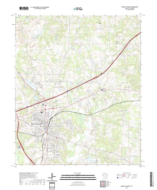
2022 Map of Mount Pleasant
USGS Topo · Published 2022About this map
The Titus County Courthouse serves as the central anchor for Mount Pleasant in this modern survey, which details a landscape defined by its many reservoirs and memorial grounds. Significant water bodies such as New City Lake, Old City Lake, and John B Stephens Junior Lake illustrate the area's developed hydrography, while the outskirts are marked by a high density of rural burial sites. Genealogists will find a wealth of local history in the presence of the Masonic Cem - West, Masonic Cem - East, and Nevils Chapel Cem, alongside smaller family or church-affiliated plots like the Riddle Cem Number 2 and Rountree Cem. The terrain is further etched by the winding paths of Hart Cr and Evans Cr, showing the persistent drainage patterns of northeast Texas amidst evolving road networks.
Find a feature on this map
184 named features on this map. Tap any name to fly to it.
Don’t see what you’re looking for? This feature index may not catch every label — zoom into the map to look around manually.
Map Details
Editions of this 2022 Mount Pleasant Map
This is the sole edition of this map. No revisions or reprints were ever made.
Other maps of this area

1953 · Texarkana
USGS Topo · 1:250,000

1956 · Texarkana
USGS Topo · 1:250,000

1964 · Harvard
USGS Topo · 1:24,000

1964 · Wilkinson
USGS Topo · 1:24,000

1964 · Talco
USGS Topo · 1:24,000

1964 · Cason
USGS Topo · 1:24,000

1965 · Winfield
USGS Topo · 1:24,000

1965 · Monticello
USGS Topo · 1:24,000

1965 · Mount Pleasant
USGS Topo · 1:24,000
1965 · Cookville
USGS Topo · 1:24,000