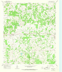
1965 Map of Cookville
USGS Topo · Published 1968About this map
The St Louis Southwestern railroad corridor defines the central development of this East Texas landscape, connecting the primary settlements of Cookville and Omaha. This mid-1960s survey captures a rural environment structured by its creek systems, where Boggy Creek and its various forks such as Little Boggy Creek and Okry Creek wind through the terrain. The map is particularly valuable for genealogical research, documenting numerous rural meeting points and resting places like Mt Moriah Ch, Pleasant Grove Ch, and several family or community burial grounds including Keith Cem and Barrier Cem. Small-scale industry is evidenced by a Gravel Pit near the eastern edge, while the transition between Titus and Morris counties is clearly delineated as it bisects smaller communities like Lone Star and Center Grove.
Find a feature on this map
32 named features on this map. Tap any name to fly to it.
Don’t see what you’re looking for? This feature index may not catch every label — zoom into the map to look around manually.
Map Details
Editions of this 1965 Cookville Map
2 editions found
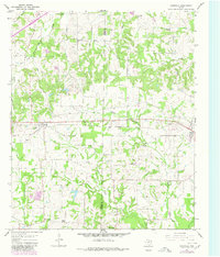
Other maps of this area

1914 · Daingerfield
USGS Topo · 1:62,500

1930 · Bassett
USGS Topo · 1:62,500

1953 · Texarkana
USGS Topo · 1:250,000

1956 · Texarkana
USGS Topo · 1:250,000

1964 · Harvard
USGS Topo · 1:24,000

1964 · Wilkinson
USGS Topo · 1:24,000

1964 · Daingerfield
USGS Topo · 1:24,000

1964 · Cason
USGS Topo · 1:24,000

1965 · Dalby Springs
USGS Topo · 1:24,000

1965 · Mount Pleasant
USGS Topo · 1:24,000