
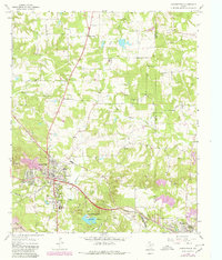
1964 Map of Daingerfield
USGS Topo · Published 1967About this map
The intersection of the Louisiana & Arkansas RR and the Louisiana Arkansas & Texas RR anchors the landscape around Daingerfield, providing a glimpse into the industrial and social heart of Morris County during the mid-1960s. The map captures a transition from the wooded ridges of the Black Mountains to the lowlands of Black Cypress Creek and Kelly Creek. To the south, Daingerfield State Park surrounds a central reservoir, while the outskirts of town reveal active resource extraction through scattered gravel pits, a Strip Mine, and the Black Mountain Mine.
Find a feature on this map
43 named features on this map. Tap any name to fly to it.
Don’t see what you’re looking for? This feature index may not catch every label — zoom into the map to look around manually.
Map Details
Editions of this 1964 Daingerfield Map
2 editions found
Other maps of this area

1914 · Daingerfield
USGS Topo · 1:62,500

1953 · Texarkana
USGS Topo · 1:250,000

1956 · Texarkana
USGS Topo · 1:250,000

1956 · Tyler
USGS Topo · 1:250,000

1960 · La Fayette
USGS Topo · 1:24,000

1962 · Avinger
USGS Topo · 1:24,000

1962 · Lone Star
USGS Topo · 1:24,000

1964 · Cason
USGS Topo · 1:24,000

1965 · Marietta
USGS Topo · 1:24,000
1965 · Sardis
USGS Topo · 1:24,000