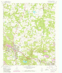
1964 Map of Daingerfield
USGS Topo · Published 1980About this map
Daingerfield and Hughes Springs anchor this portion of the East Texas piney woods as it appeared in the mid-1960s, with updates into the late 1970s. The landscape is a mosaic of family-named cemeteries and rural churches, reflecting generations of settlement along the winding courses of Black Cypress Creek and Rocky Branch. Resource extraction and industry are prominent, evidenced by the Black Mountain Mine, various Gravel Pits, and a Strip Mine located near the Texas and Northern rail line.
Find a feature on this map
44 named features on this map. Tap any name to fly to it.
Don’t see what you’re looking for? This feature index may not catch every label — zoom into the map to look around manually.
Map Details
Editions of this 1964 Daingerfield Map
2 editions found
Other maps of this area

1914 · Daingerfield
USGS Topo · 1:62,500

1953 · Texarkana
USGS Topo · 1:250,000

1956 · Texarkana
USGS Topo · 1:250,000

1956 · Tyler
USGS Topo · 1:250,000

1960 · La Fayette
USGS Topo · 1:24,000

1962 · Avinger
USGS Topo · 1:24,000

1962 · Lone Star
USGS Topo · 1:24,000

1964 · Daingerfield
USGS Topo · 1:24,000

1964 · Cason
USGS Topo · 1:24,000

1965 · Marietta
USGS Topo · 1:24,000