Old Maps of Tyler County, Texas for Genealogy
Trace your family roots with 175 historic maps of Tyler County. These high-res maps reveal old neighborhoods, homesites, landmarks, and streets — helping you uncover where your ancestors lived and how the area evolved over time.
- Explore historic neighborhoods: Identify where your relatives may have lived in the 1800s or 1900s.
- Compare maps over time: Trace the changes in streets, buildings, and landmarks for multi-generational research.
- Perfect for genealogy & ancestry research: Used by family historians and researchers to map out lineage and migration.
These maps are an incredible resource for exploring your personal connection to Tyler County's past.
Tyler County, TX maps
(175)- 1927 Map of Lufkin 4-c
 1927 Lufkin 4-c1927 Print · USGSDeep in the Piney Woods during the late twenties, this survey documents the winding Neches River and the rural communities of Polk County. Researchers can locate the Pluck PO, Seaman Ridge Sch, and the path of the Beaumont Trinity and Sabine.
 - 1928 Map of Zavalla 3-c
 1928 Zavalla 3-c1928 Print · USGSThe timber-driven landscape of East Texas is captured here in the late twenties along the winding Neches River. Researchers can trace the paths of old logging lines like the Lumber RR Switch and find rural community hubs like Rockland, Nancy, and the Saron Sch.
 - 1928 Map of Lufkin 4-d
 1928 Lufkin 4-d1928 Print · USGSDeep in the East Texas bottomlands during the late 1920s, the river systems dictate the shape of local life and county lines. Genealogists can trace family footprints near Lambert Chapel or the rural Crane Sch and Delview Sch.
 - 1931 Map of Zavalla
 1931 Zavalla1931 Print · USGSEast Texas river life and rail expansion meet in the late 1920s at the junction of the Neches River and the Beaumont Southern Pacific. Researchers can trace old river crossings like Rockland Ferry and Rock Ford or locate vanished school sites like Saron Sch.2 unique versions available
 - 1932 Map of Manning
 1932 Manning1932 Print · USGSDeep in the Piney Woods during the early thirties, this area shows the intersection of three counties along the Neches River. Genealogists can trace family footprints at Havard Cem or follow the old Waco Beaumont Trinity and Sabine Railway to Pluck PO.3 unique versions available
 - 1953 Map of Palestine, 1964 Print
 1953 Palestine1964 Print · USGSEast Texas was defined by its deep pine forests and burgeoning energy sector in the mid-1950s. Genealogists and historians can trace the rail-and-river economy through settlements like Tennessee Colony and Pollok or explore the early footprints of the Cayuga Oil Field and Davy Crockett National Forest.2 unique versions available
 - 1954 Map of Beaumont, 1964 Print
 1954 Beaumont1964 Print · USGSSoutheast Texas in the mid-fifties reveals a landscape of massive national forests, emerging reservoirs, and a booming oil economy. Genealogists and researchers can trace rural settlements like Dallardsville and Village Mills or locate early drilling sites at Sour Lake Oil Field.3 unique versions available
 - 1955 Map of Woodville, 1956 Print
 1955 Woodville1956 Print · USGSWoodville and the surrounding East Texas timberlands are captured here in the mid-fifties, centered on the Southern Pacific rail corridor. Researchers can locate family sites and early landmarks like Egypt Cemetery, Colmesneil, and the Gregory fire tower.2 unique versions available
 - 1955 Map of Camden, 1956 Print
 1955 Camden1956 Print · USGSThe deep piney woods of Polk and Tyler Counties are shown here during the mid-fifties, when timber industry rails still threaded the hills. Researchers can trace the layout of Camden and Chester or locate family sites like the Darden Palestine Sch Ch and Peach Tree Village Cem.2 unique versions available
 - 1955 Map of Curtis, 1956 Print
 1955 Curtis1956 Print · USGSJasper County is captured here in the mid-fifties just as the landscape was transforming around the Dam B Reservoir. Genealogists can trace family names across a dozen rural burial grounds, from Lanier Cem to Trotti Cem, and locate historical markers like the Bevelport Townsite.3 unique versions available
 - 1957 Map of Beaumont
 1957 Beaumont1957 Print · USGSSoutheast Texas in the mid-fifties is defined by the timber-rich lands between the Trinity River and Beaumont. Trace the history of the Alabama and Coushatti Indian Reservation or locate early campus sites like Prairie View College.
 - 1957 Map of Palestine
 1957 Palestine1957 Print · USGSEast Texas in the mid-fifties reveals a landscape of deep pine forests and winding river valleys before the era of massive reservoir construction. Researchers can trace the legacy of the timber and rail industries through labels for the Missouri Pacific RR, Davy Crockett National Forest, and Nacogdoches.
 - 1958 Map of Zavalla, 1959 Print
 1958 Zavalla1959 Print · USGSEast Texas piney woods and the Neches River valley are captured here just before the landscape-altering creation of the Sam Rayburn Reservoir. Genealogists can trace family-named sites like Dunkin Cem, the Barium Mill, and the site of Fort Teran.3 unique versions available
 - 1958 Map of Mc Gee Bend, 1959 Print
 1958 Mc Gee Bend1959 Print · USGSEast Texas at the end of the 1950s shows a landscape on the brink of change as the Angelina River is harnessed. Trace lost locations like Veach and Zavala or locate family roots at Oak Grove Ch and Sinclair Cem.3 unique versions available
 - 1958 Map of Segno, 1960 Print
 1958 Segno1960 Print · USGSDeep in the East Texas Piney Woods during the late fifties, this area shows the intersection of tribal lands and the burgeoning oil industry. Genealogists can locate family sites near Indian Village, Segno, and the Midway Cem.2 unique versions available
 - 1958 Map of Warren, 1960 Print
 1958 Warren1960 Print · USGSSoutheast Texas timber and oil lands come to life in this late fifties survey of Tyler and Hardin counties. Genealogists and researchers can trace the Southern Pacific rail line to settlements like Warren and landmarks such as the Red Oak Sch.3 unique versions available
 - 1958 Map of Spurger, 1960 Print
 1958 Spurger1960 Print · USGSSoutheast Texas in the late fifties was a landscape of river bottomlands and emerging oil fields. Researchers can trace the legacy of timber and oil through the Old Railroad Grade and Joes Lake Oil Field, or find family roots at Withers Cem and Spring Hill Ch.2 unique versions available
 - 1963 Map of Wolf Hill, 1966 Print
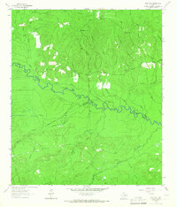 1963 Wolf Hill1966 Print · USGSDeep in the Piney Woods during the early sixties, the Neches River valley reveals a landscape of family-run cemeteries and old timber routes. Trace the Old Railroad Grade and find historic sites like Lambert Chapel or the Wolf Hill Lookout Tower.2 unique versions available
 - 1963 Map of Pluck, 1966 Print
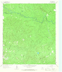 1963 Pluck1966 Print · USGSThe bottomlands of the Neches River are captured here in the early sixties, showing a landscape defined by timber-era infrastructure and rural outposts. Genealogists can locate Grimes Cem and Stryker Cem while tracing the Old Railroad Grade near Pluck.2 unique versions available
 - 1984 Map of Hortense
 1984 Hortense1984 Print · USGSThe piney woods of East Texas are captured here in the early 1980s as rural life centered around small hubs and timber tracts. Local researchers can trace old homesteads and forest roads near Hortense, Kennedy, and the winding Bear Creek.
 - 1984 Map of Chester
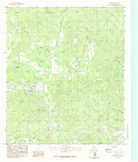 1984 Chester1984 Print · USGSChester and the surrounding piney woods are captured in the mid-1980s, documenting a landscape of small settlements and branching creeks. Researchers can trace the layout of Peach Tree Village, locate a local CEM, and follow the waters of Russell Creek or Big Hill.
 - 1984 Map of Beaumont
 1984 Beaumont1984 Print · USGSSoutheast Texas in the late seventies and early eighties shows a landscape of expanding reservoirs and deep timber industry. Researchers can trace the development of the Sam Houston National Forest or locate regional landmarks like Grabbs Prairie and the Wynne State Prison Farm.3 unique versions available
 - 1984 Map of Jacks Creek South
 1984 Jacks Creek South1984 Print · USGSDeep in the Piney Woods during the early eighties, this area shows the intersection of the energy industry and East Texas timberlands. Genealogists and historians can trace property lines near the Oil Field and along the banks of Big Sandy Creek or Cypress Creek.
 - 1984 Map of Jacks Creek North
 1984 Jacks Creek North1984 Print · USGSThe Tyler and Polk County borderlands in the mid-eighties reveal a landscape of active resource extraction and utility infrastructure. Genealogists and researchers can trace the paths of Jacks Creek and Big Cypress Creek or locate old Gravel Pits and a Pumping Station.
 - 1984 Map of Woodville
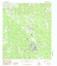 1984 Woodville1984 Print · USGSWoodville and the surrounding Tyler County timberlands are captured here in the mid-1980s as residential growth expanded around the traditional town center. Local researchers can trace the development of Doucette, Forest Lakes, and the winding paths of Turkey Creek.
Showing maps 1-25 of 175
Top cities of Tyler County
Frequently asked questions
- What are the different types of historical maps available for Tyler County?
- What is the oldest map of Tyler County?
- Where can I purchase historical maps of Tyler County for my home or office?
- Where can I download high-res historical maps of Tyler County?
- Are there historical topographic maps available for Tyler County?
- Is there historical aerial imagery available for Tyler County?
- Where are historical maps of Tyler County sourced from?