Old Maps of Ward County, Texas for Genealogy
Trace your family roots with 150 historic maps of Ward County. These high-res maps reveal old neighborhoods, homesites, landmarks, and streets — helping you uncover where your ancestors lived and how the area evolved over time.
- Explore historic neighborhoods: Identify where your relatives may have lived in the 1800s or 1900s.
- Compare maps over time: Trace the changes in streets, buildings, and landmarks for multi-generational research.
- Perfect for genealogy & ancestry research: Used by family historians and researchers to map out lineage and migration.
These maps are an incredible resource for exploring your personal connection to Ward County's past.
Ward County, TX maps
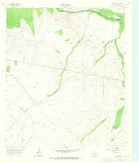
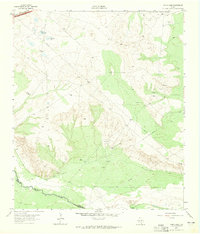
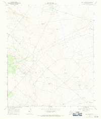
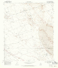
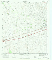
(150)- 1931 Map of Barstow
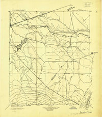 1931 Barstow1931 Print · USGSWest Texas ranching and early oil exploration meet along the Pecos River during the early thirties. Trace family ranch sites like Eclipse Ranch and Courtney Ranch or locate early rural education hubs at Welcome School.
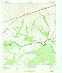
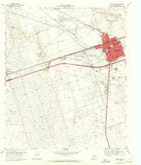
 - 1954 Map of Pecos, 1964 Print
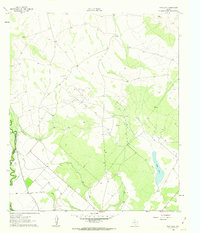
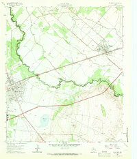
 1954 Pecos1964 Print · USGSMid-century West Texas reveals a landscape of expanding oil fields and cattle ranching along the winding Pecos River. Local historians can trace family ranch lands like Goodrich Ranch, follow the Texas and Pacific rails, or locate the historic Horsehead Crossing.3 unique versions available
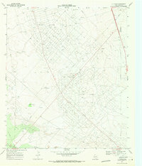
 - 1957 Map of Pecos
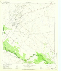
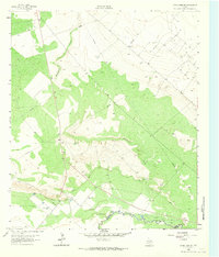
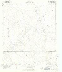
 1957 Pecos1957 Print · USGSWest Texas in the mid-fifties is a landscape of desert oil fields and vital rail corridors. Researchers can trace the sprawling Pyote Air Force Base, the historic Horsehead Crossing, and the rail stops at Mentone and Saragosa.
 - 1961 Map of Soda Lake, 1963 Print
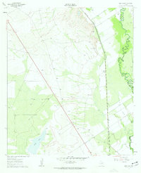
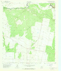
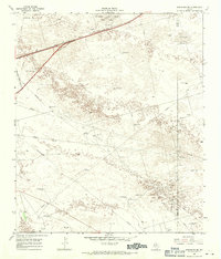
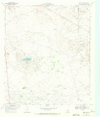
 1961 Soda Lake1963 Print · USGSThe Pecos River valley in the early sixties was a place where irrigation and oil extraction met. You can trace the path of the Barstow Canal, find the Dunegan Ranch, and locate the isolated Grave north of the Cedarvale Canal.3 unique versions available
 - 1961 Map of Mentone, 1963 Print
 1961 Mentone1963 Print · USGSMentone and the surrounding West Texas plains are captured here in the early sixties as the local economy balanced ranching with an intensive oil boom. Researchers can trace the industrial layout of the Wheat Oil Field alongside family landmarks like Moorehead Ranch and the Panhandle and Santa Fe railroad.2 unique versions available
 - 1961 Map of Sand Lake, 1963 Print
 1961 Sand Lake1963 Print · USGSThe Pecos River valley at the Reeves and Ward county line shows a landscape of rail and industry in the early sixties. Genealogists and historians can locate the Lara Cem, Patrole Sch, and the winding route of the Panhandle and Santa Fe railroad.3 unique versions available
 - 1963 Map of Ligon Ranch, 1965 Print
 1963 Ligon Ranch1965 Print · USGSThe Pecos River valley and the expanding West Texas oil fields define this mid-century landscape. Researchers can trace the layout of the Automotive Proving Ground and remote outposts like Ligon Ranch and Alberts Well.2 unique versions available
 - 1963 Map of Quito Draw, 1965 Print
 1963 Quito Draw1965 Print · USGSThe Pecos River valley in the early sixties reveals a landscape of industrial expansion and water management. Researchers can trace the path of the Texas and Pacific RR or locate family-named sites like Turner Well and Barstow Well.2 unique versions available
 - 1963 Map of China Lake NE, 1965 Print
 1963 China Lake NE1965 Print · USGSWest Texas ranching and irrigation systems are in full view during the early sixties as they snake across the Ward County line. Researchers can trace the paths of the Grand Falls Canal and family-named water sources like Lochaboy Well 2633.3 unique versions available
 - 1963 Map of Rio Pecos Ranch, 1965 Print
 1963 Rio Pecos Ranch1965 Print · USGSWest Texas ranching and petroleum production meet along the river in the early sixties. Researchers can trace the layout of the Waha Oil Field, the remote Rio Pecos Ranch, and irrigation works like the Grand Canal.3 unique versions available
 - 1963 Map of China Lake, 1965 Print
 1963 China Lake1965 Print · USGSThe Pecos River corridor in the mid-sixties reveals a landscape of industrial development and desert hydrology. Genealogists and historians can trace the boundary of Ward Co and Reeves Co, following the Texas and Pacific railroad past China Lake.2 unique versions available
 - 1963 Map of Pecos East, 1966 Print
 1963 Pecos East1966 Print · USGSReeves and Ward Counties appear in the early sixties as the irrigation and rail infrastructure of the Trans-Pecos reaches its peak. Genealogists can trace family plots at Barstow Cem or locate community centers like Mt Zion Ch and the Pecos Sch.2 unique versions available
 - 1967 Map of Soda Lake NW, 1971 Print
 1967 Soda Lake NW1971 Print · USGSThe West Texas oil frontier comes into focus in the late 1960s along the boundary of Loving and Ward counties. Researchers can trace the infrastructure of the Two Fredis Oil Field and locate family-named water sources like Ward Well and Humble Well.3 unique versions available
 - 1968 Map of Monahans SE, 1970 Print
 1968 Monahans SE1970 Print · USGSThe West Texas dunes and oil fields of Ward County are captured here in the late sixties. Trace the intersection of energy and ranching through landmarks like the Janelle Oil Field, High Lonesome Windmill, and the Texas and Pacific rail line.
 - 1968 Map of Soda Lake SE, 1970 Print
 1968 Soda Lake SE1970 Print · USGSWard County's oil-rich terrain is captured here in the late sixties, showcasing the peak development of the Permian Basin. Researchers can trace the industrial layout of the Quito Oil Field, locating family-named sites like Yarbro Well and Hays Windmill.2 unique versions available
 - 1968 Map of Cowden Place, 1971 Print
 1968 Cowden Place1971 Print · USGSThe West Texas dunes and oil fields come into focus in the late sixties at the borders of Winkler, Ector, and Ward Counties. Researchers can trace the water and oil infrastructure of the era through sites like Cowden Place, Little Diamond Windmill, and Williams Ranch.
 - 1968 Map of Wink South, 1971 Print
 1968 Wink South1971 Print · USGSWinkler County ranching and petroleum interests intersect in the Permian Basin during the late sixties. Researchers can trace the layout of the Old Railroad Grade and locate named rural landmarks like Oats Windmill and the Waldron site.2 unique versions available
 - 1968 Map of Soda Lake NE, 1971 Print
 1968 Soda Lake NE1971 Print · USGSWinkler County ranching and oil operations are captured in the late sixties at the intersection of three West Texas counties. Researchers can trace historic water infrastructure and early petroleum sites like Little Joe Oil Field, China Windmill, and Bachelor Windmill.2 unique versions available
 - 1968 Map of China Ranch, 1971 Print
 1968 China Ranch1971 Print · USGSThe high desert of Winkler and Ward counties is shown here during the peak of the late-sixties oil boom. Researchers can trace the industrial footprint of Halley Field, the Texas New Mexico railroad, and family-named landmarks like China Ranch and Mitchell Windmill.2 unique versions available
 - 1969 Map of Ozark Lake, 1971 Print
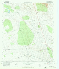
 1969 Ozark Lake1971 Print · USGSThe West Texas oil patches of Ward and Crane counties were in full production during the late sixties, marked by the massive Shipley Oil Field. Researchers can trace the development of the energy economy through sites like the Chemical Plant and the remote settlement of Royalty.2 unique versions available
 - 1969 Map of Grandfalls, 1971 Print
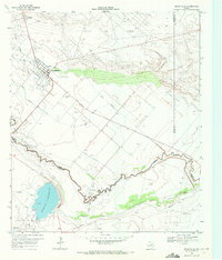 1969 Grandfalls1971 Print · USGSIn the arid Permian Basin of the late sixties, the landscape of Ward and Pecos Counties was a network of irrigation and oil production. Trace the early layout of Grandfalls and Imperial, or locate family sites near Tamarisk Cem and the Imperial Reservoir.2 unique versions available
 - 1969 Map of Pyote NE, 1971 Print
 1969 Pyote NE1971 Print · USGSWinkler and Ward Counties are defined by the mid-century petroleum boom in these expansive West Texas oil fields. Researchers can trace the industrial footprint of the Halley Oil Field and locate remote water sources like Red Tank Windmill and Wildcat Windmill.
 - 1969 Map of Pyote East, 1971 Print
 1969 Pyote East1971 Print · USGSWard County during the late sixties shows a landscape transformed by the West Texas oil boom. Researchers can trace the industrial footprint of the refinery at Wickett or locate family ranching landmarks like Tie Ranch and Thorton Ranch.2 unique versions available
 - 1969 Map of Monahans, 1971 Print
 1969 Monahans1971 Print · USGSMonahans and Ward County are shown in the late sixties as the regional oil and ranching economy flourished along the Texas and Pacific line. Researchers can trace local landmarks like Hurd Memorial Airfield, Municipal Cem, and the Wagonwheel Ranch.2 unique versions available
 - 1969 Map of 7 L Ranch, 1971 Print
 1969 7 L Ranch1971 Print · USGSThe Ward County oil patch in the late sixties reveals an industrial landscape defined by the Ward Estes North Oil Field. Trace the network of pipelines and service roads leading to the 7 L Ranch Landing Strip and the Cem near the Grandfalls Canal.
Showing maps 1-25 of 150
Top cities of Ward County
- Thorntonville historical maps
- Wickett historical maps
- Barstow historical maps
- Grandfalls historical maps
- Pyote historical maps
Frequently asked questions
- What are the different types of historical maps available for Ward County?
- What is the oldest map of Ward County?
- Where can I purchase historical maps of Ward County for my home or office?
- Where can I download high-res historical maps of Ward County?
- Are there historical topographic maps available for Ward County?
- Is there historical aerial imagery available for Ward County?
- Where are historical maps of Ward County sourced from?