
1969 Map of Pyote NE
USGS Topo · Published 1971About this map
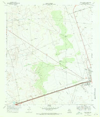
The Permian Basin's petroleum infrastructure dominates this West Texas landscape along the border of Winkler County and Ward County. Extensive industrial development is evident through the sprawling networks of the Halley Oil Field, North Estes Field, and the Magnolia Sealy Oil Field. These fields are connected by a dense web of pipelines and service roads, including the prominent Blockline Road, cutting through the characteristic Texas sand dunes.
Find a feature on this map
20 named features on this map. Tap any name to fly to it.
Don’t see what you’re looking for? This feature index may not catch every label — zoom into the map to look around manually.
Map Details
Editions of this 1969 Pyote NE Map
This is the sole edition of this map. No revisions or reprints were ever made.
Other maps of this area

1954 · Pecos
USGS Topo · 1:250,000

1957 · Pecos
USGS Topo · 1:250,000

1968 · Wink South
USGS Topo · 1:24,000

1968 · China Ranch
USGS Topo · 1:24,000

1969 · Pyote East
USGS Topo · 1:24,000

1969 · Monahans
USGS Topo · 1:24,000
1969 · Pyote West
USGS Topo · 1:24,000

1970 · Wink North
USGS Topo · 1:24,000

1970 · Kermit
USGS Topo · 1:24,000
1971 · Wheeler Ranch
USGS Topo · 1:24,000