2020s Maps of Webb County, Texas
Explore 68 historic maps of Webb County from the 2020s. These maps offer a rare glimpse into what life looked like during the 2020s — showing old roads, neighborhoods, homes, and landmarks that have changed or disappeared over time.
Whether you're researching your family's past, planning a metal detecting trip, or studying how Webb County's landscape evolved across the 2020s, these high-resolution maps are a powerful tool for exploring the history of this region.
- Focus on a specific era: All maps on this page are from the 2020s, giving you a focused view of this time period.
- See what’s changed: Compare century-old streets, trails, and buildings to today's modern landscape using overlays and satellite layers.
- Research with precision: Use these maps for genealogy, historical research, land use analysis, or educational projects.
- View, download, or print: Maps are fully viewable online in high resolution, and can be downloaded or printed for your own records.
Start exploring Webb County's history through authentic maps from the 2020s. This is your window into the past.
Webb County, TX maps
(68)- 2022 Map of Mills Bennett SW, 2022 Print
 2022 Mills Bennett SW2022 Print · USGSWebb County ranching country is mapped here in the early twenty-first century, showing the vital infrastructure of South Texas land use. Researchers can trace the layout of family-named water sources and rural roads like Welhousen Rd, Pina Tank, and De La Garza Tank.
 - 2022 Map of Alamito Creek NE, 2022 Print
 2022 Alamito Creek NE2022 Print · USGSSouth Texas ranching country in the early 2020s is defined by its wide drainage basins and rural road networks. Trace the courses of Becerra Cr and Salado Cr or locate family-named water features like Nunley Lake.
 - 2022 Map of Mirando City, 2022 Print
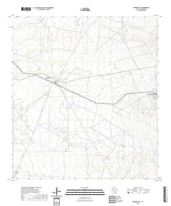 2022 Mirando City2022 Print · USGSDeep in the Webb County ranchlands during the early 2020s, this landscape shows the rural layout of south Texas. Genealogists and local historians can trace the Aguilares Cem and the small communities of Aguilares and Mirando City.
 - 2022 Map of Shipp Ranch, 2022 Print
 2022 Shipp Ranch2022 Print · USGSThis South Texas ranchland survey captures the essential water-dependent landscape of Webb County in the early 2020s. Researchers can trace the network of vital watering holes and ephemeral drainages including Ranch Viejo Tank, Salado Cr, and Potrero Arriba Tank.
 - 2022 Map of Albercas Ranch, 2022 Print
 2022 Albercas Ranch2022 Print · USGSSouth Texas ranch land at the meeting point of Webb, Zapata, and Jim Hogg counties is documented in this modern survey. Researchers can trace land use through features like the Jacalon Ranch Airport and the historic Albercas de San Felipe Spring.
 - 2022 Map of Tios Creek, 2022 Print
 2022 Tios Creek2022 Print · USGSThe South Texas ranching country of Webb County is documented here in the early twenty-first century, showing the intersection of local routes and traditional land use. Researchers can trace cattle-country infrastructure through numerous water features like Middle Tios Tank and Willow Tank near the settlement of La Coma.
 - 2022 Map of Biel Lake South, 2022 Print
 2022 Biel Lake South2022 Print · USGSThe South Texas brush country of Webb County is mapped here in 2022, showcasing a landscape defined by seasonal water systems. Researchers can trace the winding paths of Black Creek, Mesquitoso Cr, and the waters of Biel Lake.
 - 2022 Map of Pato Creek, 2022 Print
 2022 Pato Creek2022 Print · USGSWebb County ranch lands are documented here in the early 2020s, showing a landscape shaped by seasonal drainages and private transit. Researchers can trace the paths of Mule Cr and Becerra Cr alongside rural routes like Callaghan Rd and Don Chema Rd.
 - 2022 Map of Callaghan Ranch South, 2022 Print
 2022 Callaghan Ranch South2022 Print · USGSThe South Texas landscape north of Laredo comes into focus during this era of modern development and infrastructure. Genealogists and researchers can trace the growth of communities like Botines, Four Points, and Bonanza Hills along the highway.
 - 2022 Map of Salt Well, 2022 Print
 2022 Salt Well2022 Print · USGSThe South Texas borderlands are captured here in the early twenty-first century as the Rio Grande winds through a remote landscape. Researchers can trace the path of Borrego Creek and the route of FM 1021 where the boundaries of Maverick and Webb counties meet.
 - 2022 Map of Agua Azul Creek East, 2022 Print
 2022 Agua Azul Creek East2022 Print · USGSThe South Texas brush country along the Webb and Zapata county line is captured here in the early twenty-first century. Researchers can trace the ranching landscape through the paths of Agua Azul Cr, Albercas Cr, and Ranch Rd 8010B.
 - 2022 Map of Callaghan Ranch SE, 2022 Print
 2022 Callaghan Ranch SE2022 Print · USGSOpen Texas rangeland in Webb County is documented here during the early twenty-first century, showing a landscape defined by large ranching tracts. Researchers can trace the path of Carrizitos Cr and follow the routes of Ranch Rd 6178A and Callaghan Rd.
 - 2022 Map of Venado Creek East, 2022 Print
 2022 Venado Creek East2022 Print · USGSSouthern Texas ranchlands are captured here in the early twenty-first century, showcasing a landscape of essential water catchments and winding brush-country drainages. Researchers can trace the layout of family-named landmarks like Frank Nunley Lake and Martinena Ranch Lake along the path of Los Olmos Cr.
 - 2022 Map of Orvil, 2022 Print
 2022 Orvil2022 Print · USGSThe northern reaches of the Laredo corridor and the settlement of Orvil are documented in this recent survey of the Webb County brushland. Researchers can trace the intersection of modern logistics at Killam Industrial Blvd with traditional water tanks like La Presa Grande and Tortuga Tank.
 - 2022 Map of Spohn Ranch, 2022 Print
 2022 Spohn Ranch2022 Print · USGSRanching life in Webb County comes into focus in this recent survey of the South Texas brush country. Researchers and land historians can trace modern grazing infrastructure through named features like La Moca Ranch, Kennedy Tank, and Palito Blanco Arroyo.
 - 2022 Map of Cerritos Blancos, 2022 Print
 2022 Cerritos Blancos2022 Print · USGSWebb County ranching country is shown here in the modern era, detailing a complex water-management landscape. Researchers can trace historic ranching infrastructure including Cerritos Blancos, the long stretch of Las Tiendas Rd, and livestock reservoirs like Huisache Tank.
 - 2022 Map of Venado Creek West, 2022 Print
 2022 Venado Creek West2022 Print · USGSWebb County at the start of the 2020s remains a landscape of sprawling ranches and winding desert streams. Researchers can trace the path of the I-35 Frontage Rd or follow local routes like Callaghan Rd and Zamora Rd as they cross Venado Cr.
 - 2022 Map of Oilton, 2022 Print
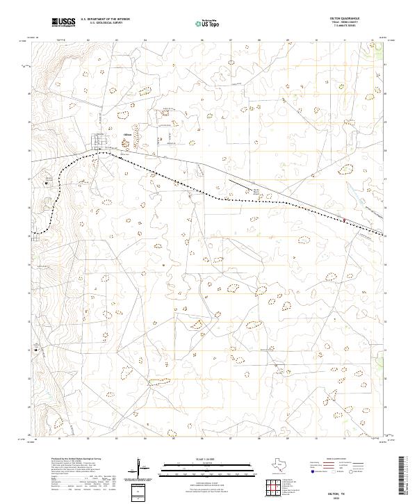 2022 Oilton2022 Print · USGSThe South Texas ranching country around Oilton is documented here in the early twenty-first century. Genealogists can locate family burial sites at Oilton Cem and Los Ojuelos Cem or trace the drainage of the Arroyo de los Angles.
 - 2022 Map of Chupadera Creek, 2022 Print
 2022 Chupadera Creek2022 Print · USGSThe South Texas borderlands along the Rio Grande are documented here in a modern era of large-scale ranching and international boundaries. Trace the remote landscape of Webb and Dimmit Counties through landmarks like Cathedral Rock, Chupadera Spring, and private airstrips.
 - 2022 Map of Nido Ranch, 2022 Print
 2022 Nido Ranch2022 Print · USGSWebb County ranching country is shown here in the early twenty-first century as a landscape defined by vital water tanks and seasonal arroyos. Researchers can map the area's infrastructure through landmarks like Nido Tank, Tejones Cr, and the Columbia Toll Rd.
 - 2022 Map of Pinto Creek, 2022 Print
 2022 Pinto Creek2022 Print · USGSWebb County ranch land remains defined by its water sources and historical transit routes in the twenty-first century. Researchers can trace the path of Eagle Pass Road past the Galván South River Tank and across the beds of Pinto Creek.
 - 2022 Map of Landrum Tank, 2022 Print
 2022 Landrum Tank2022 Print · USGSThe ranchlands of Dimmit and Webb Counties are captured here in the early 2020s, showing a landscape defined by large holdings and seasonal creek beds. Researchers can trace the path of Espejo, the Briscoes Catarina Ranch Airport, and the route of FM 2688.
 - 2022 Map of Galvan Ranch, 2022 Print
 2022 Galvan Ranch2022 Print · USGSWebb County ranchland in the early twenty-first century remains a landscape of vast private holdings and seasonal watercourses. Researchers can trace the drainage of Santa Isabel Cr and the paths of rural transit along Galvan Rd or Ranch Rd 6236A.
 - 2022 Map of Mesteno Creek South, 2022 Print
 2022 Mesteno Creek South2022 Print · USGSThe ranchlands along the border of Webb and La Salle counties are seen here in recent detail. Genealogists and land researchers can trace property access and hydrologic patterns along Jaboncillo Cr and the length of Ranch Rd 863.
 - 2022 Map of Mesteno Creek North, 2022 Print
 2022 Mesteno Creek North2022 Print · USGSThe South Texas brush country at the meeting of Dimmit, Webb, and La Salle counties is captured here in the early twenty-first century. Researchers can trace the winding paths of Pelon Ciz Cr and Las Raices Cr along the remote Raices Rd.
Showing maps 1-25 of 68
Top cities of Webb County
- Laredo historical maps
- Rio Bravo historical maps
- El Cenizo historical maps
- Oilton historical maps
- Bruni historical maps
- La Presa historical maps
See more
Frequently asked questions
- What are the different types of historical maps available for Webb County?
- What is the oldest map of Webb County?
- Where can I purchase historical maps of Webb County for my home or office?
- Where can I download high-res historical maps of Webb County?
- Are there historical topographic maps available for Webb County?
- Is there historical aerial imagery available for Webb County?
- Where are historical maps of Webb County sourced from?