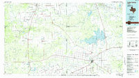
1980s Maps of Wilbarger County, Texas
Explore 18 historic maps of Wilbarger County from the 1980s. These maps offer a rare glimpse into what life looked like during the 1980s — showing old roads, neighborhoods, homes, and landmarks that have changed or disappeared over time.
Whether you're researching your family's past, planning a metal detecting trip, or studying how Wilbarger County's landscape evolved across the 1980s, these high-resolution maps are a powerful tool for exploring the history of this region.
- Focus on a specific era: All maps on this page are from the 1980s, giving you a focused view of this time period.
- See what’s changed: Compare century-old streets, trails, and buildings to today's modern landscape using overlays and satellite layers.
- Research with precision: Use these maps for genealogy, historical research, land use analysis, or educational projects.
- View, download, or print: Maps are fully viewable online in high resolution, and can be downloaded or printed for your own records.
Start exploring Wilbarger County's history through authentic maps from the 1980s. This is your window into the past.
Wilbarger County, TX maps
(18)- 1983 Map of Boggy Creek, 1984 Print
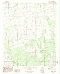 1983 Boggy Creek1984 Print · USGSWilbarger County ranchlands are captured here in the early eighties, showing the detailed hydrology and cattle country of North Texas. Researchers can locate specific water features and land management sites like Flax Tank, Plum Creek, and Stone Tank.
 - 1983 Map of Tolbert, 1984 Print
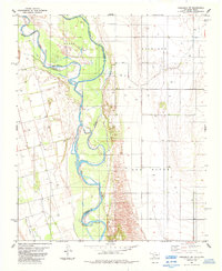
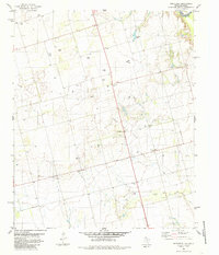
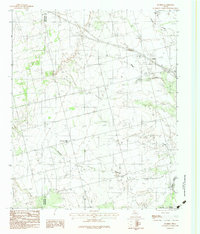 1983 Tolbert1984 Print · USGSThe rural landscape of Wilbarger County in the early eighties shows a transition from prairie farmsteads to the banks of the Pease River. Researchers can locate the settlement of Tolbert along the Burlington Northern rail line and trace family sites near Farmers Valley.2 unique versions available
 - 1983 Map of Rayland, 1984 Print
 1983 Rayland1984 Print · USGSWilbarger County ranchlands and the winding Pease River are captured in the early eighties. Genealogists can trace family homesteads near Rayland or locate the rural Cem and Antelope Springs tucked into the breaks.2 unique versions available
 - 1983 Map of Lockett, 1984 Print
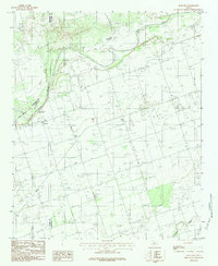
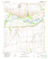
 1983 Lockett1984 Print · USGSWilbarger County comes to life in this early 1980s survey of the plains surrounding the county seat. Genealogists and local historians can trace the relationship between Lockett and Vernon, locating the Rodeo Ground, Hospital, and rural Cemetery plots.
 - 1983 Map of Vernon, 1984 Print
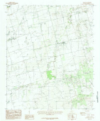
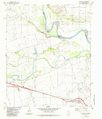
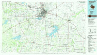
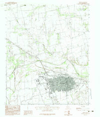 1983 Vernon1984 Print · USGSWilbarger County at the start of the 1980s reveals a well-developed regional hub centered on the city of Vernon. Researchers can trace the layout of Vernon Regional Junior College and find local landmarks like the Drive-In Theater and the community of Paradise.
 - 1983 Map of Harrold, 1984 Print
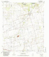
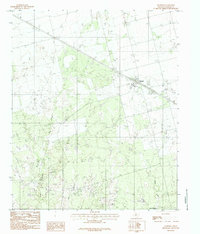 1983 Harrold1984 Print · USGSHarrold and the surrounding Wilbarger County plains are captured here in the early eighties as a landscape defined by the oil industry. Researchers can trace the sprawling Oil Field sites, the local Cem, and the drainage patterns of Rock Creek and Lake Electra.2 unique versions available
 - 1984 Map of Elmer, 1985 Print
 1984 Elmer1985 Print · USGSThe Oklahoma-Texas borderlands come alive in the mid-1980s, centered on the river convergence and rail lines near Elmer. Local historians can trace old landmarks like Doans Crossing, Southside Sch, and the winding Red Hollow.
 - 1984 Map of Cowboy Springs, 1985 Print
 1984 Cowboy Springs1985 Print · USGSThe Red River borderlands of Tillman County are captured here in the early eighties, showcasing the shifting riverbed and rural industry. Genealogists and historians can trace the Indefinite Boundary and find local sites like Suttle, Cowboy Springs, and various oil wells.
 - 1984 Map of Frederick SW, 1985 Print
 1984 Frederick SW1985 Print · USGSThe Oklahoma-Texas borderlands come into focus in the early eighties, where the Red River meanders through Tillman and Jackson counties. Researchers can trace the Indefinite Boundary and locate numerous family or industrial Wells and an Oil Well across the Richland landscape.
 - 1985 Map of Lake Kemp
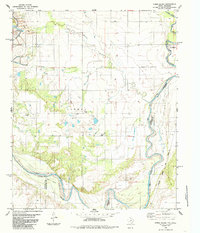
 1985 Lake Kemp1985 Print · USGSThe North Texas plains come into sharp focus in the mid-eighties as a region defined by its vast reservoirs and deep-rooted agricultural hubs. Genealogists and local historians can trace the rural landscape surrounding Seymour, the rail lines of the Burlington Northern, and landmarks like The Narrows.2 unique versions available
 - 1985 Map of Oklaunion
 1985 Oklaunion1985 Print · USGSWilbarger County, Texas, and Tillman County, Oklahoma, meet along the river-carved border in the mid-eighties. Trace the local rail-and-water economy through features like the Burlington Northern line, the town of Oklaunion, and Eastview Memorial Cemetery.
 - 1985 Map of Ayers Island
 1985 Ayers Island1985 Print · USGSThe Red River valley at the Texas-Oklahoma border comes into focus in the late seventies, showing a landscape of mineral mining and rail transport. Researchers can trace family sites like Carmel Cem and Boggy Cem or locate industrial landmarks such as the Creta Mine.
 - 1985 Map of Davidson
 1985 Davidson1985 Print · USGSThe Oklahoma-Texas borderlands in the mid-1980s are defined by the shifting sands of the Red River and the rural hub of Davidson. Genealogists and historians can trace the Burlington Northern rail corridor and find local landmarks like Immanuel Ch and the settlement of Elliott.
 - 1985 Map of Wichita Falls
 1985 Wichita Falls1985 Print · USGSWichita Falls and the surrounding North Texas oil patches are captured here during a period of established energy production and military importance. Genealogists and historians can trace family-named sites and regional hubs like Sheppard Air Force Base, Electra, and Lake Arrowhead State Park.2 unique versions available
 - 1985 Map of Northside
 1985 Northside1985 Print · USGSThe Red River valley at the Texas-Oklahoma border comes into focus in the mid-1980s. Genealogists and historians can trace local family roots at Fargo Cem and Bell Cem or locate the active production sites of the Fargo Oil Field.
 - 1985 Map of Odell, 1986 Print
 1985 Odell1986 Print · USGSThe Texas-Oklahoma borderlands in the mid-1980s come into focus here, showing the rural community of Odell at the intersection of rail and river. Genealogists and historians can trace the paths of the Atchison Topeka and Santa Fe railroad or locate family operations near the local Oil Field and Wanderers Creek.
 - 1985 Map of Burkburnett, 1986 Print
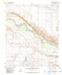
 1985 Burkburnett1986 Print · USGSThe Red River valley and North Texas oil fields are captured here in the mid-eighties, showing the vital connection between military hubs and rail towns. Researchers can trace the path of the Missouri Kansas Texas railroad through Burkburnett or locate Waurika Lake and Sheppard Air Force Base.2 unique versions available
 - 1986 Map of Vernon
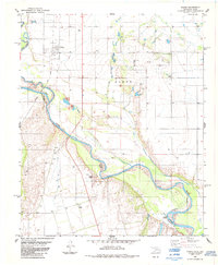
 1986 Vernon1986 Print · USGSNorth Texas and Southern Oklahoma meet along the river in the mid-1980s, revealing a landscape defined by ranching, oil production, and rail transport. Researchers can locate distinct landmarks such as Medicine Mound, the Conley Oil Field, and the community of Punkin Center.
End of results
Showing maps 1-18 of 18
Top cities of Wilbarger County
Frequently asked questions
- What are the different types of historical maps available for Wilbarger County?
- What is the oldest map of Wilbarger County?
- Where can I purchase historical maps of Wilbarger County for my home or office?
- Where can I download high-res historical maps of Wilbarger County?
- Are there historical topographic maps available for Wilbarger County?
- Is there historical aerial imagery available for Wilbarger County?
- Where are historical maps of Wilbarger County sourced from?