Old Maps of Wilbarger County, Texas for Genealogy
Trace your family roots with 170 historic maps of Wilbarger County. These high-res maps reveal old neighborhoods, homesites, landmarks, and streets — helping you uncover where your ancestors lived and how the area evolved over time.
- Explore historic neighborhoods: Identify where your relatives may have lived in the 1800s or 1900s.
- Compare maps over time: Trace the changes in streets, buildings, and landmarks for multi-generational research.
- Perfect for genealogy & ancestry research: Used by family historians and researchers to map out lineage and migration.
These maps are an incredible resource for exploring your personal connection to Wilbarger County's past.
Wilbarger County, TX maps
(170)- 1916 Map of Electra, 1961 Print
 1916 Electra1961 Print · USGSElectra and the surrounding plains of North Texas are captured here just as the regional oil and rail economy was transforming the landscape. Genealogists and historians can trace the precise locations of the County Line School, Mt Carmel Church, and the Red River School.
 - 1917 Map of Beaver Creek, 1961 Print
 1917 Beaver Creek1961 Print · USGSNorth Texas at the end of the Great War was a landscape of remote schoolhouses and creekside chapels near the Wilbarger and Wichita county line. Researchers can locate early rural landmarks like Marvin Chapel, Ronda School, and the namesake Beaver Creek School.
 - 1918 Map of Electra
 1918 Electra1918 Print · USGSThe North Texas plains near the Wichita-Wilbarger border show a growing network of roads and rural schools during the late nineteen-teens. Researchers can trace early family settlements and local landmarks like Mt Carmel Church, the Enterprise School, and the busy Electra townsite.
 - 1920 Map of Beaver Creek
 1920 Beaver Creek1920 Print · USGSWichita and Wilbarger counties are captured here just after the Great War, showing a landscape defined by seasonal creek beds and isolated schoolhouses. Researchers can locate early community hubs like Marvin Chapel, Ronda School, and landmarks such as Potato Hill.2 unique versions available
 - 1954 Map of Wichita Falls, 1966 Print
 1954 Wichita Falls1966 Print · USGSNorth Texas in the mid-fifties is captured here as a landscape of expanding oil fields and vital rail corridors. Genealogists and historians can trace family roots through rural landmarks like Bacon Chapel and the rail-side growth of Seymour and Archer City.3 unique versions available
 - 1955 Map of Lawton, 1958 Print
 1955 Lawton1958 Print · USGSSouthwestern Oklahoma and North Texas are shown here in the mid-fifties, dominated by the Wichita Mountains and the vital Red River watershed. Genealogists and historians can trace the foundations of Lawton alongside rural landmarks like Rainy Mountain Church and Pleasant Hill School.5 unique versions available
 - 1958 Map of Wichita Falls
 1958 Wichita Falls1958 Print · USGSNorth Texas during the late fifties reveals a landscape defined by the booming petroleum industry and established rail hubs. Researchers can trace the development of Wichita Falls and discover rural landmarks like Barton's Chapel or the Hull-Silk Oil Field.
 - 1958 Map of Davidson, 1959 Print
 1958 Davidson1959 Print · USGSThe Red River border between Oklahoma and Texas comes alive in this mid-century survey of the river's confluence with the Pease River. Researchers can trace the path of the Fort Worth and Denver (Burlington) rail line through Oklaunion and Harrold or locate rural landmarks like Sharp Gin and Immanuel Ch.2 unique versions available
 - 1958 Map of Frederick, 1959 Print
 1958 Frederick1959 Print · USGSAcross the Tillman County plains in the late fifties, the landscape was defined by the transition from agriculture to oil. Researchers can trace the rail corridors of the Missouri Kansas Texas or locate local centers like Middick Store and Tesca Ch.
 - 1958 Map of Vernon, 1959 Print
 1958 Vernon1959 Print · USGSWilbarger County is captured in the late fifties as the local economy balanced ranching traditions with growing civic infrastructure. Researchers can locate family landmarks such as Lockett High Sch, the Santa Rosa Roundup Rodeo Grounds, and Pleasant Home Ch.2 unique versions available
 - 1958 Map of Electra, 1959 Print
 1958 Electra1959 Print · USGSThe Texas-Oklahoma borderlands thrived during the late 1950s as the petroleum industry reshaped the North Texas prairie around Electra. Genealogists and historians can trace the foundations of local communities through landmarks like Haynesville (Punkin Center), Antioch Ch, and the site of Fort Augur.
 - 1958 Map of Elmer, 1960 Print
 1958 Elmer1960 Print · USGSThe Oklahoma-Texas borderlands are captured here in the late fifties as oil production and ranching shaped the landscape. Researchers can locate vanished rural landmarks like Amerada Camp, the Fargo Oil Field, and the Southside School.2 unique versions available
 - 1966 Map of Franklin Bend, 1968 Print
 1966 Franklin Bend1968 Print · USGSNorth Texas ranching country in the mid-1960s is defined by the winding course of the Wichita River. Researchers can locate isolated ranching outposts such as Sweet La Cruz Cow Camp and the notable horseshoe curve at Franklin Bend.
 - 1966 Map of Santa Rosa Lake, 1968 Print
 1966 Santa Rosa Lake1968 Print · USGSWilbarger County ranching and energy operations are documented here in the mid-sixties during the early years of the reservoir. Researchers can trace land use through working sites like Santa Rosa Ranch, D's Camp, and the northern Oil Field.
 - 1966 Map of Santa Rosa Lake SW, 1968 Print
 1966 Santa Rosa Lake SW1968 Print · USGSThe Rolling Plains of North Texas are captured here in the mid-1960s, showing the rugged ranch lands where Baylor, Foard, and Wilbarger counties intersect. Genealogists and researchers can trace local landmarks like Corral and Waggoner or follow the paths of South Beaver Creek and the North Wichita River.
 - 1966 Map of Grayback, 1968 Print
 1966 Grayback1968 Print · USGSIn the mid-1960s, this portion of Wilbarger County was a busy intersection of ranching and oil production. Researchers can trace the OIL FIELD infrastructure and find local landmarks like Grayback, Zacaweista Ranch, and the Mack Cem.
 - 1966 Map of Lake Diversion, 1968 Print
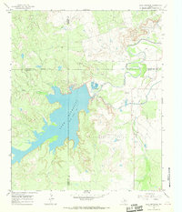 1966 Lake Diversion1968 Print · USGSThe North Texas plains meet the industrial waterworks of the mid-sixties in this survey of the Archer and Wichita county lines. Trace the local economy through petroleum landmarks like the Potts Oil Field and the technical operations at the Dundee Fish Hatchery.
 - 1966 Map of Lake Electra, 1968 Print
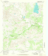 1966 Lake Electra1968 Print · USGSWilbarger County is captured here in the mid-1960s as a productive landscape of petroleum extraction and cattle ranching. Researchers can trace the layout of the Oil Field or locate local landmarks like Craig Bridge and the Red Pasture Pens.
 - 1966 Map of Northeast Lake Kemp, 1968 Print
 1966 Northeast Lake Kemp1968 Print · USGSThe northern waters of Baylor County are captured here in the mid-1960s, showing the complex shoreline of the local reservoir. Trace early ranching footprints at Coffee Creek Cow Camp or explore the inlets around Goat Island and Whiskey Creek.
 - 1966 Map of Northwest Lake Kemp, 1969 Print
 1966 Northwest Lake Kemp1969 Print · USGSThe ranchlands of Baylor and Wilbarger Counties come into focus in the mid-1960s, centered on the drainage systems feeding the reservoir. Researchers can trace land use through the Indian Creek Pens and the winding paths of Beaver Creek and West Coffee Creek.
 - 1966 Map of Santa Rosa Lake NW, 1969 Print
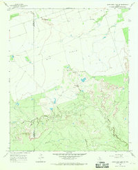 1966 Santa Rosa Lake NW1969 Print · USGSTexas ranching and agricultural life near the Wilbarger and Foard county line are preserved here in the mid-sixties. Local researchers can locate working landmarks like Iron Pens, Slay Camp, and the winding banks of Beaver Creek.
 - 1968 Map of Beaver Creek, 1971 Print
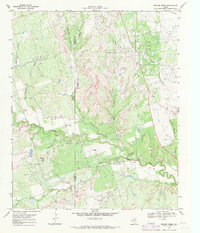 1968 Beaver Creek1971 Print · USGSThe oil-rich borderlands of Wichita and Wilbarger counties are documented here in the late sixties during a period of heavy production. Trace family history and industrial footprints through the Electra Oil Field, Ronda Cem, and Potato Hill.
 - 1972 Map of Electra, 1974 Print
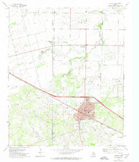 1972 Electra1974 Print · USGSWichita County was defined by its oil economy and rail connections during the 1970s. Trace the industrial landscape of Electra through its Oil Wells, Gasoline Plant, and local landmarks like the Rodeo Ground.
 - 1975 Map of Elmore City NE
 1975 Elmore City NE1975 Print · USGSThe Red River borderlands of Oklahoma and Texas are captured here in the mid-1970s through detailed aerial photography. Researchers can trace the agricultural layout surrounding Elmer and Hess and study the shifting sandbars of the Red River.
 - 1975 Map of Frederick SW
 1975 Frederick SW1975 Print · USGSThe Oklahoma-Texas borderlands are captured in high-detail aerial imagery during the mid-1970s, showcasing the vast agricultural grid meeting the river's edge. Researchers can trace the winding, braided course of the North Fork Red River as it carves through the local landscape.
Showing maps 1-25 of 170
Top cities of Wilbarger County
Frequently asked questions
- What are the different types of historical maps available for Wilbarger County?
- What is the oldest map of Wilbarger County?
- Where can I purchase historical maps of Wilbarger County for my home or office?
- Where can I download high-res historical maps of Wilbarger County?
- Are there historical topographic maps available for Wilbarger County?
- Is there historical aerial imagery available for Wilbarger County?
- Where are historical maps of Wilbarger County sourced from?