1960s Maps of Williamson County, Texas
Explore 21 historic maps of Williamson County from the 1960s. These maps offer a rare glimpse into what life looked like during the 1960s — showing old roads, neighborhoods, homes, and landmarks that have changed or disappeared over time.
Whether you're researching your family's past, planning a metal detecting trip, or studying how Williamson County's landscape evolved across the 1960s, these high-resolution maps are a powerful tool for exploring the history of this region.
- Focus on a specific era: All maps on this page are from the 1960s, giving you a focused view of this time period.
- See what’s changed: Compare century-old streets, trails, and buildings to today's modern landscape using overlays and satellite layers.
- Research with precision: Use these maps for genealogy, historical research, land use analysis, or educational projects.
- View, download, or print: Maps are fully viewable online in high resolution, and can be downloaded or printed for your own records.
Start exploring Williamson County's history through authentic maps from the 1960s. This is your window into the past.
Williamson County, TX maps
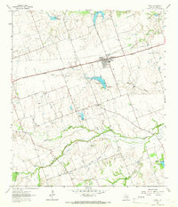
(21)- 1962 Map of Liberty Hill, 1966 Print
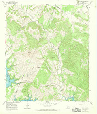
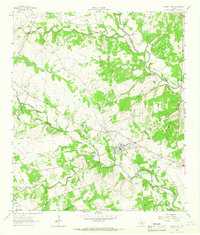 1962 Liberty Hill1966 Print · USGSThe rural landscape of Liberty Hill and Seward Junction is captured in the early sixties as the railroad era still shaped the hill country. Researchers can find family-named landmarks and old burial grounds like Buck Cem and Liberty Hill Cem.2 unique versions available
 - 1962 Map of Leander, 1966 Print
 1962 Leander1966 Print · USGSCentral Texas settlements and Hill Country ranch land thrive along the rail line during the early sixties. Genealogists can trace family names at Bagdad Cem and White Stone, or locate the Independent Sch near the Southern Pacific tracks.4 unique versions available
 - 1962 Map of Nameless, 1966 Print
 1962 Nameless1966 Print · USGSThe rural Texas Hill Country comes to life in the 1960s, showing the intersection of Travis and Williamson counties. Genealogists can locate family landmarks like Miller Cem, the small settlement of Nameless, and the sprawling Post Oak Ridge.2 unique versions available
 - 1962 Map of Leander NE, 1966 Print
 1962 Leander NE1966 Print · USGSThe North Fork of the San Gabriel River system defines this Williamson County landscape in the early sixties. Genealogists can trace family names at Anderson Cem and Bullion Cem, or locate landmarks like Union Chapel and Seward Junction.4 unique versions available
 - 1963 Map of Friendship, 1964 Print
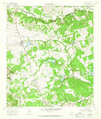
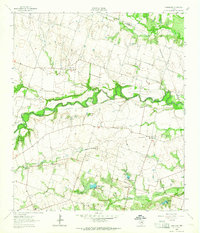 1963 Friendship1964 Print · USGSWilliamson County rural life is captured here in the early sixties, as the river valley settlements were being prepared for controlled inundation. Local historians can trace family-named sites like Wuthrich Hill, the Allison Cem, and the communities of Friendship and Laneport.2 unique versions available
 - 1963 Map of San Gabriel, 1964 Print
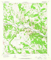
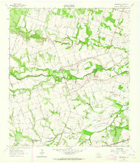 1963 San Gabriel1964 Print · USGSMilam and Williamson counties appear here in the early sixties as a landscape of river-bottom farms and small rural outposts. Genealogists and local historians can trace legacy sites like Hamilton Cem, Johns Ch, and the community at San Gabriel.2 unique versions available
 - 1963 Map of Davilla, 1965 Print
 1963 Davilla1965 Print · USGSBell and Milam counties in the early sixties remained a landscape of quiet rural settlements and family-named landmarks. Genealogists can trace family footprints at Davilla Cem, locate the former Donahoe Sch, or find the springs that fed Stigall Lake No 1.2 unique versions available
 - 1964 Map of Bartlett, 1966 Print
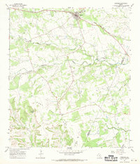
 1964 Bartlett1966 Print · USGSCentral Texas prairie life in the 1960s centers on Bartlett at the county line. Genealogists can trace family names at Stockton and Roocker cemeteries or follow the Missouri Kansas Texas rail line.2 unique versions available
 - 1964 Map of Cobbs Cavern, 1966 Print
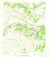
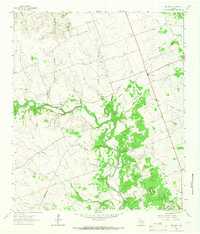
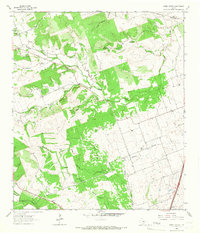 1964 Cobbs Cavern1966 Print · USGSThe ranching country of Williamson County is captured here in the mid-1960s, showing a landscape defined by limestone springs and family-named creeks. Researchers can locate burial sites like Farmer Cem and geological landmarks like Cobbs Cavern.
 - 1964 Map of Taylor, 1966 Print
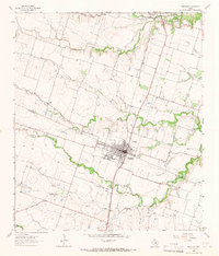
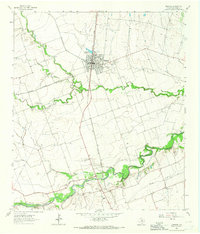
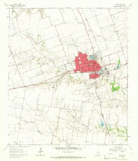 1964 Taylor1966 Print · USGSTaylor was a thriving railroad and medical hub in the mid-1960s, centered on the crossing of two major rail lines. Genealogists and local historians can trace the town's social fabric through the St Marys Cem, The Johns Hospital, and the outlying settlement of Frame Switch.3 unique versions available
 - 1964 Map of Jarrell, 1966 Print
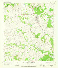
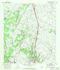
 1964 Jarrell1966 Print · USGSJarrell and the surrounding Williamson County farmland are captured here in the mid-1960s as Interstate 35 began to shape the corridor. Genealogists can locate family landmarks like Corn Hill Cem, Holy Trinity Sch, and the small settlement of Theon.
 - 1964 Map of Thorndale, 1966 Print
 1964 Thorndale1966 Print · USGSThorndale and the surrounding Texas blackland prairies are shown in the mid-sixties as the region balanced rail-line commerce with emerging oil production. Genealogists and local historians can locate St John Ch, the Abbott Oil Field, and rural communities like Salty and Conoley.2 unique versions available
 - 1964 Map of Thrall, 1966 Print
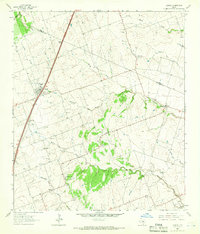
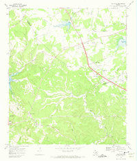
 1964 Thrall1966 Print · USGSEast of Taylor in the mid-1960s, this area of Williamson County shows a landscape of steady oil production and rail-side farming towns. Genealogists and historians can locate family sites at Christ Ch Cem or trace the early footprint of the Thrall Oil Field and the Missouri Pacific line.2 unique versions available
 - 1964 Map of Mahomet, 1966 Print
 1964 Mahomet1966 Print · USGSThe Burnet and Williamson county line comes alive in the mid-1960s, showing a landscape of Hill Country ranching and river crossings. Genealogists and historians can trace family roots at Mahomet Cem, Gabriel Mills, and the crossing at Greens Crossing.2 unique versions available
 - 1964 Map of Florence, 1966 Print
 1964 Florence1966 Print · USGSFlorence and the surrounding Williamson County countryside are captured here in the mid-sixties, a landscape of limestone ridges and winding creeks. Genealogists can locate several family burial grounds including Wesley Chapel Cem and Andice Cem, or trace the rural road network connecting Florence and Andice.2 unique versions available
 - 1964 Map of Granger, 1966 Print
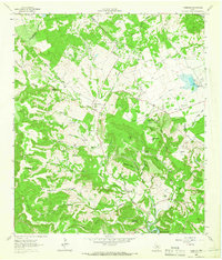
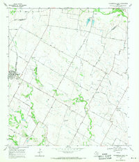
 1964 Granger1966 Print · USGSThe town of Granger and its surrounding farmstead landscape are captured here in the mid-1960s. Genealogists can trace family names across a dozen sites like Gardner Cem, Macedonia Cem, and the Crispus Attucks Sch.3 unique versions available
 - 1966 Map of Travis Peak, 1969 Print
 1966 Travis Peak1969 Print · USGSThe Texas Hill Country at the meeting of Travis, Burnet, and Williamson counties is shown here in the mid-1960s. Family historians and researchers can locate Hensel Cem, trace the drainage of Cow Creek, and identify high points like Boultinghouse Mountain.2 unique versions available
 - 1967 Map of Bertram, 1970 Print
 1967 Bertram1970 Print · USGSBertram thrived as a railroad and quarrying hub in the Texas Hill Country during the late sixties. Genealogists and local researchers can trace old family burial grounds like South Gabriel Cem or locate rural landmarks such as Mt Zion Ch and Buzzard Roost.2 unique versions available
 - 1968 Map of Jollyville, 1971 Print
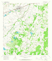
 1968 Jollyville1971 Print · USGSNorth of Austin in the late sixties, the landscape was beginning to shift from rural crossroads to suburban centers. Trace the foundations of Jollyville and Pecan Park alongside historic sites like Pond Springs Cem and the Oak Grove Ch.3 unique versions available
 - 1968 Map of Pflugerville East, 1971 Print
 1968 Pflugerville East1971 Print · USGSThe rural countryside east of Pflugerville in the late sixties reveals a landscape of family farms and Swedish-German heritage. Trace early roads and burial sites like New Sweden, Germania Hall, and Pfluger Cem.3 unique versions available
 - 1968 Map of Pflugerville West, 1971 Print
 1968 Pflugerville West1971 Print · USGSThe rail-and-road corridor north of Austin is captured here in the late sixties, showing the early industrial and suburban growth of Travis and Williamson counties. Genealogists and local historians can trace family sites like Bratton Cem and vanished waypoints such as Merrelltown and Coxville.2 unique versions available
End of results
Showing maps 1-21 of 21
Top cities of Williamson County
- Round Rock historical maps
- Georgetown historical maps
- Cedar Park historical maps
- Hutto historical maps
- Taylor historical maps
- Liberty Hill historical maps
See more
Frequently asked questions
- What are the different types of historical maps available for Williamson County?
- What is the oldest map of Williamson County?
- Where can I purchase historical maps of Williamson County for my home or office?
- Where can I download high-res historical maps of Williamson County?
- Are there historical topographic maps available for Williamson County?
- Is there historical aerial imagery available for Williamson County?
- Where are historical maps of Williamson County sourced from?