1900s (20th Century) Maps of Wink, Texas
Explore 5 historic maps of Wink from the 1900s (20th Century). These maps offer a rare glimpse into what life looked like during the 1900s — showing old roads, neighborhoods, homes, and landmarks that have changed or disappeared over time.
Whether you're researching your family's past, planning a metal detecting trip, or studying how Wink's landscape evolved across the 1900s, these high-resolution maps are a powerful tool for exploring the history of this region.
- Focus on a specific era: All maps on this page are from the 1900s, giving you a focused view of this time period.
- See what’s changed: Compare century-old streets, trails, and buildings to today's modern landscape using overlays and satellite layers.
- Research with precision: Use these maps for genealogy, historical research, land use analysis, or educational projects.
- View, download, or print: Maps are fully viewable online in high resolution, and can be downloaded or printed for your own records.
Start exploring Wink's history through authentic maps from the 1900s. This is your window into the past.
Wink, TX maps
(5)- 1954 Map of Pecos, 1964 Print
 1954 Pecos1964 Print · USGSMid-century West Texas reveals a landscape of expanding oil fields and cattle ranching along the winding Pecos River. Local historians can trace family ranch lands like Goodrich Ranch, follow the Texas and Pacific rails, or locate the historic Horsehead Crossing.3 unique versions available
 - 1957 Map of Pecos
 1957 Pecos1957 Print · USGSWest Texas in the mid-fifties is a landscape of desert oil fields and vital rail corridors. Researchers can trace the sprawling Pyote Air Force Base, the historic Horsehead Crossing, and the rail stops at Mentone and Saragosa.
 - 1968 Map of Wink South, 1971 Print
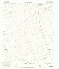 1968 Wink South1971 Print · USGSWinkler County ranching and petroleum interests intersect in the Permian Basin during the late sixties. Researchers can trace the layout of the Old Railroad Grade and locate named rural landmarks like Oats Windmill and the Waldron site.2 unique versions available
 - 1970 Map of Wink North, 1973 Print
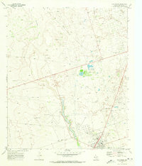 1970 Wink North1973 Print · USGSWinkler County ranching and oil country are shown in detail as they appeared in the early seventies. Trace the historic Old RR Grade and find family-named landmarks like Smith Arena or isolated cattle-country outposts like Forty Windmills.
 - 1986 Map of Kermit
 1986 Kermit1986 Print · USGSWest Texas during the mid-eighties was a landscape defined by the energy industry and the winding Pecos River. Trace the development of Oil Field networks near Kermit, the historic Horsehead Crossing, and the rail lines of the Missouri Pacific.2 unique versions available
End of results
Showing maps 1-5 of 5
Top cities near Wink
- Monahans historical maps
- Kermit historical maps
- Thorntonville historical maps
- Wickett historical maps
- Pyote historical maps
Top neighborhoods of Wink
- Park PLace historical maps
- Stanolind historical maps
- West Heights historical maps
- Northside historical maps
- Western Heights historical maps
- Wink Original Town historical maps
See more
Frequently asked questions
- What are the different types of historical maps available for Wink?
- What is the oldest map of Wink?
- Where can I purchase historical maps of Wink for my home or office?
- Where can I download high-res historical maps of Wink?
- Are there historical topographic maps available for Wink?
- Is there historical aerial imagery available for Wink?
- Where are historical maps of Wink sourced from?