Old Maps of Wise County, Texas for Academic Research
Study the evolution of Wise County with 159 high-resolution historic maps. Whether you're teaching, researching, or modeling changes in land use, these maps provide essential visual documentation of urban, environmental, and geographic change.
- Analyze long-term change: Track patterns in development, transportation, and natural features.
- Ideal for environmental or urban studies: Support academic projects with primary historical map data.
- Use in the classroom or lab: Educators and researchers rely on these maps to bring historical context to life.
These maps are a powerful tool for teaching, research, and visualizing how Wise County has changed over the decades.
Wise County, TX maps
(159)- 1891 Map of Weatherford
 1891 Weatherford1891 Print · USGSParker County and the surrounding ranchlands are shown here in the 1890s as the rail network transformed the region. Researchers can trace early river transport at Powell Ferry or locate vanished sites like Veal Station, Center Mill, and the Bear Creek P.O.
 - 1893 Map of Weatherford
 1893 Weatherford1893 Print · USGSParker County was at a pivotal turning point in the late nineteenth century as railroads began to stitch together the North Texas cattle country. Genealogists and local historians can trace early crossings like Powell Ferry and landmarks like Center Mill or Veal Station.5 unique versions available
 - 1894 Map of Fort Worth, 1918 Print
 1894 Fort Worth1918 Print · USGSNorth Texas at the end of the nineteenth century centers on a burgeoning Fort Worth and its strategic rail junctions. Researchers can locate early township sites like Johnson Station and Birdville or trace the military footprint of Camp Bowie.3 unique versions available
 - 1924 Map of Sunset 4-d
 1924 Sunset 4-d1924 Print · USGSWise County was a landscape of small farming communities and country schoolhouses during the mid-twenties. Genealogists can locate family roots near Anneville, Deep Creek School, or along the Chicago Rock Island and Gulf railroad.
 - 1930 Map of Boyd
 1930 Boyd1930 Print · USGSNorth-central Texas rural life comes into focus in the mid-1920s as the Chicago Rock Island and Gulf railroad tracks its way through Boyd. Genealogists and historians can locate old landmarks like Arkansas Sch and the community of Aurora.2 unique versions available
 - 1932 Map of Springtown
 1932 Springtown1932 Print · USGSThe crossroads of North Texas in the 1920s and 30s reveal a landscape of small farming communities and country parishes. Trace the early footprints of Reno, Briar, and Azle, or locate family sites near New Hope Ch and Onion Hill Sch.
 - 1954 Map of Dallas, 1963 Print
 1954 Dallas1963 Print · USGSNorth Texas in the mid-fifties and early sixties reveals a landscape of rapid urban growth and water management. Genealogists and historians can trace the evolution of the metroplex through landmarks like Hensley Field, Boles Orphan Home, and the Texas & Pacific RR.4 unique versions available
 - 1954 Map of Sherman, 1964 Print
 1954 Sherman1964 Print · USGSThe Red River valley and North Texas plains are captured here in the mid-fifties, showing the region as new reservoirs like Lake Texoma and Lavon Reservoir reshaped the land. Genealogists can trace family roots through specific local landmarks like Courtney P O, Pilot Grove Sch, and New Hope Ch.2 unique versions available
 - 1955 Map of Avondale, 1956 Print
 1955 Avondale1956 Print · USGSTarrant County at the midpoint of the century shows a unique mix of military aviation, lakeside recreation, and rural school districts. Genealogists can trace family footprints at Dido Ch, Eagle Mountain Sch, and the historic airfield at Hicks Field.5 unique versions available
 - 1955 Map of Azle, 1956 Print
 1955 Azle1956 Print · USGSAs suburban growth reached the shores of Eagle Mountain Lake in the mid-fifties, this area at the Wise and Parker County lines remained a network of rural schools and family chapels. Researchers can find long-standing landmarks like Wesley Chapel, Jaybird Cem, and the old Drive-in Theater.6 unique versions available
 - 1955 Map of Haltom City, 1964 Print
 1955 Haltom City1964 Print · USGSTarrant County at the peak of the mid-century aviation and defense boom shows a region rapidly transforming from ranch land into a strategic hub. Genealogists and historians can trace family plots at Mount Olivet Cemetery or the early footprints of Haltom City, Saginaw, and White Settlement.
 - 1958 Map of Dallas
 1958 Dallas1958 Print · USGSNorth Texas in the late fifties shows the dramatic expansion of the Metroplex as it absorbs surrounding farm towns. Genealogists and historians can trace old rail lines like the Missouri-Kansas-Texas and locate early lakefront developments at Eagle Mountain Lake and Lake Worth Village.
 - 1958 Map of Sherman, 1959 Print
 1958 Sherman1959 Print · USGSNorth Texas and Southern Oklahoma were undergoing significant development in the late fifties as the Red River Valley transit networks matured. Researchers can trace historic family-named locations such as Saddler Bend, the grounds of Perrin AFB, and early shoreline developments at Lake Texoma.
 - 1958 Map of Springtown, 1960 Print
 1958 Springtown1960 Print · USGSSpringtown and the surrounding Parker County countryside are shown here at the height of the mid-century oil boom. Genealogists and historians can trace family sites at Goshen, locate the Historical Monument at Veal Station, or find burials in the Bill Clark Cem.4 unique versions available
 - 1959 Map of Poolville, 1960 Print
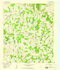 1959 Poolville1960 Print · USGSNorth Texas in the late fifties was a landscape of rural community and emerging energy production across the Parker and Wise County line. Researchers can locate family landmarks like Erwin Cem, early oil and gas infrastructure in the Toto Gas Field, and the historic townsite of Poolville.2 unique versions available
 - 1959 Map of Weatherford, 1960 Print
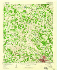 1959 Weatherford1960 Print · USGSParker County at the end of the fifties reveals a landscape of growing towns and established rural crossroads. Genealogists and historians can trace family-named sites from Poolville to Peaster, including Zion Hill Ch and Weatherford College.2 unique versions available
 - 1960 Map of Bridgeport West, 1961 Print
 1960 Bridgeport West1961 Print · USGSWise County's landscape in the early sixties is dominated by the sprawling shoreline of Lake Bridgeport and the rail activity in Bridgeport. Researchers can locate historic burial sites like the Oldtown Cem and Mexican Cem or trace rural landmarks like the Pleasant Valley Ch.4 unique versions available
 - 1960 Map of Bridgeport East, 1961 Print
 1960 Bridgeport East1961 Print · USGSThe West Fork Trinity River valley in the early sixties was a landscape of industrial energy and deep-rooted rural life. Researchers can trace the Chicago Rock Island and Pacific rail line between Paradise and Bridgeport, while locating local landmarks like Cuba Church and Paradise Cemetery.2 unique versions available
 - 1960 Map of Decatur, 1961 Print
 1960 Decatur1961 Print · USGSDecatur and the surrounding Wise County countryside are captured in the early sixties as the modern highway system begins to take shape. Researchers can locate the grounds of Decatur College, rural landmarks like New Salem Ch, and the old siding at Herman.3 unique versions available
 - 1960 Map of Boyd, 1961 Print
 1960 Boyd1961 Print · USGSWise County's river-and-rail corridor is captured here in the early sixties, centered on the town of Boyd. Genealogists and historians can locate numerous family-named burial sites like Arkansas Cem and Stoker Cem, or trace the winding West Fork Trinity River.3 unique versions available
 - 1960 Map of Gibtown, 1961 Print
 1960 Gibtown1961 Print · USGSThe rural borderlands of Jack, Wise, and Parker counties appear here in the early 1960s as a landscape of cattle ranching and emerging oil production. Trace family roots at Ebenezer Cem and Gibtown, or follow the path of the Old RR Grade near Rock Hollow.2 unique versions available
 - 1960 Map of Cottondale, 1961 Print
 1960 Cottondale1961 Print · USGSWise County in the early sixties reveals a landscape shaped by emerging energy fields and older rail corridors. Researchers can locate vanished points like Draco (Site) and Lucky Ridge (Site) alongside Annas Chapel and its cemetery.
 - 1960 Map of Bluett, 1961 Print
 1960 Bluett1961 Print · USGSNorthern Texas ranching and farming lands are captured here in the early sixties along the Wise-Denton county line. Genealogists can locate rural landmarks like Corinth Ch and the small settlement of Bluett near the waters of Morris Branch.3 unique versions available
 - 1960 Map of Wizard Wells, 1961 Print
 1960 Wizard Wells1961 Print · USGSThe Jacksboro area in the early sixties is defined here by the rising waters of Lake Bridgeport and a thriving energy industry. Researchers can find Wizard Wells Cem, trace the Rock Island and Pacific line, and locate dozens of early gas wells.2 unique versions available
 - 1960 Map of Rhome, 1961 Print
 1960 Rhome1961 Print · USGSWise County cattle country and rail junctions are documented here at the start of the sixties. You can trace the path of the FORT WORTH AND DENVER through Rhome or locate family sites like Fairview Ch and Aurora Cem.3 unique versions available
Showing maps 1-25 of 159
Top cities of Wise County
- Decatur historical maps
- Bridgeport historical maps
- Rhome historical maps
- Boyd historical maps
- Runaway Bay historical maps
- Aurora historical maps
See more
Frequently asked questions
- What are the different types of historical maps available for Wise County?
- What is the oldest map of Wise County?
- Where can I purchase historical maps of Wise County for my home or office?
- Where can I download high-res historical maps of Wise County?
- Are there historical topographic maps available for Wise County?
- Is there historical aerial imagery available for Wise County?
- Where are historical maps of Wise County sourced from?