Old Maps of Cunningham Hill, Utah for Hiking & Exploration
Hike through history with 11 historic maps of Cunningham Hill. Explore old trails, ghost towns, and forgotten backroads — perfect for outdoor adventurers and local explorers.
- Rediscover forgotten places: Map out old mining camps, roads, and footpaths that no longer exist on modern maps.
- Layer with modern tools: Combine with LiDAR or satellite views to plan hikes through historical terrain.
- Made for exploration: Popular among hikers, overlanders, and local history lovers.
Use these maps to find adventure and explore the hidden past of Cunningham Hill.
Cunningham Hill, UT maps
(11)- 1885 Map of Beaver
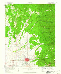
 1885 Beaver1885 Print · USGSSouth-central Utah in the 1880s was a landscape of high plateaus and valley settlements tied to the lifelines of the Sevier River and Beaver Creek. Family researchers can trace early town layouts in Beaver and Fillmore or locate rural outposts like Minersville and Kanosh.5 unique versions available
 - 1953 Map of Richfield, 1963 Print
 1953 Richfield1963 Print · USGSCentral Utah in the early fifties reveals a complex geography of high plateaus and desert basins tied together by the Union Pacific rail lines. Genealogists and historians can trace family roots in Richfield or Kanosh and locate remote operations like the Blue Star Mine or Newhouse.3 unique versions available
 - 1958 Map of Richfield
 1958 Richfield1958 Print · USGSCentral Utah in the late fifties shows a landscape of mountain forests and desert basins connected by the Union Pacific Railroad. Genealogists and historians can trace rail stops at Nada Station, mines like the Blue Star Mine, and tribal lands of the Paiute Indian Reservation.2 unique versions available
 - 1958 Map of Beaver, 1960 Print
 1958 Beaver1960 Print · USGSBeaver and the surrounding high desert valleys are documented here in the late fifties as the town grew along the historic corridor of the Utah state roads. Genealogists and local historians can locate civic landmarks like Belknap Sch and Mtn View Cemetery or trace old mining claims such as the Rob Roy Mine.2 unique versions available
 - 1980 Map of Beaver, 1981 Print
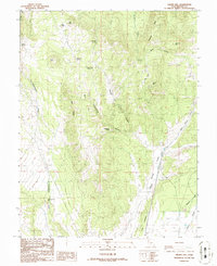
 1980 Beaver1981 Print · USGSSouthern Utah at the start of the 1980s reveals a rugged landscape of high mountain plateaus and essential desert irrigation networks. Researchers can trace the path of the Denver and Rio Grande Western through Marysvale or locate local landmarks like the Deer Trail Mine and Puffer Lake.2 unique versions available
 - 1986 Map of Gillies Hill
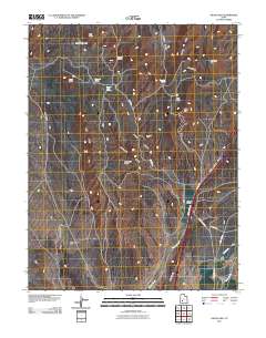
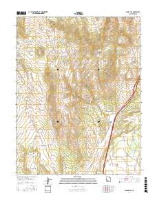
 1986 Gillies Hill1986 Print · USGSBeaver County, Utah, is mapped during the mid-eighties, showing a landscape shaped by volcanic knolls and essential desert springs. Researchers can locate remote resource sites like Prospects and a Gravel Pit or trace water sources from Carlyle Spring to Fields Creek.
 - 2011 Map of Gillies Hill, 2011 Print
 2011 Gillies Hill2011 Print · USGSCovers Cunningham Hill, including Beaver County, United States, and other nearby areas
 - 2014 Map of Gillies Hill, 2014 Print
 2014 Gillies Hill2014 Print · USGSCovers Cunningham Hill, including Beaver County, United States, and other nearby areas
 - 2017 Map of Gillies Hill, 2017 Print
 2017 Gillies Hill2017 Print · USGSCovers Cunningham Hill, including Beaver County, United States, and other nearby areas
 - 2020 Map of Gillies Hill, 2020 Print
 2020 Gillies Hill2020 Print · USGSCovers Cunningham Hill, including Beaver County, United States, and other nearby areas
 - 2023 Map of Gillies Hill, 2023 Print
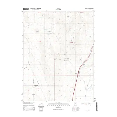
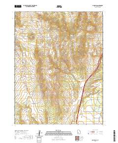
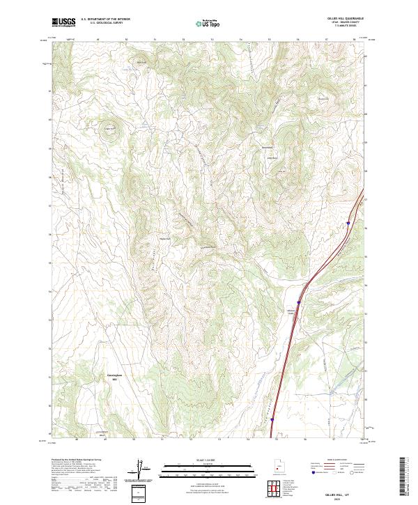 2023 Gillies Hill2023 Print · USGSBeaver County is captured in this contemporary study of the high-desert terrain near the southern reaches of the Mineral Mountains. Trace local water management and terrain features from the Manderfield Ditch and Wildcat Fields to the volcanic peak of Crater Knoll.
End of results
Showing maps 1-11 of 11
Top cities near Cunningham Hill
Frequently asked questions
- What are the different types of historical maps available for Cunningham Hill?
- What is the oldest map of Cunningham Hill?
- Where can I purchase historical maps of Cunningham Hill for my home or office?
- Where can I download high-res historical maps of Cunningham Hill?
- Are there historical topographic maps available for Cunningham Hill?
- Is there historical aerial imagery available for Cunningham Hill?
- Where are historical maps of Cunningham Hill sourced from?