Old Maps of Cache County, Utah for Hiking & Exploration
Hike through history with 244 historic maps of Cache County. Explore old trails, ghost towns, and forgotten backroads — perfect for outdoor adventurers and local explorers.
- Rediscover forgotten places: Map out old mining camps, roads, and footpaths that no longer exist on modern maps.
- Layer with modern tools: Combine with LiDAR or satellite views to plan hikes through historical terrain.
- Made for exploration: Popular among hikers, overlanders, and local history lovers.
Use these maps to find adventure and explore the hidden past of Cache County.
Cache County, UT maps
(244)- 1912 Map of Randolph
 1912 Randolph1912 Print · USGSThe high valley ranching country of the Utah-Wyoming border is captured here in the early twentieth century. Genealogists and historians can trace family land holdings such as Rex Ranch or Sixmile Ranch and find old routes like the Ogden Road.3 unique versions available
 - 1914 Map of Logan, 1957 Print
 1914 Logan1957 Print · USGSCache Valley thrives in the early nineteen-hundreds as a hub of rail travel and sugar beet processing. Genealogists can locate family homesteads near Stephenson School, trace the Oregon Short Line, or find remote operations like the Amazon Mine.
 - 1916 Map of Logan
 1916 Logan1916 Print · USGSCache Valley and the northern Wasatch Range come alive in this mid-1910s survey, showing the peak of the local rail-and-sugar economy. Genealogists can locate family holdings like Hardware Ranch, early rural sites like Stephenson School, and the industrial Sugar Factory.4 unique versions available
 - 1949 Map of Boulter Mts
 1949 Boulter Mts1949 Print · USGSThe high peaks of the Boulter Mountains were a center of Utah mining activity in the late 1940s. Genealogists and historians can trace the sites of the Scranton settlement and various mining claims like the Silver Dollar Mine and Hot Stuff Mine.
 - 1954 Map of Ogden, 1967 Print
 1954 Ogden1967 Print · USGSThe northern Utah corridor and Wyoming borderlands are captured here in the mid-1950s, showing the region's transition from mountain wilderness to settled valleys. Researchers can trace historic institutions like Utah State University or locate vanished points like Church Butte Station and the Trappist Monastery.3 unique versions available
 - 1954 Map of Brigham City, 1968 Print
 1954 Brigham City1968 Print · USGSNorthern Utah and the edges of the Great Salt Lake are captured here during the mid-fifties, showing the region's transition from pioneer rail hubs to modern military ranges. Researchers can find old sidings like Lemay Siding, the Golden Spike Monument, and settlements like Washakie.4 unique versions available
 - 1955 Map of Paradise, 1956 Print
 1955 Paradise1956 Print · USGSSouthern Cache Valley thrives as a pastoral hub during the mid-fifties, centered on the gridded settlements of Paradise and Avon. Genealogists and researchers can trace family-named landmarks like McMurdie Hollow or locate historical sites including the local Cemetery and the Trout Farm along the Little Bear River.3 unique versions available
 - 1955 Map of Mantua, 1956 Print
 1955 Mantua1956 Print · USGSThe mountain town of Mantua and the surrounding national forest are captured here in the mid-1950s. Genealogists and researchers can locate the Mantua Cemetery, trace mining sites like the Holton Mine, and find youth camps such as Camp Utaba.4 unique versions available
 - 1955 Map of Huntsville, 1956 Print
 1955 Huntsville1956 Print · USGSHuntsville and the Ogden Valley are shown in the mid-fifties just as the region's river-fed agriculture began to blend with new lakeside recreation. Genealogists and local historians can trace family plots at Mountain View Cemetery or locate early industrial sites like Shanghai Creek No 1 Mine and Patio Springs.4 unique versions available
 - 1955 Map of James Peak, 1956 Print
 1955 James Peak1956 Print · USGSThe high wilderness of the Cache National Forest is documented here in the mid-fifties, showing a landscape defined by canyons and peaks. Researchers can locate remote sites like the Honey Bee Mine, Fourmile Ranch, and the Davenport Jeep Trail.4 unique versions available
 - 1955 Map of Mount Pisgah, 1956 Print
 1955 Mount Pisgah1956 Print · USGSThe high passes of the Wellsville Mountains and the valley settlements of Wellsville and Mantua are captured here in the mid-1950s. Genealogists and local historians can trace family plots at Mount Sterling Cemetery or locate old landmarks like Babbit Shanty Hill and Gold Mine Hill.4 unique versions available
 - 1955 Map of Brigham City, 1957 Print
 1955 Brigham City1957 Print · USGSBrigham City and the surrounding Box Elder valley are captured in the mid-fifties during a period of steady civic growth. Genealogists and historians can trace neighborhood developments around Lincoln School or follow the old Union Pacific lines out to Corinne and the Baker Mine.2 unique versions available
 - 1958 Map of Ogden
 1958 Ogden1958 Print · USGSNorthern Utah and southwestern Wyoming are captured here during a period of steady growth and military expansion. You can trace the Union Pacific rail lines and early road networks connecting Ogden and Logan to Bear Lake and Evanston.
 - 1958 Map of Brigham City
 1958 Brigham City1958 Print · USGSNorthern Utah in the late fifties shows a landscape of extremes, from the salt flats to the bustling Bear River Valley. Trace historical routes like the Old Immigrant Trail and locate local landmarks such as the Brigham Sugar Mill and Booth Valley School.
 - 1960 Map of Ogden
 1960 Ogden1960 Print · USGSIn the mid-1950s, this region of the American West balanced military expansion with frontier history along the Union Pacific RR. Genealogists and historians can trace old settlements like Fort Bridger, the residential growth of Washington Terrace, and industrial sites from the Hill AFB complex to the coal mines of Kemmerer.
 - 1961 Map of Honeyville, 1963 Print
 1961 Honeyville1963 Print · USGSThe Bear River valley at the foot of the Wellsville Mountains is captured here in the early sixties. Researchers can trace the Union Pacific line through Honeyville and Deweyville, or locate family landmarks like Jensen Spring and Tolman Springs.2 unique versions available
 - 1961 Map of Logan, 1963 Print
 1961 Logan1963 Print · USGSCache Valley thrives in the early sixties as a center of faith and industry, from the mountain-framed streets of Logan to the waters of Hyrum Reservoir. Genealogists and historians can trace family ties at the Logan Cemetery or locate landmarks like the Molasses Sugar Factory and South Cache High Sch.3 unique versions available
 - 1962 Map of Brigham City
 1962 Brigham City1962 Print · USGSNorthern Utah in the early sixties reveals a landscape of vast salt flats and growing towns along the Wasatch Front. Researchers can trace the Southern Pacific line past the Golden Spike Monument or locate landmarks like Indian Cave and Donner-Reed Pass.
 - 1962 Map of Wellsville, 1963 Print
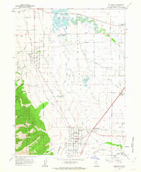 1962 Wellsville1963 Print · USGSCache Valley agriculture and mountain terrain meet in the early 1960s as irrigation canals and rail lines connect established communities. Researchers can trace the Union Pacific route through Mendon and Wellsville or locate local landmarks like Pelican Pond and the Wellsville Res.3 unique versions available
 - 1964 Map of Monte Cristo PK, 1965 Print
 1964 Monte Cristo PK1965 Print · USGSThe northern Utah highlands and the Cache National Forest are shown here in the mid-1960s at a moment of intense topographic detail. Researchers can trace remote high-country water sources and landmarks like Monte Cristo Peak, Dry Bread Pond, and Bullpecker Spring.2 unique versions available
 - 1964 Map of Smithfield, 1966 Print
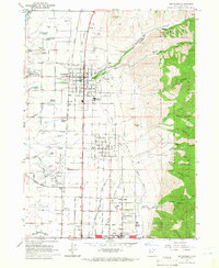 1964 Smithfield1966 Print · USGSThe Cache Valley flourished in the mid-sixties as a hub of irrigation and rail-connected agriculture between the Bear River and the mountains. Genealogists and historians can trace family-named sites like William Smith Spring, the rural community of Greenville, and the historic grid of Smithfield.4 unique versions available
 - 1964 Map of Richmond, 1966 Print
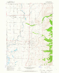 1964 Richmond1966 Print · USGSThe northern Cache Valley comes alive in the mid-1960s, showing the agricultural heartland along the Idaho-Utah border. Genealogists and local historians can trace family land near Lewiston, the Sugar Refinery, and the Union Pacific rail lines.
 - 1964 Map of Sharp Mountain, 1966 Print
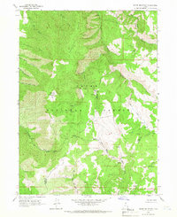 1964 Sharp Mountain1966 Print · USGSThe high ridge country of the Wasatch Range is captured here in the mid-1960s, showing the intersection of Cache and Weber counties. Local historians can locate the La Plata Mine and trace the headwaters of the Little Bear River and Cinnamon Creek.3 unique versions available
 - 1964 Map of Clarkston, 1966 Print
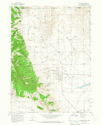 1964 Clarkston1966 Print · USGSSettled at the foot of the western mountains in the 1960s, this area around Clarkston shows a transition from high forest to fertile valley floor. Genealogists and historians can locate the local Cem, the Gravel Pit, and family-named landmarks like Myler Grove and Archibald Hollow.2 unique versions available
 - 1964 Map of Browns Hole, 1966 Print
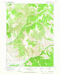 1964 Browns Hole1966 Print · USGSThe Ogden Valley hinterlands during the mid-sixties show a balance of irrigation agriculture and forest recreation near the Weber County line. You can trace early canyon access and recreation spots like Meadows Campground, Diversion Dam, and the winding Geertson Canyon.2 unique versions available
Showing maps 1-25 of 244
Top cities of Cache County
- Logan historical maps
- Hyrum historical maps
- North Logan historical maps
- Smithfield historical maps
- Providence historical maps
- Wellsville historical maps
See more
Frequently asked questions
- What are the different types of historical maps available for Cache County?
- What is the oldest map of Cache County?
- Where can I purchase historical maps of Cache County for my home or office?
- Where can I download high-res historical maps of Cache County?
- Are there historical topographic maps available for Cache County?
- Is there historical aerial imagery available for Cache County?
- Where are historical maps of Cache County sourced from?