1960s Maps of Cache County, Utah
Explore 28 historic maps of Cache County from the 1960s. These maps offer a rare glimpse into what life looked like during the 1960s — showing old roads, neighborhoods, homes, and landmarks that have changed or disappeared over time.
Whether you're researching your family's past, planning a metal detecting trip, or studying how Cache County's landscape evolved across the 1960s, these high-resolution maps are a powerful tool for exploring the history of this region.
- Focus on a specific era: All maps on this page are from the 1960s, giving you a focused view of this time period.
- See what’s changed: Compare century-old streets, trails, and buildings to today's modern landscape using overlays and satellite layers.
- Research with precision: Use these maps for genealogy, historical research, land use analysis, or educational projects.
- View, download, or print: Maps are fully viewable online in high resolution, and can be downloaded or printed for your own records.
Start exploring Cache County's history through authentic maps from the 1960s. This is your window into the past.
Cache County, UT maps
(28)- 1960 Map of Ogden
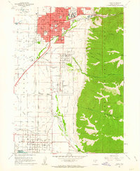
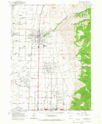
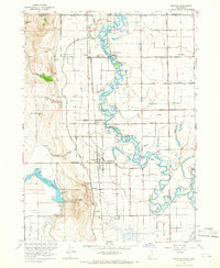
 1960 Ogden1960 Print · USGSIn the mid-1950s, this region of the American West balanced military expansion with frontier history along the Union Pacific RR. Genealogists and historians can trace old settlements like Fort Bridger, the residential growth of Washington Terrace, and industrial sites from the Hill AFB complex to the coal mines of Kemmerer.
 - 1961 Map of Honeyville, 1963 Print
 1961 Honeyville1963 Print · USGSThe Bear River valley at the foot of the Wellsville Mountains is captured here in the early sixties. Researchers can trace the Union Pacific line through Honeyville and Deweyville, or locate family landmarks like Jensen Spring and Tolman Springs.2 unique versions available
 - 1961 Map of Logan, 1963 Print
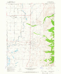
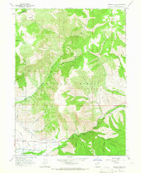
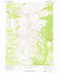
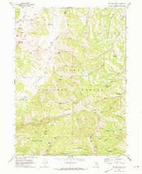
 1961 Logan1963 Print · USGSCache Valley thrives in the early sixties as a center of faith and industry, from the mountain-framed streets of Logan to the waters of Hyrum Reservoir. Genealogists and historians can trace family ties at the Logan Cemetery or locate landmarks like the Molasses Sugar Factory and South Cache High Sch.3 unique versions available
 - 1962 Map of Brigham City
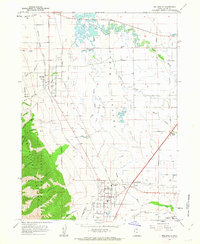
 1962 Brigham City1962 Print · USGSNorthern Utah in the early sixties reveals a landscape of vast salt flats and growing towns along the Wasatch Front. Researchers can trace the Southern Pacific line past the Golden Spike Monument or locate landmarks like Indian Cave and Donner-Reed Pass.
 - 1962 Map of Wellsville, 1963 Print
 1962 Wellsville1963 Print · USGSCache Valley agriculture and mountain terrain meet in the early 1960s as irrigation canals and rail lines connect established communities. Researchers can trace the Union Pacific route through Mendon and Wellsville or locate local landmarks like Pelican Pond and the Wellsville Res.3 unique versions available
 - 1964 Map of Monte Cristo PK, 1965 Print
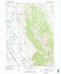
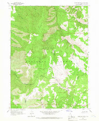
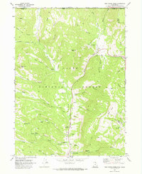
 1964 Monte Cristo PK1965 Print · USGSThe northern Utah highlands and the Cache National Forest are shown here in the mid-1960s at a moment of intense topographic detail. Researchers can trace remote high-country water sources and landmarks like Monte Cristo Peak, Dry Bread Pond, and Bullpecker Spring.2 unique versions available
 - 1964 Map of Smithfield, 1966 Print
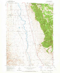
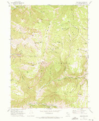
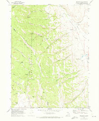
 1964 Smithfield1966 Print · USGSThe Cache Valley flourished in the mid-sixties as a hub of irrigation and rail-connected agriculture between the Bear River and the mountains. Genealogists and historians can trace family-named sites like William Smith Spring, the rural community of Greenville, and the historic grid of Smithfield.4 unique versions available
 - 1964 Map of Richmond, 1966 Print
 1964 Richmond1966 Print · USGSThe northern Cache Valley comes alive in the mid-1960s, showing the agricultural heartland along the Idaho-Utah border. Genealogists and local historians can trace family land near Lewiston, the Sugar Refinery, and the Union Pacific rail lines.
 - 1964 Map of Sharp Mountain, 1966 Print
 1964 Sharp Mountain1966 Print · USGSThe high ridge country of the Wasatch Range is captured here in the mid-1960s, showing the intersection of Cache and Weber counties. Local historians can locate the La Plata Mine and trace the headwaters of the Little Bear River and Cinnamon Creek.3 unique versions available
 - 1964 Map of Clarkston, 1966 Print
 1964 Clarkston1966 Print · USGSSettled at the foot of the western mountains in the 1960s, this area around Clarkston shows a transition from high forest to fertile valley floor. Genealogists and historians can locate the local Cem, the Gravel Pit, and family-named landmarks like Myler Grove and Archibald Hollow.2 unique versions available
 - 1964 Map of Browns Hole, 1966 Print
 1964 Browns Hole1966 Print · USGSThe Ogden Valley hinterlands during the mid-sixties show a balance of irrigation agriculture and forest recreation near the Weber County line. You can trace early canyon access and recreation spots like Meadows Campground, Diversion Dam, and the winding Geertson Canyon.2 unique versions available
 - 1964 Map of Portage, 1966 Print
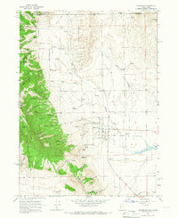
 1964 Portage1966 Print · USGSThe Idaho-Utah borderlands are captured here in the mid-1960s, showing the agricultural valley floor set against the peaks of the Cache National Forest. Local researchers can trace family sites in Portage and Washakie, or locate the Washakie Cem and Plymouth Cem.2 unique versions available
 - 1964 Map of Newton, 1966 Print
 1964 Newton1966 Print · USGSNewton and the Cache Valley wetlands are captured here in the mid-1960s, showing a landscape defined by irrigation and the Union Pacific rail. Researchers can locate family sites near Benson Sch, trace the Old Railroad Grade, or find landmarks like Quigley Crossing.3 unique versions available
 - 1964 Map of Cutler Dam, 1966 Print
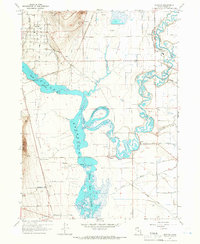
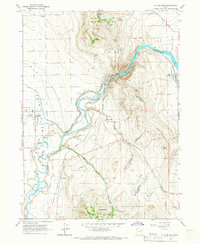 1964 Cutler Dam1966 Print · USGSThe Bear River valley in the mid-1960s shows a landscape of mountain-fringed agriculture and river engineering. Trace the historic rail and water networks connecting Fielding, Cache Junction, and the infrastructure of the Cutler Dam.
 - 1964 Map of Trenton, 1966 Print
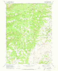
 1964 Trenton1966 Print · USGSThe Cache Valley at the height of the mid-century shows a landscape of river-fed agriculture and rail-side settlements along the Utah-Idaho border. Local researchers can trace the historic Union Pacific tracks through Trenton or locate the Cornish Cem and Newton Reservoir.2 unique versions available
 - 1968 Map of Dairy Ridge, 1970 Print
 1968 Dairy Ridge1970 Print · USGSThe high ridges of the Cache National Forest come into focus in the late sixties, showing a landscape managed for timber and range. Researchers can locate remote landmarks like the Monte Cristo Guard Sta, Woodruff Road, and dozens of named water sources like Neponset Spring.3 unique versions available
 - 1969 Map of Tony Grove Creek, 1973 Print
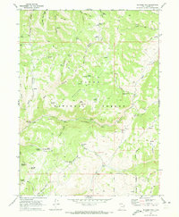
 1969 Tony Grove Creek1973 Print · USGSHigh in the Cache National Forest during the late sixties, this survey captures the intersection of mountainous recreation and resource history. Trace the trails leading to the Amazon Mine, explore the Beaver Mtn Ski Area, or locate the Tony Grove Memorial Guard Station.
 - 1969 Map of Boulder Mtn, 1973 Print
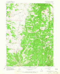
 1969 Boulder Mtn1973 Print · USGSCache County's high country is documented here in the late sixties, showing a wilderness landscape shaped by early mining and ranching. Trace the locations of remote landmarks like the Lucky Star Mine, Warrens Spring, and the unique Sow Hole and Boar Hole depressions.3 unique versions available
 - 1969 Map of Porcupine Reservoir, 1973 Print
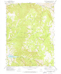 1969 Porcupine Reservoir1973 Print · USGSThe Bear River Range in the late sixties shows a remote landscape of steep canyons and forest service lands just after the reservoir was established. Trace mountain trails and water management sites like Cooks Cabin, the Porcupine Reservoir, and Mineral Point.
 - 1969 Map of Hardware Ranch, 1973 Print
 1969 Hardware Ranch1973 Print · USGSThe Cache National Forest in the late sixties reveals a landscape of high ridges and isolated ranching outposts. Researchers can trace the water sources and trails of the era, from the Hardware Ranch and Anderson Ranch to remote landmarks like Gold Hill and Petes Trail.
 - 1969 Map of Logan Peak, 1973 Print
 1969 Logan Peak1973 Print · USGSThe Bear River Range and Logan Peak are captured here in the late sixties, showing a high-altitude landscape of pack trails and forest service outposts. Genealogists and researchers can trace local landmarks like Adams Corral, the Quarry, and remote water sources like Ferry Spring.
 - 1969 Map of Mt. Elmer, 1973 Print
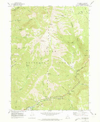 1969 Mt. Elmer1973 Print · USGSThe high peaks of the Bear River Range and the Logan River canyon floor are captured here in the late sixties. Researchers can trace forest management and early recreation sites like the Wood Camp Guard Station, Wind Cave, and the Old Jardine Juniper.3 unique versions available
 - 1969 Map of Curtis Ridge, 1973 Print
 1969 Curtis Ridge1973 Print · USGSThe high mountain divide between Cache and Rich Counties is captured here in the late sixties, showing a landscape defined by livestock water and pack routes. Researchers can trace the Hardware Ranch Trail and find family-named landmarks like Little Crawford Spring, Thorsen Spring, and Walton Gulch.3 unique versions available
 - 1969 Map of Red Spur Mtn, 1973 Print
 1969 Red Spur Mtn1973 Print · USGSUpland forest and grazing lands in the Cache and Rich county borderlands are shown here in the late sixties. Researchers can trace land use through features like the Elk Valley Guard Station, Bug Lake, and family-named landmarks like Nebeker Spring.2 unique versions available
 - 1969 Map of Meadowville, 1973 Print
 1969 Meadowville1973 Print · USGSMeadowville and the high canyons of the Rich County border are captured here during the late sixties. Researchers can trace family history through the Meadowville Cem and find remote landmarks like Kearl Reservoir, Log Cabin Ridge, and Nebeker Spring.
Showing maps 1-25 of 28
Top cities of Cache County
- Logan historical maps
- Hyrum historical maps
- North Logan historical maps
- Smithfield historical maps
- Providence historical maps
- Wellsville historical maps
See more
Frequently asked questions
- What are the different types of historical maps available for Cache County?
- What is the oldest map of Cache County?
- Where can I purchase historical maps of Cache County for my home or office?
- Where can I download high-res historical maps of Cache County?
- Are there historical topographic maps available for Cache County?
- Is there historical aerial imagery available for Cache County?
- Where are historical maps of Cache County sourced from?