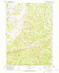
1969 Map of Red Spur Mtn
USGS Topo · Published 1973About this map
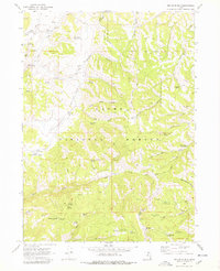
The Cache National Forest high country along the border of Cache and Rich Counties is defined by a complex network of canyons and high-altitude water management. In the late 1960s, this landscape supported a mix of forest management and livestock grazing, evidenced by the Elk Valley Guard Station and Curtis Creek Guard Station. The drainage systems of Laketown Creek and Curtis Creek are punctuated by numerous small-scale water features like Deer Lick Reservoir, Wes Reservoir, and Bug Lake. Notable family-named landmarks such as Nebeker Spring, Weston Spring, and Cox Spring indicate the long-standing use of these upland pastures. The terrain transitions from the high peaks of Red Spur Mtn down into the broad expanses of Strawberry Valley and Little Strawberry Valley, where Dry Lake and the Basin Beaver Ponds collect seasonal runoff.
Find a feature on this map
57 named features on this map. Tap any name to fly to it.
Don’t see what you’re looking for? This feature index may not catch every label — zoom into the map to look around manually.
Map Details
Editions of this 1969 Red Spur Mtn Map
2 editions found
Other maps of this area

1912 · Randolph
USGS Topo · 1:125,000

1914 · Logan
USGS Topo · 1:125,000

1916 · Logan
USGS Topo · 1:125,000

1949 · Boulter Mts
USGS Topo · 1:24,000

1954 · Ogden
USGS Topo · 1:250,000

1958 · Ogden
USGS Topo · 1:250,000

1960 · Ogden
USGS Topo · 1:250,000

1969 · Boulder Mtn
USGS Topo · 1:24,000
1969 · Birch Creek Reservoirs
USGS Topo · 1:24,000
1969 · Hardware Ranch
USGS Topo · 1:24,000