
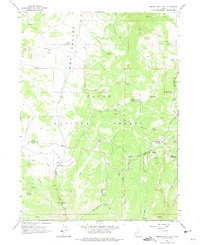
1964 Map of Monte Cristo PK
USGS Topo · Published 1965About this map
Monte Cristo Peak and Mt McKinnon dominate the high-elevation terrain of the Cache National Forest, marking a complex junction where Cache, Rich, and Weber counties meet. This 1964 field-checked survey reveals a landscape defined by an intricate network of drainage systems and isolated water sources, including the headwaters of the Bear River and Little Bear River. The topographic detail highlights the reliance on specific landmarks for navigation through the dense draws and hollows, such as Ant Flat and Dry Bread. For those studying the hydrology of the Wasatch Range, the map identifies numerous specific water points like Bullpecker Spring, Indian Spring, and Limestone Spring. The presence of several named hollows, including Blake Hollow and Skunk Hollow, alongside early trails, provides a clear view of the backcountry geography before modern development or major infrastructure reached this part of the northern Utah highlands.
Find a feature on this map
41 named features on this map. Tap any name to fly to it.
Don’t see what you’re looking for? This feature index may not catch every label — zoom into the map to look around manually.
Map Details
Editions of this 1964 Monte Cristo PK Map
2 editions found
Other maps of this area

1912 · Randolph
USGS Topo · 1:125,000

1914 · Logan
USGS Topo · 1:125,000

1916 · Logan
USGS Topo · 1:125,000

1954 · Ogden
USGS Topo · 1:250,000

1958 · Ogden
USGS Topo · 1:250,000

1960 · Ogden
USGS Topo · 1:250,000
1964 · Sharp Mountain
USGS Topo · 1:24,000
1964 · Browns Hole
USGS Topo · 1:24,000
1964 · Causey Dam
USGS Topo · 1:24,000

1968 · Horse Ridge
USGS Topo · 1:24,000