Old Maps of Horse Canyon, Utah for Metal Detecting
Plan your next treasure hunt with 15 historic maps of Horse Canyon. Find old homesites, ghost towns, trails, and gathering spots that may be lost to time — perfect for identifying promising metal detecting locations.
- Locate forgotten sites: Uncover places like long-lost settlements, abandoned rail lines, or gathering spots.
- Plan better hunts: Use map overlays combined with LiDAR or satellite views to narrow in on historically rich areas.
- Made for detectorists: Thousands of hobbyists use these maps to discover relics, coins, and hidden history.
Use these historic maps to boost your research and find new opportunities beneath the surface of Horse Canyon.
Horse Canyon, UT maps
(15)- 1886 Map of Price River
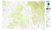
 1886 Price River1886 Print · USGSEmery County and the surrounding canyonlands are documented here just as the railroad arrived in the mid-1880s. Local researchers can trace the early path of the Denver and Rio Grande Western R. R. through Castle Gate, Price, and Sunny Side.4 unique versions available
 - 1896 Map of Price River
 1896 Price River1896 Print · USGSEmery County was transitioning into a vital rail corridor during the late nineteenth century. Trace the early layout of Price and Castle Dale alongside the winding Denver and Rio Grande Western RR and the depths of Desolation Canyon.
 - 1948 Map of Woodside, 1960 Print
 1948 Woodside1960 Print · USGSEmery County was a landscape of coal mining and rail transport at the end of the 1940s. Genealogists and local historians can trace the foundations of Woodside and the Silvagni Ranch or locate the Geneva Coal Mine at the foot of the Book Cliffs.
 - 1949 Map of Woodside, 1973 Print
 1949 Woodside1973 Print · USGSThe Book Cliffs and Price River valley come into focus during the late 1940s, a period of active rail transport and coal mining. Researchers can locate the Geneva Coal Mine, the small community of Woodside, and the remote Silvagni Ranch along the desert washes.
 - 1950 Map of Woodside
 1950 Woodside1950 Print · USGSEmery County was a landscape of deep canyons and rail-side outposts at the midpoint of the twentieth century. Researchers can trace the industrial footprint of the Geneva Coal Mine or locate early settlements and family landmarks like Woodside, Silvagni Ranch, and the local Cem.2 unique versions available
 - 1956 Map of Price, 1968 Print
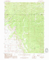
 1956 Price1968 Print · USGSCentral Utah in the mid-fifties showcases a landscape shaped by coal mining and mountain-fed irrigation. Trace the rail-and-river economy through the Geneva Coal Mine, the Union Pacific line, and settlements like Price and Ephraim.3 unique versions available
 - 1960 Map of Price
 1960 Price1960 Print · USGSCentral Utah in the late fifties was a landscape of coal-hauling railroads and high plateau settlements. Genealogists and local historians can trace the rail-to-river economy from Price to the mountain mining camps of Hiawatha, Dragerton, and Sunnyside.2 unique versions available
 - 1962 Map of Price
 1962 Price1962 Print · USGSCentral Utah during the early sixties shows a landscape balancing high-mountain forestry with valley agriculture and coal mining. Genealogists and historians can trace the Denver and Rio Grande Western rail lines through industrial hubs like Price or locate formerly active sites like Coal City (abandoned).
 - 1980 Map of Huntington, 1981 Print
 1980 Huntington1981 Print · USGSEmery and Carbon County landscapes are captured here during the early eighties, showcasing a region defined by high plateaus and mining towns. Researchers can trace the Denver and Rio Grande Western Railroad corridor and locate landmarks like the Cleveland-Lloyd Dinosaur Quarry and Hiawatha.
 - 1985 Map of Lila Point
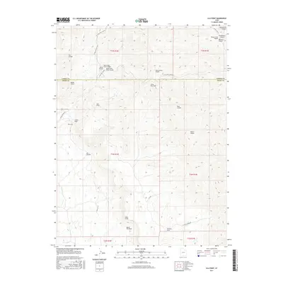
 1985 Lila Point1985 Print · USGSThe Book Cliffs escarpment and Emery County desert appear here in the mid-1980s. Researchers can trace the rugged drainage systems of Horse Canyon and Lila Canyon or locate landmarks like Lila Point and Buckskin.
 - 2011 Map of Lila Point, 2011 Print
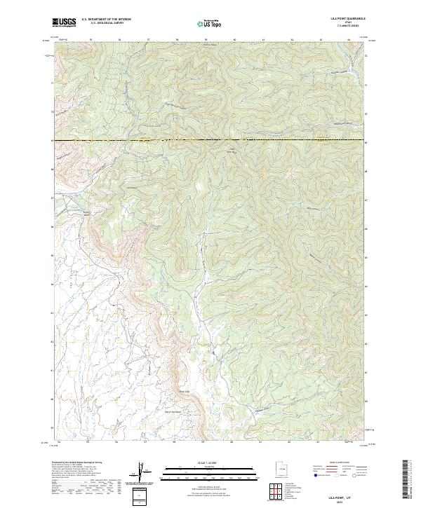
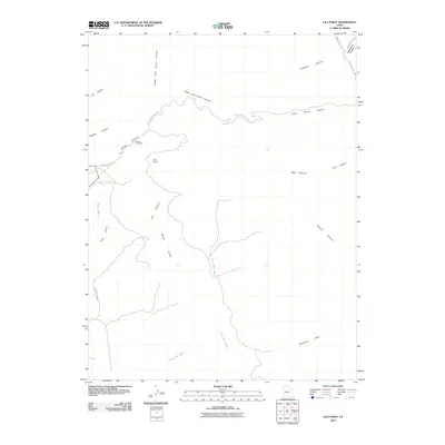 2011 Lila Point2011 Print · USGSCovers Horse Canyon, including Carbon County, Emery County, and other nearby areas
 - 2014 Map of Lila Point, 2014 Print
 2014 Lila Point2014 Print · USGSCovers Horse Canyon, including Carbon County, Emery County, and other nearby areas
 - 2017 Map of Lila Point, 2017 Print
 2017 Lila Point2017 Print · USGSCovers Horse Canyon, including Carbon County, Emery County, and other nearby areas
 - 2020 Map of Lila Point, 2020 Print
 2020 Lila Point2020 Print · USGSCovers Horse Canyon, including Carbon County, Emery County, and other nearby areas
 - 2023 Map of Lila Point, 2023 Print
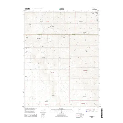
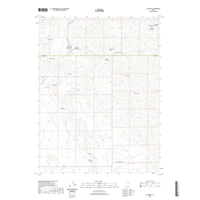
 2023 Lila Point2023 Print · USGSThe Carbon and Emery county line runs through this high desert terrain near the edge of the Book Cliffs. Researchers can trace the drainage patterns and access routes through Lila Canyon, Patmos Ridge, and along Horse Canyon Rd.
End of results
Showing maps 1-15 of 15
Frequently asked questions
- What are the different types of historical maps available for Horse Canyon?
- What is the oldest map of Horse Canyon?
- Where can I purchase historical maps of Horse Canyon for my home or office?
- Where can I download high-res historical maps of Horse Canyon?
- Are there historical topographic maps available for Horse Canyon?
- Is there historical aerial imagery available for Horse Canyon?
- Where are historical maps of Horse Canyon sourced from?