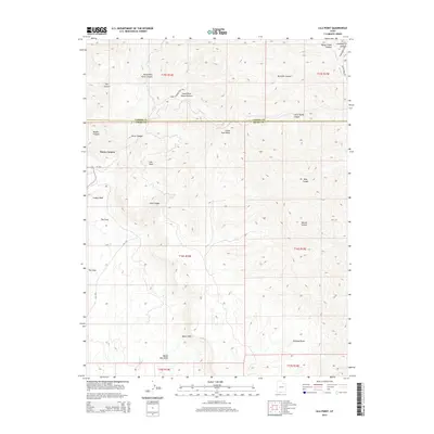
2014 Map of Lila Point
USGS Topo · Published 2014About this map
Lila Point stands as a prominent geographic feature along the dramatic escarpment of the Book Cliffs, where the high plateau drops toward the desert floor. This 2014 survey details the complex drainage systems of the region, including the North Fork and South Fork Horse Canyon, which carve through the high country. The map documents the boundary between Carbon and Emery counties, a line that cuts across several major geological features including Buckskin Canyon and Horse Canyon. Remote transportation routes like Range Creek Rd and Ut-124 provide the primary access through this arid landscape, connecting isolated landmarks such as The Cove and Grassy Wash. The map's contour data emphasizes the steep relief and deep incisions of Nelson Canyon and Bear Canyon as they descend toward Marsh Flat Wash.
Find a feature on this map
29 named features on this map. Tap any name to fly to it.
Don’t see what you’re looking for? This feature index may not catch every label — zoom into the map to look around manually.
Map Details
Editions of this 2014 Lila Point Map
This is the sole edition of this map. No revisions or reprints were ever made.
Other maps of this area

1886 · Price River
USGS Topo · 1:250,000

1896 · Price River
USGS Topo · 1:250,000

1915 · Sunnyside
USGS Topo · 1:62,500

1948 · Woodside
USGS Topo · 1:62,500

1949 · Woodside
USGS Topo · 1:62,500

1950 · Woodside
USGS Topo · 1:62,500

1954 · Flat Canyon
USGS Topo · 1:62,500

1954 · Range Creek
USGS Topo · 1:62,500

1956 · Price
USGS Topo · 1:250,000

1960 · Price
USGS Topo · 1:250,000