Old Maps of Kanab, Utah for Genealogy
Trace your family roots with 21 historic maps of Kanab. These high-res maps reveal old neighborhoods, homesites, landmarks, and streets — helping you uncover where your ancestors lived and how the area evolved over time.
- Explore historic neighborhoods: Identify where your relatives may have lived in the 1800s or 1900s.
- Compare maps over time: Trace the changes in streets, buildings, and landmarks for multi-generational research.
- Perfect for genealogy & ancestry research: Used by family historians and researchers to map out lineage and migration.
These maps are an incredible resource for exploring your personal connection to Kanab's past.
Kanab, UT maps
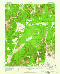
(21)- 1886 Map of Kanab
 1886 Kanab1886 Print · USGSSouthern Utah in the late nineteenth century remains a frontier of deep canyons and high plateaus. Researchers can trace early pioneer outposts and river settlements like Orderville, Mt. Carmel, and Kanab tucked beneath the Vermilion Cliffs.5 unique versions available
 - 1953 Map of Cedar City, 1966 Print
 1953 Cedar City1966 Print · USGSSouthwestern Utah's high plateaus and desert basins are mapped here during the mid-fifties, showing the region before the modern interstate system. Researchers can trace historic mining at Silver Reef, follow the Union Pacific line, and locate early settlements like Kanarraville and Toquerville.3 unique versions available
 - 1954 Map of Kanab SE, 1956 Print
 1954 Kanab SE1956 Print · USGSThe Utah-Arizona borderlands come into focus during the mid-fifties, centered on the settlement of Kanab and the northern edge of the Kaibab Indian Reservation. Researchers can locate a Cem, the local Landing Strip, and ancient Cliff Dwellings tucked into the surrounding canyons.
 - 1954 Map of Johnson SW, 1956 Print
 1954 Johnson SW1956 Print · USGSSouthern Utah and northern Arizona were documented in this 1950s survey during an era of significant topographic mapping across the Vermilion Cliffs. Researchers can trace old ranching activity at Robinson Ranch and locate remote water sources such as Sheep Spring and Hog Canyon Spring.
 - 1954 Map of Johnson, 1959 Print
 1954 Johnson1959 Print · USGSSouthern Utah's high desert plateaus are documented here in the mid-1950s, showing the intersection of ranching life and ancient history. You can trace the Johnson settlement and locate Cliff Dwellings, Petroglyphs, and the Montezuma Mine.3 unique versions available
 - 1957 Map of Kanab, 1960 Print
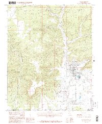
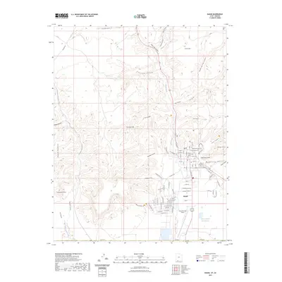
 1957 Kanab1960 Print · USGSSouthern Utah during the mid-fifties shows a landscape of deep canyons and high desert mesas on the edge of the Arizona border. Genealogists and historians can trace the early layout of Kanab and Mt Carmel, alongside remote sites like a Cliff Dwelling and the Foot Ranch.2 unique versions available
 - 1958 Map of Cedar City
 1958 Cedar City1958 Print · USGSSouthwestern Utah in the late fifties was a land of mineral extraction and monumental landscapes. Genealogists and historians can trace pioneer-era settlements like Grafton and Parowan alongside industrial sites such as the Silver Reef Mine.2 unique versions available
 - 1962 Map of Cedar City
 1962 Cedar City1962 Print · USGSSouthern Utah in the early sixties showcases a landscape of dramatic plateaus and historic mining outposts. Trace the early settlement patterns at the Silver Reef (ruins), locate the Iron Mine near the Hurricane Cliffs, or find the Fort Harmony Monument.
 - 1980 Map of Kanab, 1981 Print
 1980 Kanab1981 Print · USGSSouthern Utah in the late seventies is a landscape of massive geologic terraces and isolated ranching towns. Trace the growth of Kanab and Springdale or locate vanished sites like Shunesburg among the White Cliffs and Vermilion Cliffs.
 - 1985 Map of Kanab
 1985 Kanab1985 Print · USGSThe high desert landscape of the Utah-Arizona border comes into focus in the mid-1980s, centered on the settlement of Kanab. Researchers can trace the town's footprint, including the Cem, the Movie Set (Fort), and the rugged Vermilion Cliffs.2 unique versions available
 - 1987 Map of Thompson Point
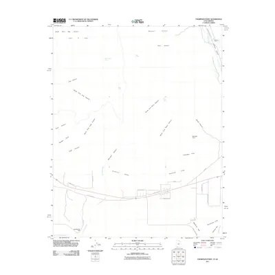
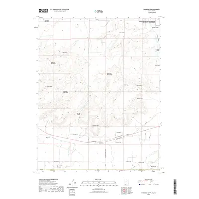
 1987 Thompson Point1987 Print · USGSThe high plateaus of the Utah-Arizona border are captured in the late eighties, showing a landscape of massive escarpments and hidden springs. Researchers can trace the 4WD trails leading to Open Pit Mines and remote water sources like Sheep Springs or Ram Spring.
 - 2011 Map of Kanab, 2011 Print
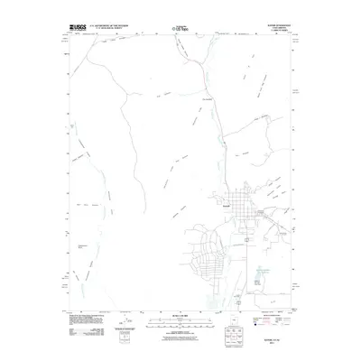 2011 Kanab2011 Print · USGSCovers Kanab, including Kaibab, Fredonia, and other nearby areas
 - 2011 Map of Thompson Point, 2011 Print
 2011 Thompson Point2011 Print · USGSCovers Kanab, including Coconino County, Kane County, and other nearby areas
 - 2014 Map of Thompson Point, 2014 Print
 2014 Thompson Point2014 Print · USGSCovers Kanab, including Coconino County, Kane County, and other nearby areas
 - 2014 Map of Kanab, 2014 Print
 2014 Kanab2014 Print · USGSCovers Kanab, including Kaibab, Fredonia, and other nearby areas
 - 2017 Map of Thompson Point, 2017 Print
 2017 Thompson Point2017 Print · USGSCovers Kanab, including Coconino County, Kane County, and other nearby areas
 - 2017 Map of Kanab, 2017 Print
 2017 Kanab2017 Print · USGSCovers Kanab, including Kaibab, Fredonia, and other nearby areas
 - 2020 Map of Kanab, 2020 Print
 2020 Kanab2020 Print · USGSCovers Kanab, including Kaibab, Fredonia, and other nearby areas
 - 2020 Map of Thompson Point, 2020 Print
 2020 Thompson Point2020 Print · USGSCovers Kanab, including Coconino County, Kane County, and other nearby areas
 - 2023 Map of Kanab, 2023 Print
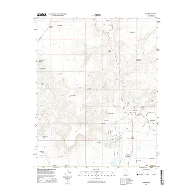
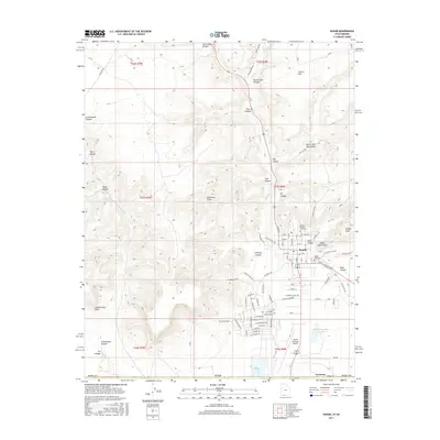
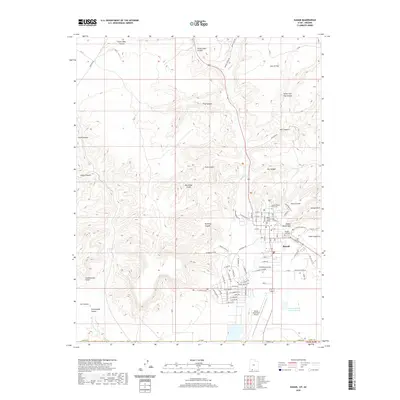
 2023 Kanab2023 Print · USGSSouthern Utah's canyon country is documented here in the early twenty-first century, centered on the settlement of Kanab. Genealogists and historians can trace local landmarks like the Kane County Court House, Kanab City Cem, and the Indian Dance Hall.
 - 2023 Map of Thompson Point, 2023 Print
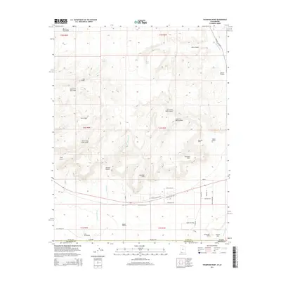
 2023 Thompson Point2023 Print · USGSSouthern Utah's dramatic desert terrain is captured here in the contemporary era as the city of Kanab meets the towering Vermilion Cliffs. Genealogists and historians can trace the early pioneers through the Johnson Cem and explore named landmarks like Eightmile Gap and Muggins Flat.
End of results
Showing maps 1-21 of 21
Top cities near Kanab
Top neighborhoods of Kanab
Frequently asked questions
- What are the different types of historical maps available for Kanab?
- What is the oldest map of Kanab?
- Where can I purchase historical maps of Kanab for my home or office?
- Where can I download high-res historical maps of Kanab?
- Are there historical topographic maps available for Kanab?
- Is there historical aerial imagery available for Kanab?
- Where are historical maps of Kanab sourced from?