Old Maps of Washington County, Utah for Academic Research
Study the evolution of Washington County with 213 high-resolution historic maps. Whether you're teaching, researching, or modeling changes in land use, these maps provide essential visual documentation of urban, environmental, and geographic change.
- Analyze long-term change: Track patterns in development, transportation, and natural features.
- Ideal for environmental or urban studies: Support academic projects with primary historical map data.
- Use in the classroom or lab: Educators and researchers rely on these maps to bring historical context to life.
These maps are a powerful tool for teaching, research, and visualizing how Washington County has changed over the decades.
Washington County, UT maps
(213)- 1885 Map of St. George
 1885 St. George1885 Print · USGSSouthern Utah’s high deserts and river valleys are captured here during the mid-1880s, an era of mining expansion and early settlement. Researchers can trace the layout of pioneer towns like Silver Reef, Virgin City, and the historic site of Mountain Meadows.
 - 1885 Map of Pioche
 1885 Pioche1885 Print · USGSLincoln County was a center of frontier mining and ranching during the mid-1880s. Genealogists and historians can trace the early layout of the silver-rich Pioche district and find remote locations like Bullionville, Panacca, and Hackberry Spring.4 unique versions available
 - 1886 Map of Kanab
 1886 Kanab1886 Print · USGSSouthern Utah in the late nineteenth century remains a frontier of deep canyons and high plateaus. Researchers can trace early pioneer outposts and river settlements like Orderville, Mt. Carmel, and Kanab tucked beneath the Vermilion Cliffs.5 unique versions available
 - 1886 Map of Saint Thomas
 1886 Saint Thomas1886 Print · USGSSoutheastern Nevada's river valleys and early trails are captured here in the late nineteenth century, long before the creation of Lake Mead. Genealogists and historians can locate early settlements like Saint Thomas and Old Callville, and trace river crossings at Stone Ferry and Scanlon Ferry.6 unique versions available
 - 1886 Map of Mt. Trumbull
 1886 Mt. Trumbull1886 Print · USGSMohave County in the late nineteenth century was a territory of extreme verticality and scarce water. Historians can trace early routes through the Arizona Strip via vital water stops like Pierce Ferry, Witches Pool, and Pakoon Spring.
 - 1886 Map of Pioche, 1896 Print
 1886 Pioche1896 Print · USGSEastern Nevada and the Utah borderlands are captured here during the height of the regional mining boom in the late nineteenth century. Genealogists and historians can trace early settlements and vital water sources like Bullionville, Panacca, and Hackberry Spring.
 - 1891 Map of St. George
 1891 St. George1891 Print · USGSSouthwestern Utah in the early 1890s was a landscape of pioneer outposts and mining ventures at the edge of the Escalante Desert. Genealogists and historians can trace the early footprints of St George, the mining camp at Silver Reef, and the now-quiet site of Iron City.4 unique versions available
 - 1892 Map of Mt. Trumbull
 1892 Mt. Trumbull1892 Print · USGSNorthwestern Arizona in the late nineteenth century was a frontier of isolated springs and massive plateaus. You can trace early routes across the Colorado River at Pierce Ferry and locate vital water at Pakoon Spring or Witch Pool.6 unique versions available
 - 1893 Map of Saint Thomas
 1893 Saint Thomas1893 Print · USGSSouthern Nevada at the close of the nineteenth century reveals a network of river-based settlements and trails. Genealogists and researchers can trace the early locations of Saint Thomas, Old Callville, and the Stone Ferry crossing.
 - 1950 Map of Iron Mountain, 1959 Print
 1950 Iron Mountain1959 Print · USGSSouthern Utah's mining and ranching heritage is on full display in the 1950s as industry expands across the Harmony Mountains. Researchers can locate specific operations like the Columbia Steel Mine alongside historical landmarks such as Old Irontown and Page Ranch.
 - 1950 Map of Stoddard Mtn, 1975 Print
 1950 Stoddard Mtn1975 Print · USGSIron County at mid-century reveals a landscape of industrial rail and seasonal mountain camps. Researchers can trace the Union Pacific line to the Iron Mountain Wye or locate the site of the Coal Mine (Inactive) and Kelsey Deer Camp.
 - 1950 Map of Page Ranch, 1979 Print
 1950 Page Ranch1979 Print · USGSIron County mining and ranching culture are preserved here in the mid-twentieth century as industrial pits and historic ruins dot the landscape. Genealogists and historians can trace pioneer roots at the Old Irontown (Historic Site) and local cattle history at Page Ranch or The Dairy.
 - 1951 Map of Stoddard Mtn
 1951 Stoddard Mtn1951 Print · USGSThe Harmony Mountains of southern Utah are captured here in the early fifties, showing a rugged interior at the Iron and Washington county line. Researchers can trace the Union Pacific spur to Iron Mountain Wye and locate remote outposts like Kelsey Deer Camp and an inactive coal mine.
 - 1951 Map of Page Ranch
 1951 Page Ranch1951 Print · USGSIron County ranching and heavy industry intersect at the start of the fifties as iron mining intensifies on the mountain slopes. Researchers can locate the Old Irontown Ruins, trace the Union Pacific line to the Columbia Steel Mine, and find family outposts like Page Ranch.2 unique versions available
 - 1953 Map of Cedar City, 1966 Print
 1953 Cedar City1966 Print · USGSSouthwestern Utah's high plateaus and desert basins are mapped here during the mid-fifties, showing the region before the modern interstate system. Researchers can trace historic mining at Silver Reef, follow the Union Pacific line, and locate early settlements like Kanarraville and Toquerville.3 unique versions available
 - 1953 Map of Grand Canyon, 1967 Print
 1953 Grand Canyon1967 Print · USGSArizona's northern frontier is captured here in the mid-twentieth century, from the high plateaus to the desert basins. Trace early routes like Arizona 67, explore the isolated Moccasin settlement, or locate early landmarks such as Mount Trumbull.3 unique versions available
 - 1954 Map of La Verkin 4 SE
 1954 La Verkin 4 SE1954 Print · USGSThe high desert plateaus of the Utah-Arizona border are captured here in the mid-1950s. Researchers can trace the layout of the Canaan Ranch, locate water sources like Canaan Wash, and identify landmarks from Smithsonian Butte to Canaan Gap.2 unique versions available
 - 1954 Map of Caliente
 1954 Caliente1954 Print · USGSLincoln County at mid-century reveals a landscape defined by the Union Pacific rail line and expanding Cold War military ranges. Researchers can trace the heritage of mining towns like Pioche, locate the Prince Mine, or find early airfields at Panaca Airport and Caliente.5 unique versions available
 - 1954 Map of Beaver Dam Mts NE
 1954 Beaver Dam Mts NE1954 Print · USGSThe Shivwits Indian Reservation and the Santa Clara River valley are mapped here in the mid-1950s. Genealogists and local historians can locate the Shivwits settlement, a small Cem, and desert water sources like Pahcoon Springs.2 unique versions available
 - 1954 Map of Las Vegas
 1954 Las Vegas1954 Print · USGSLas Vegas and the Mojave Desert are shown in the early fifties as the region's military and recreational footprint expanded. Genealogists and historians can trace the early layout of North Las Vegas, the sites of Indian Springs Air Force Base, and long-established towns like Bunkerville.5 unique versions available
 - 1954 Map of La Verkin 4 NW, 1956 Print
 1954 La Verkin 4 NW1956 Print · USGSSouthern Utah in the mid-1950s reveals a landscape defined by the river and the mesa. Trace the early layout of Virgin, the nearby Virgin Oil Field, and the small settlement at Mountain Dell.
 - 1954 Map of La Verkin 4 SW, 1956 Print
 1954 La Verkin 4 SW1956 Print · USGSThe high plateau country along the Utah-Arizona border is surveyed here in the early 1950s. Trace the remote trails and seasonal water sources that sustained early ranching, from Gould Spring to the isolated high grounds of Little Creek Mountain and Abs Clearing.
 - 1954 Map of Hurricane Cliffs 2 NW, 1956 Print
 1954 Hurricane Cliffs 2 NW1956 Print · USGSThe Arizona Strip during the mid-fifties was a land of high mesas and vital water holes for cattle ranching along the Mohave county line. Researchers can trace the historic Sunshine Trail across West Mesa to find remote landmarks like Blake Pond and Joe Blake Hill.
 - 1954 Map of Orderville Canyon NW, 1956 Print
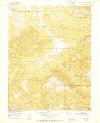
 1954 Orderville Canyon NW1956 Print · USGSThe high plateau country along the Iron and Washington County line is captured here in the early fifties. Researchers can trace the ranching history of the area via features like Virgin Flats and various Stock Tank sites near Miners Peak.
 - 1954 Map of La Verkin 3 NW, 1956 Print
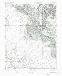
 1954 La Verkin 3 NW1956 Print · USGSWashington County at the mid-century shows a landscape shaped by ranching and the Virgin River. Local historians can trace the foundations of Harrisburg, locate the Bastion Ranch, and identify early industrial efforts at the local Coal Mine.
Showing maps 1-25 of 213
Top cities of Washington County
- St. George historical maps
- Washington historical maps
- Hurricane historical maps
- Ivins historical maps
- Santa Clara historical maps
- La Verkin historical maps
See more
Frequently asked questions
- What are the different types of historical maps available for Washington County?
- What is the oldest map of Washington County?
- Where can I purchase historical maps of Washington County for my home or office?
- Where can I download high-res historical maps of Washington County?
- Are there historical topographic maps available for Washington County?
- Is there historical aerial imagery available for Washington County?
- Where are historical maps of Washington County sourced from?