
1954 Map of Beaver Dam Mts NE
USGS Topo · Published 1954About this map
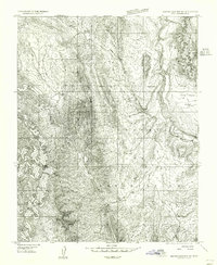
Shivwits Indian Reservation dominates this 1954 landscape in Washington County, Utah, providing a detailed look at the rural environment before later development. The settlement of Shivwits is documented along the Santa Clara River, accompanied by a local Cem and Gravel Pit that highlight the small-scale infrastructure of the period. This preliminary survey emphasizes the water sources critical to the arid region, marking Pahcoon Springs, Camp Spring, and several designated Reservoir sites. To the east, the flat expanse of the Santa Clara Bench contrasts with the steep terrain of Whitmore Canyon. The mapping, based on 1953 aerial photography, captures the exact limits of the Shivwits Indian Reservation Boundary as it stood at mid-century.
Find a feature on this map
12 named features on this map. Tap any name to fly to it.
Don’t see what you’re looking for? This feature index may not catch every label — zoom into the map to look around manually.
Map Details
Editions of this 1954 Beaver Dam Mts NE Map
2 editions found
Other maps of this area

1885 · St. George
USGS Topo · 1:250,000

1891 · St. George
USGS Topo · 1:250,000

1953 · Cedar City
USGS Topo · 1:250,000

1954 · Gunlock
USGS Topo · 1:24,000

1954 · Beaver Dam Mts SE
USGS Topo · 1:24,000

1954 · St. George
USGS Topo · 1:62,500

1956 · St. George NW
USGS Topo · 1:24,000
1956 · St. George SW
USGS Topo · 1:24,000

1958 · Cedar City
USGS Topo · 1:250,000

1962 · Cedar City
USGS Topo · 1:250,000