Old Maps of Hildale, Utah for Academic Research
Study the evolution of Hildale with 22 high-resolution historic maps. Whether you're teaching, researching, or modeling changes in land use, these maps provide essential visual documentation of urban, environmental, and geographic change.
- Analyze long-term change: Track patterns in development, transportation, and natural features.
- Ideal for environmental or urban studies: Support academic projects with primary historical map data.
- Use in the classroom or lab: Educators and researchers rely on these maps to bring historical context to life.
These maps are a powerful tool for teaching, research, and visualizing how Hildale has changed over the decades.
Hildale, UT maps
(22)- 1885 Map of St. George
 1885 St. George1885 Print · USGSSouthern Utah’s high deserts and river valleys are captured here during the mid-1880s, an era of mining expansion and early settlement. Researchers can trace the layout of pioneer towns like Silver Reef, Virgin City, and the historic site of Mountain Meadows.
 - 1886 Map of Kanab
 1886 Kanab1886 Print · USGSSouthern Utah in the late nineteenth century remains a frontier of deep canyons and high plateaus. Researchers can trace early pioneer outposts and river settlements like Orderville, Mt. Carmel, and Kanab tucked beneath the Vermilion Cliffs.5 unique versions available
 - 1891 Map of St. George
 1891 St. George1891 Print · USGSSouthwestern Utah in the early 1890s was a landscape of pioneer outposts and mining ventures at the edge of the Escalante Desert. Genealogists and historians can trace the early footprints of St George, the mining camp at Silver Reef, and the now-quiet site of Iron City.4 unique versions available
 - 1953 Map of Cedar City, 1966 Print
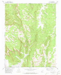
 1953 Cedar City1966 Print · USGSSouthwestern Utah's high plateaus and desert basins are mapped here during the mid-fifties, showing the region before the modern interstate system. Researchers can trace historic mining at Silver Reef, follow the Union Pacific line, and locate early settlements like Kanarraville and Toquerville.3 unique versions available
 - 1954 Map of La Verkin 4 SE
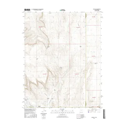
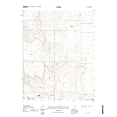
 1954 La Verkin 4 SE1954 Print · USGSThe high desert plateaus of the Utah-Arizona border are captured here in the mid-1950s. Researchers can trace the layout of the Canaan Ranch, locate water sources like Canaan Wash, and identify landmarks from Smithsonian Butte to Canaan Gap.2 unique versions available
 - 1956 Map of Springdale SW
 1956 Springdale SW1956 Print · USGSHigh plateau country along the Utah-Arizona border is captured in the mid-fifties during this preliminary survey. Researchers can trace the drainage of Short Creek and locate remote landmarks like Goat Springs and Maxwell Canyon.
 - 1958 Map of Cedar City
 1958 Cedar City1958 Print · USGSSouthwestern Utah in the late fifties was a land of mineral extraction and monumental landscapes. Genealogists and historians can trace pioneer-era settlements like Grafton and Parowan alongside industrial sites such as the Silver Reef Mine.2 unique versions available
 - 1962 Map of Cedar City
 1962 Cedar City1962 Print · USGSSouthern Utah in the early sixties showcases a landscape of dramatic plateaus and historic mining outposts. Trace the early settlement patterns at the Silver Reef (ruins), locate the Iron Mine near the Hurricane Cliffs, or find the Fort Harmony Monument.
 - 1980 Map of Hildale
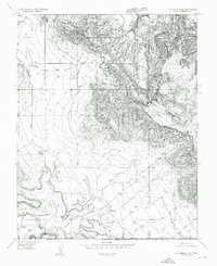
 1980 Hildale1980 Print · USGSThe borderlands of Utah and Arizona are captured here in the late seventies, showing the development of Hildale against the Vermilion Cliffs. Follow old routes like the Pack Trail to find backcountry water sources like Cappies Rock Spring and Goat Springs.2 unique versions available
 - 1980 Map of St. George, 1981 Print
 1980 St. George1981 Print · USGSThe St. George region underwent significant expansion in the early eighties as ranching traditions met new modern development. Researchers can trace the heritage of the Virgin River valley through sites like Grafton, the Apex Mine, and Snow Canyon State Park.2 unique versions available
 - 1980 Map of Kanab, 1981 Print
 1980 Kanab1981 Print · USGSSouthern Utah in the late seventies is a landscape of massive geologic terraces and isolated ranching towns. Trace the growth of Kanab and Springdale or locate vanished sites like Shunesburg among the White Cliffs and Vermilion Cliffs.
 - 1980 Map of Smithsonian Butte, 1981 Print
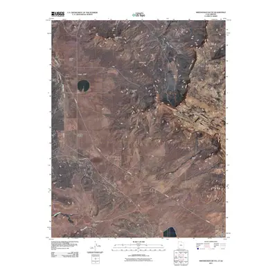
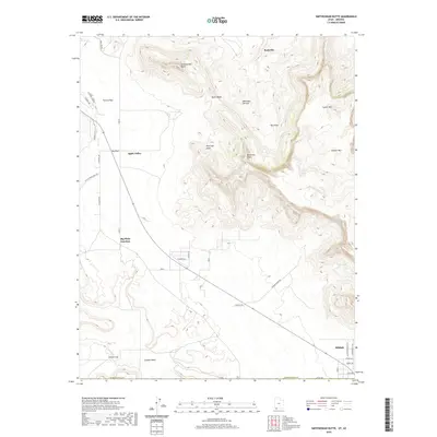
 1980 Smithsonian Butte1981 Print · USGSThe high desert borderlands of Washington County and Mohave County are captured here in the early eighties. Researchers can locate remote landmarks like Canaan Ranch and Big Plain Junction or trace water sources like Sawmill Spring.2 unique versions available
 - 2011 Map of Smithsonian Butte, 2011 Print
 2011 Smithsonian Butte2011 Print · USGSCovers Hildale, including Colorado City, Apple Valley, and other nearby areas
 - 2011 Map of Hildale, 2011 Print
 2011 Hildale2011 Print · USGSCovers Hildale, including Colorado City, Mohave County, and other nearby areas
 - 2014 Map of Hildale, 2014 Print
 2014 Hildale2014 Print · USGSCovers Hildale, including Colorado City, Mohave County, and other nearby areas
 - 2014 Map of Smithsonian Butte, 2014 Print
 2014 Smithsonian Butte2014 Print · USGSCovers Hildale, including Colorado City, Apple Valley, and other nearby areas
 - 2017 Map of Smithsonian Butte, 2017 Print
 2017 Smithsonian Butte2017 Print · USGSCovers Hildale, including Colorado City, Apple Valley, and other nearby areas
 - 2017 Map of Hildale, 2017 Print
 2017 Hildale2017 Print · USGSCovers Hildale, including Colorado City, Mohave County, and other nearby areas
 - 2020 Map of Smithsonian Butte, 2020 Print
 2020 Smithsonian Butte2020 Print · USGSCovers Hildale, including Colorado City, Apple Valley, and other nearby areas
 - 2020 Map of Hildale, 2020 Print
 2020 Hildale2020 Print · USGSCovers Hildale, including Colorado City, Mohave County, and other nearby areas
 - 2023 Map of Smithsonian Butte, 2023 Print
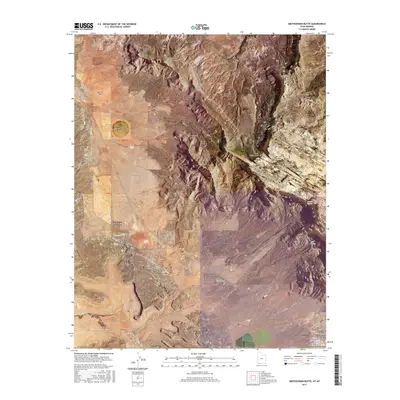
 2023 Smithsonian Butte2023 Print · USGSSouthwestern Utah's high desert plateaus and sandstone cliffs are captured here during a period of modern growth and conservation. Researchers can trace the residential expansion of Hildale and Apple Valley alongside rugged landmarks like Smithsonian Butte and the Vermilion Cliffs.
 - 2023 Map of Hildale, 2023 Print
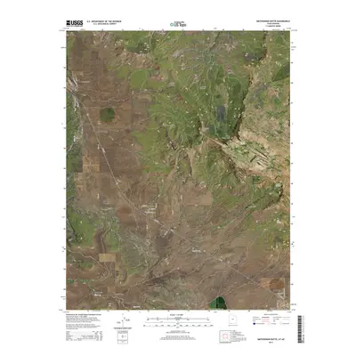
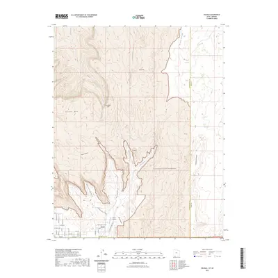 2023 Hildale2023 Print · USGSThe border community of Hildale is documented here as it appeared in 2023, nestled between the Canaan Mountain Wilderness and the Arizona line. Trace local history through the Hildale Infant Cem and prominent landmarks like The Beehive and Maxwell Canyon.
End of results
Showing maps 1-22 of 22
Top cities near Hildale
- Colorado City historical maps
- Centennial Park historical maps
- Apple Valley historical maps
- Virgin historical maps
- Springdale historical maps
- Cane Beds historical maps
See more
Frequently asked questions
- What are the different types of historical maps available for Hildale?
- What is the oldest map of Hildale?
- Where can I purchase historical maps of Hildale for my home or office?
- Where can I download high-res historical maps of Hildale?
- Are there historical topographic maps available for Hildale?
- Is there historical aerial imagery available for Hildale?
- Where are historical maps of Hildale sourced from?