
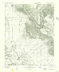
1954 Map of La Verkin 4 SE
USGS Topo · Published 1954About this map
Canaan Mountain dominates the eastern horizon of this 1954 survey, where the high plateaus of southern Utah meet the Arizona border. The landscape is defined by the massive plateau of Big Plain and the deep incision of Canaan Gap to the south. Human presence is sparse, centered on the Canaan Ranch and the crossroads at Big Plain Junction. Water sources are critical in this arid environment, marked by numerous isolated springs and several small reservoirs located along Canaan Wash. The map also captures the prominent landmark of Smithsonian Butte near the northern boundary, illustrating the dramatic geological transitions and cattle-ranching territory of Washington County before modern development reached this corner of the state.
Find a feature on this map
14 named features on this map. Tap any name to fly to it.
Don’t see what you’re looking for? This feature index may not catch every label — zoom into the map to look around manually.
Map Details
Editions of this 1954 La Verkin 4 SE Map
2 editions found
Other maps of this area

1885 · St. George
USGS Topo · 1:250,000

1886 · Kanab
USGS Topo · 1:250,000

1886 · Mt. Trumbull
USGS Topo · 1:250,000

1886 · Kaibab
USGS Topo · 1:250,000

1891 · St. George
USGS Topo · 1:250,000

1892 · Mt. Trumbull
USGS Topo · 1:250,000

1953 · Cedar City
USGS Topo · 1:250,000

1953 · Grand Canyon
USGS Topo · 1:250,000

1954 · La Verkin 4 NW
USGS Topo · 1:24,000

1954 · La Verkin 4 SW
USGS Topo · 1:24,000