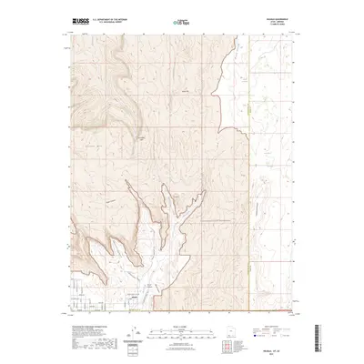
2023 Map of Hildale
USGS Topo · Published 2023About this map
Hildale sits at the foot of dramatic geologic formations where the desert floor meets the towering Vermilion Cliffs. This 2023 map captures the town's distinct grid of streets, including Utah Ave and Uzona Ave, established long before the formal designation of the surrounding Canaan Mountain Wilderness. The geography is defined by deep incisions in the plateau, such as Maxwell Canyon and Water Canyon, which channel seasonal runoff toward the settlement. Genealogists and local historians will find the Hildale Infant Cem located at the edge of the residential blocks, serving as a poignant marker of the community's history. The landscape is dotted with named springs and peaks like Cappies Rock Spring and the prominent The Beehive, illustrating the vital importance of water sources in this arid borderland between Utah and Arizona.
Find a feature on this map
44 named features on this map. Tap any name to fly to it.
Don’t see what you’re looking for? This feature index may not catch every label — zoom into the map to look around manually.
Map Details
Editions of this 2023 Hildale Map
This is the sole edition of this map. No revisions or reprints were ever made.
Other maps of this area

1885 · St. George
USGS Topo · 1:250,000

1886 · Kanab
USGS Topo · 1:250,000

1886 · Mt. Trumbull
USGS Topo · 1:250,000

1886 · Kaibab
USGS Topo · 1:250,000

1891 · St. George
USGS Topo · 1:250,000

1892 · Mt. Trumbull
USGS Topo · 1:250,000

1953 · Cedar City
USGS Topo · 1:250,000

1953 · Grand Canyon
USGS Topo · 1:250,000

1954 · La Verkin 4 SE
USGS Topo · 1:24,000
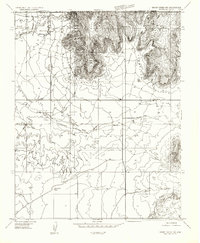
1954 · Short Creek NW
USGS Topo · 1:24,000