1980s Maps of Caledonia County, Vermont
Explore 22 historic maps of Caledonia County from the 1980s. These maps offer a rare glimpse into what life looked like during the 1980s — showing old roads, neighborhoods, homes, and landmarks that have changed or disappeared over time.
Whether you're researching your family's past, planning a metal detecting trip, or studying how Caledonia County's landscape evolved across the 1980s, these high-resolution maps are a powerful tool for exploring the history of this region.
- Focus on a specific era: All maps on this page are from the 1980s, giving you a focused view of this time period.
- See what’s changed: Compare century-old streets, trails, and buildings to today's modern landscape using overlays and satellite layers.
- Research with precision: Use these maps for genealogy, historical research, land use analysis, or educational projects.
- View, download, or print: Maps are fully viewable online in high resolution, and can be downloaded or printed for your own records.
Start exploring Caledonia County's history through authentic maps from the 1980s. This is your window into the past.
Caledonia County, VT maps
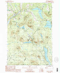
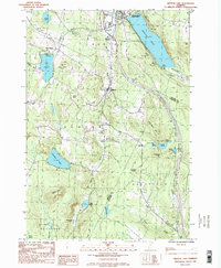
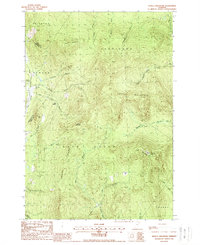
(22)- 1981 Map of Knox Mountain
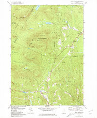 1981 Knox Mountain1981 Print · USGSThe Vermont highlands near Orange and Groton are captured in the early 1980s, showing a landscape shaped by state forests and mountain peaks. Genealogists and hikers can locate Westville Cem, the William Scott Mem Mon, and the Lookout Tower atop Spruce Mtn.2 unique versions available
 - 1983 Map of Barnet
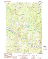
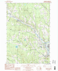
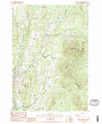
 1983 Barnet1983 Print · USGSThe Vermont and New Hampshire borderlands come alive in the early eighties, centered on the river-and-rail corridor of the Connecticut River. Researchers can trace the Canadian Pacific tracks through Barnet and locate small hamlets like Ewells Mills and Mosquitoville.
 - 1983 Map of St. Johnsbury
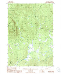
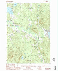
 1983 St. Johnsbury1983 Print · USGSCaledonia County's rail and river corridors are captured in the early eighties as the region balanced its industrial heritage with expanding highway infrastructure. Genealogists can locate family sites from Greenbank Hollow to Walden, including the Pope Cem and the Noyesville Sch.2 unique versions available
 - 1986 Map of Mount Washington
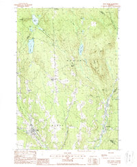
 1986 Mount Washington1986 Print · USGSThe northern New England highlands are shown here in the mid-eighties, centered on the high peaks and river valleys of the New Hampshire borderlands. Researchers can trace historic transportation lines like the Mount Washington Cog Railway and the Maine Central Railroad near Gorham and Lancaster.
 - 1986 Map of Groveton
 1986 Groveton1986 Print · USGSThe North Country's rugged borderlands come into focus in the mid-1980s, tracing the river-and-rail corridors of the Connecticut River valley. Genealogists and historians can locate family landmarks in North Stratford, Groveton, and Guildhall or trace the Canadian National RR.2 unique versions available
 - 1986 Map of Wolcott, 1987 Print
 1986 Wolcott1987 Print · USGSVermont's Lamoille River valley and the surrounding uplands are captured here in the mid-1980s as the region maintained its rural and recreational character. Trace the layout of riverside settlements like Wolcott and Pottersville or locate family landmarks near Scribner Hill and North Wolcott.2 unique versions available
 - 1986 Map of Marshfield, 1987 Print
 1986 Marshfield1987 Print · USGSThe Green Mountain foothills and the sprawling Groton State Forest are documented in the mid-eighties. Trace old settlements like Marshfield Station and Lanesboro alongside the shores of Lake Groton.
 - 1986 Map of Sutton, 1987 Print
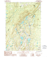
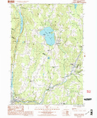
 1986 Sutton1987 Print · USGSThe northern Vermont uplands of the 1980s are defined here by high-elevation lakes and the deep notch of Lake Willoughby. Trace local rail and settlement history through Willoughby (Kimball Sta), Sutton Station, and the slopes of Mount Hor.2 unique versions available
 - 1986 Map of Woodbury, 1987 Print
 1986 Woodbury1987 Print · USGSCentral Vermont in the mid-1980s was characterized by a dense network of glacial lakes and small mountain settlements. Genealogists and local historians can trace the community structures of South Woodbury and North Calais or locate old Quarries and Cem markers.2 unique versions available
 - 1986 Map of Lyndonville, 1987 Print
 1986 Lyndonville1987 Print · USGSCaledonia County, Vermont, enters the late twentieth century as a landscape of highland forests and tight river-valley villages. Genealogists and local historians can trace the roads connecting Lyndonville and Wheelock past Lyndon State College and rural Cem sites.2 unique versions available
 - 1986 Map of Crystal Lake, 1987 Print
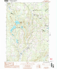
 1986 Crystal Lake1987 Print · USGSOrleans County is captured in the mid-1980s during a period of steady rural life among the hills and glacial ponds. Genealogists can trace the settlements of Barton, Glover, and West Glover while locating landmarks like Lake Parker, Shadow Lake, and Simpson Hill.2 unique versions available
 - 1986 Map of Caspian Lake, 1987 Print
 1986 Caspian Lake1987 Print · USGSThe upland villages of Orleans and Caledonia counties are captured here in the mid-1980s, centered on the clear waters of Caspian Lake. Genealogists and historians can trace the local road networks connecting Hardwick Street, Greensboro Bend, and East Hardwick.2 unique versions available
 - 1986 Map of Cabot, 1987 Print
 1986 Cabot1987 Print · USGSCentral Vermont in the mid-eighties was a landscape of river-valley hamlets and upland ponds. Genealogists and local historians can trace the settlement footprints of Cabot, South Walden, and the rail-linked Walden Heights.2 unique versions available
 - 1986 Map of Stannard, 1987 Print
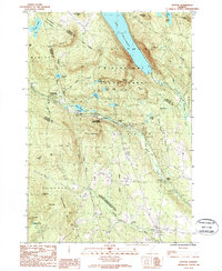
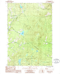 1986 Stannard1987 Print · USGSNortheast Vermont at the mid-eighties shows a landscape of upland forests and scattered hamlets between the Lamoille River and Stannard Mountain. Trace the rural developments of Stannard and East Greensboro, or find old industrial sites at Fairbanks Mills on Mill Brook.
 - 1988 Map of Seneca Mountain
 1988 Seneca Mountain1988 Print · USGSThe Northeast Kingdom's interior is captured here in the late 1980s, showing a landscape defined by the steep East Haven Range. Researchers can trace remote locales like Lost Nation and the headwaters of the Passumpsic River East Branch.
 - 1988 Map of Burke Mountain
 1988 Burke Mountain1988 Print · USGSThe Vermont highlands of the late eighties are defined here by the steep slopes of Burke Mtn and the working landscapes of the Caledonia and Essex county lines. Genealogists and hikers can trace old routes like Calendar Brook or locate historic hamlets including Burke Hollow and Red Village.2 unique versions available
 - 1988 Map of Montpelier
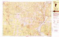
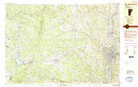
 1988 Montpelier1988 Print · USGSThe area surrounding Vermont’s capital city appears here during the early 1940s, showing the vital rail-and-river network. Genealogists can trace family names across a dozen district schools and rural sites like Middlesex Center and the Talc Mine.2 unique versions available
 - 1988 Map of Gallup Mills
 1988 Gallup Mills1988 Print · USGSNortheastern Vermont's timberlands are captured here in the late eighties, centered on the Moose River valley and its surrounding ridges. Researchers can trace the heritage of local logging sites and industry at Moccasin Mill (Site), the remote Gallup Mills settlement, and the Cem at Victory.2 unique versions available
 - 1988 Map of West Burke
 1988 West Burke1988 Print · USGSVermont's Northeast Kingdom shows its quiet, late-twentieth-century character in this detailed survey of the Burke and Newark area. Genealogists and hikers can trace the roads connecting Newark Street, Hartwellville, and the waters of Center Pond.2 unique versions available
 - 1988 Map of Island Pond
 1988 Island Pond1988 Print · USGSThe Northeast Kingdom's highlands are captured here in the late eighties, showing the remote waters and peaks of Essex and Orleans counties. Genealogists and hikers can trace landmarks from the Bald Mtn Lookout Tower to the lakefront at Island Pond and the Cem near East Charleston.2 unique versions available
 - 1988 Map of Mount Washington, 1989 Print
 1988 Mount Washington1989 Print · USGSThe New Hampshire high country in the late 1980s is defined by its iconic peaks and the legacy of mountain tourism. Trace the routes of the historic Mount Washington Cog Railway and the Maine Central RR through the gaps of Crawford Notch State Park.
 - 1989 Map of Mount Mansfield
 1989 Mount Mansfield1989 Print · USGSNorthern Vermont in the late eighties remains a landscape of deep forests and isolated mountain villages. Genealogists and hikers can trace the old rail lines of the Canadian Pacific RR or locate family sites near Lake Willoughby and Brownington Village.
End of results
Showing maps 1-22 of 22
Top cities of Caledonia County
- Saint Johnsbury historical maps
- Hardwick historical maps
- Danville historical maps
- Lyndon historical maps
- Sutton historical maps
- Groton historical maps
See more
Frequently asked questions
- What are the different types of historical maps available for Caledonia County?
- What is the oldest map of Caledonia County?
- Where can I purchase historical maps of Caledonia County for my home or office?
- Where can I download high-res historical maps of Caledonia County?
- Are there historical topographic maps available for Caledonia County?
- Is there historical aerial imagery available for Caledonia County?
- Where are historical maps of Caledonia County sourced from?