Old Maps of Castleton, Vermont for Hiking & Exploration
Hike through history with 33 historic maps of Castleton. Explore old trails, ghost towns, and forgotten backroads — perfect for outdoor adventurers and local explorers.
- Rediscover forgotten places: Map out old mining camps, roads, and footpaths that no longer exist on modern maps.
- Layer with modern tools: Combine with LiDAR or satellite views to plan hikes through historical terrain.
- Made for exploration: Popular among hikers, overlanders, and local history lovers.
Use these maps to find adventure and explore the hidden past of Castleton.
Castleton, VT maps
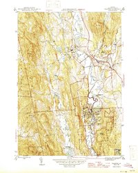
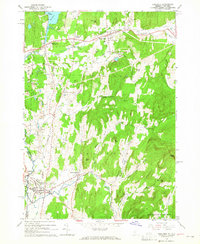
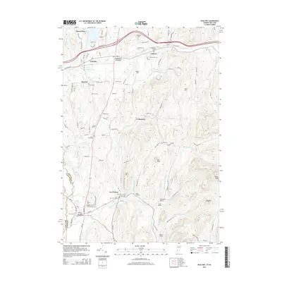
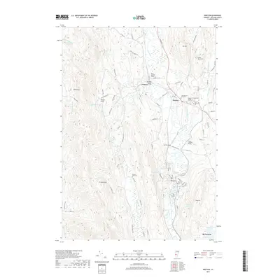
(33)- 1895 Map of Castleton, 1960 Print
 1895 Castleton1960 Print · USGSRutland County's rugged terrain and valley settlements are captured here in the late nineteenth century, showing a landscape defined by mountain peaks and rail lines. You can trace the path of the Delaware and Hudson RR and locate vanished hamlets like Gothantown and Blissville.
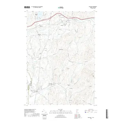
 - 1897 Map of Castleton
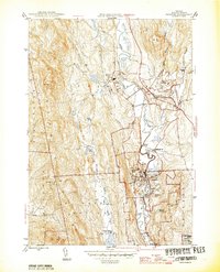
 1897 Castleton1897 Print · USGSRutland County's industrial and agricultural heartland is captured here at the close of the nineteenth century. Researchers can trace historic rail routes like the Clarendon and Pittsford R. R. or locate family homesteads near Lake Bomoseen and Clarendon Springs.9 unique versions available
 - 1944 Map of Proctor
 1944 Proctor1944 Print · USGSRutland County's industrial and social landscape is captured here in the mid-1940s as rail lines and river valleys define local life. Genealogists and researchers can trace local landmarks like Riverside Cem, Vermont Sanatorium, and the Gorham Bridge crossing.3 unique versions available
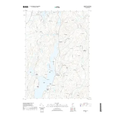
 - 1944 Map of Bomoseen
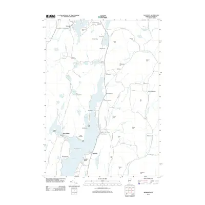
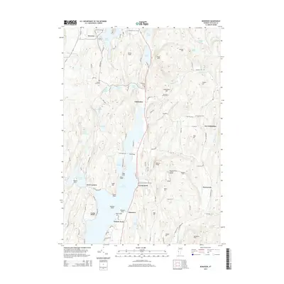
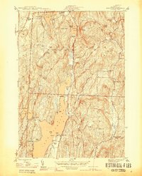 1944 Bomoseen1944 Print · USGSLake Bomoseen and the surrounding hills of Rutland County are captured in the mid-1940s during a period of transition between traditional farming and lakefront recreation. Researchers can locate rural landmarks like Turnpike Sch, East Hubbardton Cem, and the village of West Castleton.5 unique versions available
 - 1946 Map of Proctor
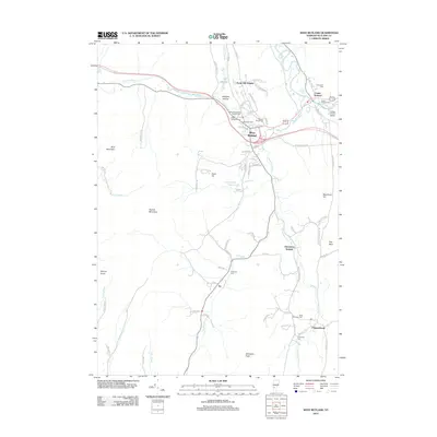
 1946 Proctor1946 Print · USGSThe marble industrial center of Proctor and the neighboring town of Pittsford are shown here in the mid-1940s. Genealogists and historians can trace the locations of Riverside Cem, the Vermont Sanatorium, and local landmarks like Gorham Bridge.
 - 1950 Map of Glens Falls
 1950 Glens Falls1950 Print · USGSThe Adirondacks and the Green Mountains meet in this mid-century survey of the New York and Vermont borderlands. Researchers can trace the industrial rail corridors of the Rutland RR and Delaware & Hudson RR connecting Glens Falls, Rutland, and the shores of Lake George.
 - 1956 Map of Glens Falls, 1968 Print
 1956 Glens Falls1968 Print · USGSUpper New York and the Vermont mountains are captured here in the mid-fifties, showing the rugged rail-and-river network of the Northeast. Researchers can trace the paths of the Delaware and Hudson RR and Rutland RR as they wind through valley towns like Poultney and Whitehall.3 unique versions available
 - 1959 Map of Glens Falls
 1959 Glens Falls1959 Print · USGSUpper New York and Vermont are captured here during the late 1950s, a period of transition for these mountain communities. Researchers can trace the legacy of the region's river-and-rail economy through landmarks like Lake George, Saratoga Springs, and Killington Peak.2 unique versions available
 - 1964 Map of Glens Falls
 1964 Glens Falls1964 Print · USGSThe tri-state borderlands of New York, Vermont, and New Hampshire appear here in the mid-1960s. Researchers can trace the rail routes of the Rutland RR and find historic sites like Ticonderoga and Saratoga National Historical Park.
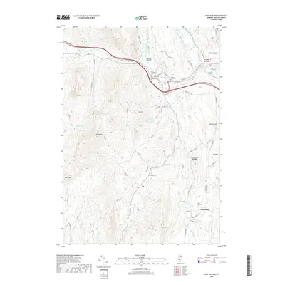
 - 1964 Map of West Rutland, 1965 Print
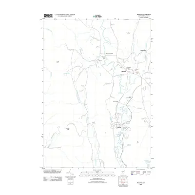
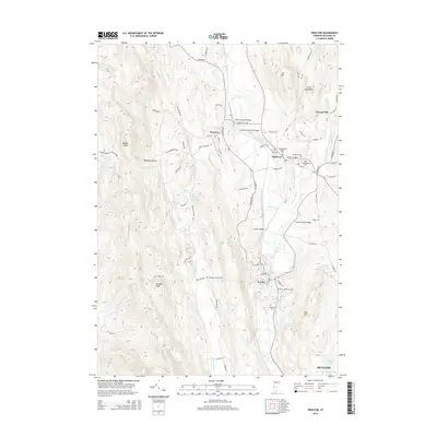
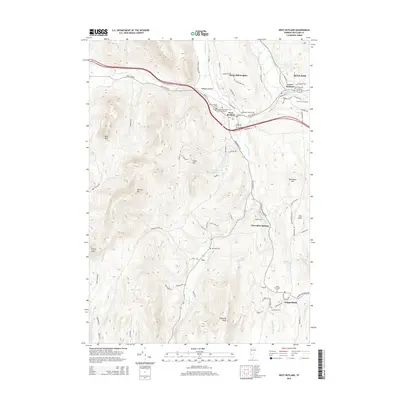
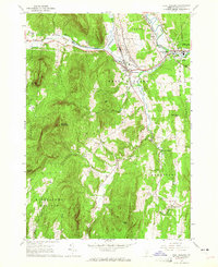 1964 West Rutland1965 Print · USGSRutland County's industrial and rural character is preserved here in the mid-1960s. Genealogists and historians can trace the rail lines of the Delaware and Hudson Railroad and find long-established sites like Clarendon Springs and Edmunds Cem.4 unique versions available
 - 1964 Map of Poultney, 1965 Print
 1964 Poultney1965 Print · USGSRutland County in the mid-1960s shows a landscape shaped by the slate industry and deep-rooted collegiate towns. Researchers can trace historic family cemeteries like Ward Cem and Gates Cem or follow the path of the Delaware and Hudson railroad.4 unique versions available
 - 1986 Map of Ticonderoga
 1986 Ticonderoga1986 Print · USGSThe Lake Champlain valley in the mid-eighties shows a landscape defined by Revolutionary War history and deep wilderness. Researchers can trace the Delaware and Hudson RR through the mountains or locate local landmarks like Fort Ticonderoga, St. Genevieve Cem, and the Ore Bed.
 - 1989 Map of Ticonderoga
 1989 Ticonderoga1989 Print · USGSThe Champlain Valley and Adirondack foothills meet in the late eighties, documenting a historic borderland defined by mountain lakes and timber. Genealogists and historians can trace the paths of the Delaware and Hudson RR or locate the Hubbardton Battlefield State Historic Site.2 unique versions available
 - 2012 Map of Bomoseen, 2012 Print
 2012 Bomoseen2012 Print · USGSCovers Castleton, including Fair Haven, Pittsford, and other nearby areas
 - 2012 Map of Proctor, 2012 Print
 2012 Proctor2012 Print · USGSCovers Castleton, including Rutland City, West Rutland, and other nearby areas
 - 2012 Map of West Rutland, 2012 Print
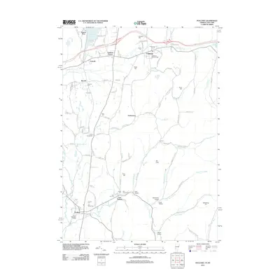
 2012 West Rutland2012 Print · USGSCovers Castleton, including Rutland City, Poultney, and other nearby areas
 - 2012 Map of Poultney, 2012 Print
 2012 Poultney2012 Print · USGSCovers Castleton, including Poultney, Poultney Village, and other nearby areas
 - 2015 Map of Bomoseen, 2015 Print
 2015 Bomoseen2015 Print · USGSCovers Castleton, including Fair Haven, Pittsford, and other nearby areas
 - 2015 Map of Proctor, 2015 Print
 2015 Proctor2015 Print · USGSCovers Castleton, including Rutland City, West Rutland, and other nearby areas
 - 2015 Map of West Rutland, 2015 Print
 2015 West Rutland2015 Print · USGSCovers Castleton, including Rutland City, Poultney, and other nearby areas
 - 2015 Map of Poultney, 2015 Print
 2015 Poultney2015 Print · USGSCovers Castleton, including Poultney, Poultney Village, and other nearby areas
 - 2018 Map of Poultney, 2018 Print
 2018 Poultney2018 Print · USGSCovers Castleton, including Poultney, Poultney Village, and other nearby areas
 - 2018 Map of West Rutland, 2018 Print
 2018 West Rutland2018 Print · USGSCovers Castleton, including Rutland City, Poultney, and other nearby areas
 - 2018 Map of Bomoseen, 2018 Print
 2018 Bomoseen2018 Print · USGSCovers Castleton, including Fair Haven, Pittsford, and other nearby areas
 - 2018 Map of Proctor, 2018 Print
 2018 Proctor2018 Print · USGSCovers Castleton, including Rutland City, West Rutland, and other nearby areas
Showing maps 1-25 of 33
Top cities near Castleton
- Rutland City historical maps
- Granville historical maps
- Fort Ann historical maps
- Ticonderoga historical maps
- Brandon historical maps
- Whitehall historical maps
See more
Top neighborhoods of Castleton
- Blissville historical maps
- Bomoseen historical maps
- Castleton Corners historical maps
- Crystal Beach historical maps
- Hydeville historical maps
- Point of Pines historical maps
See more
Frequently asked questions
- What are the different types of historical maps available for Castleton?
- What is the oldest map of Castleton?
- Where can I purchase historical maps of Castleton for my home or office?
- Where can I download high-res historical maps of Castleton?
- Are there historical topographic maps available for Castleton?
- Is there historical aerial imagery available for Castleton?
- Where are historical maps of Castleton sourced from?