1940s Maps of Craig County, Virginia
Explore 5 historic maps of Craig County from the 1940s. These maps offer a rare glimpse into what life looked like during the 1940s — showing old roads, neighborhoods, homes, and landmarks that have changed or disappeared over time.
Whether you're researching your family's past, planning a metal detecting trip, or studying how Craig County's landscape evolved across the 1940s, these high-resolution maps are a powerful tool for exploring the history of this region.
- Focus on a specific era: All maps on this page are from the 1940s, giving you a focused view of this time period.
- See what’s changed: Compare century-old streets, trails, and buildings to today's modern landscape using overlays and satellite layers.
- Research with precision: Use these maps for genealogy, historical research, land use analysis, or educational projects.
- View, download, or print: Maps are fully viewable online in high resolution, and can be downloaded or printed for your own records.
Start exploring Craig County's history through authentic maps from the 1940s. This is your window into the past.
Craig County, VA maps
(5)- 1944 Map of Waiteville
 1944 Waiteville1944 Print · USGSThe borderlands of Giles and Craig counties are captured here in the early twentieth century, showing a transition from rail-dependent industry to rural isolation. Genealogists and historians can trace family locations near Mt Olivet Ch, the settlement at Waiteville, and the now-silent tracks of the Norfolk and Western Ry.
 - 1945 Map of New Castle, 1964 Print
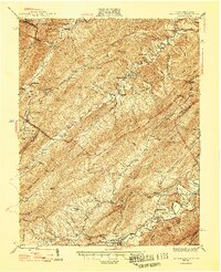
 1945 New Castle1964 Print · USGSThe mountain gaps of Craig and Alleghany Counties are captured here at the end of the war, when mining and rail transport still defined the local economy. Researchers can trace the legacy of industry and faith at Jordan Mines, Lignite, and Shoafs Chapel.
 - 1947 Map of New Castle
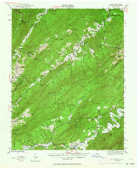
 1947 New Castle1947 Print · USGSThe Virginia and West Virginia borderlands in the late 1940s reveal a landscape of mountain resorts and industrial remnants. You can trace the legacy of mineral spas at Sweet Springs and locate early community hubs like Jordan Mines and the Fenwick Mine.2 unique versions available
 - 1947 Map of Roanoke, 1948 Print
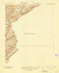
 1947 Roanoke1948 Print · USGSCentral Virginia in the late 1940s reveals a region defined by its great mountain ridges and the powerful river-and-rail economy connecting Roanoke to Lynchburg. Researchers can trace the path of the Virginian RR and locate historic county seats like Charlotte Court House.2 unique versions available
 - 1948 Map of Ronceverte, 1964 Print
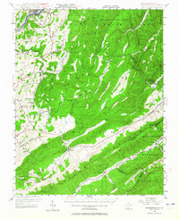 1948 Ronceverte1964 Print · USGSThe West Virginia and Virginia borderlands come into focus in the late 1940s, showing the mountain communities between the Greenbrier River and the Jefferson National Forest. Genealogists can locate family-named landmarks like McGlone and Gutes, or trace rural institutions such as Pleasant Valley Sch and Red Mill.
End of results
Showing maps 1-5 of 5
Top cities of Craig County
Frequently asked questions
- What are the different types of historical maps available for Craig County?
- What is the oldest map of Craig County?
- Where can I purchase historical maps of Craig County for my home or office?
- Where can I download high-res historical maps of Craig County?
- Are there historical topographic maps available for Craig County?
- Is there historical aerial imagery available for Craig County?
- Where are historical maps of Craig County sourced from?