2020s Maps of Craig County, Virginia
Explore 13 historic maps of Craig County from the 2020s. These maps offer a rare glimpse into what life looked like during the 2020s — showing old roads, neighborhoods, homes, and landmarks that have changed or disappeared over time.
Whether you're researching your family's past, planning a metal detecting trip, or studying how Craig County's landscape evolved across the 2020s, these high-resolution maps are a powerful tool for exploring the history of this region.
- Focus on a specific era: All maps on this page are from the 2020s, giving you a focused view of this time period.
- See what’s changed: Compare century-old streets, trails, and buildings to today's modern landscape using overlays and satellite layers.
- Research with precision: Use these maps for genealogy, historical research, land use analysis, or educational projects.
- View, download, or print: Maps are fully viewable online in high resolution, and can be downloaded or printed for your own records.
Start exploring Craig County's history through authentic maps from the 2020s. This is your window into the past.
Craig County, VA maps
(13)- 2022 Map of Oriskany, 2022 Print
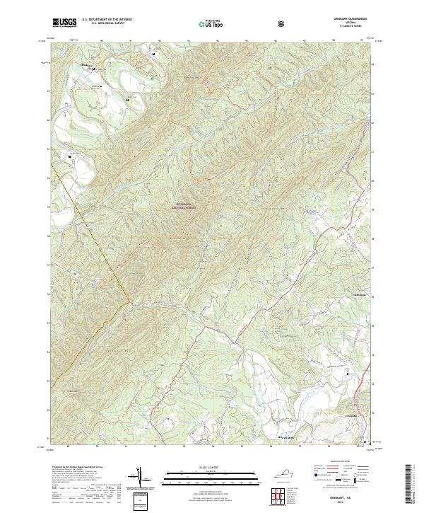 2022 Oriskany2022 Print · USGSThe Botetourt County backcountry near Fincastle is shown here in the contemporary era, dominated by the ridges of the Jefferson National Forest. Genealogists can locate several family landmarks including the Anderson Family Cem, McAlester Cem, and the settlement at Oriskany.
 - 2022 Map of Alleghany, 2022 Print
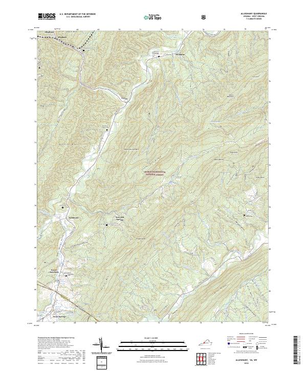 2022 Alleghany2022 Print · USGSThe Virginia and West Virginia borderlands are shown here in the early 2020s, highlighting the historic thermal spring resorts. Genealogists can trace family roots at the Stone Family Cem, Hylton Cem, and the sites of Old Sweet Springs.
 - 2022 Map of Potts Creek, 2022 Print
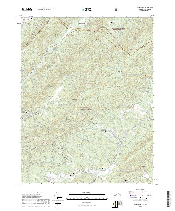 2022 Potts Creek2022 Print · USGSThe Virginia and West Virginia borderlands are shown here in modern detail, where the steep ridges of the George Washington and Jefferson National Forests meet. Genealogists can trace numerous ancestral sites including the McCormick Family Cem, Paxton Cem, and Oak Grove Cem.
 - 2022 Map of Jordan Mines, 2022 Print
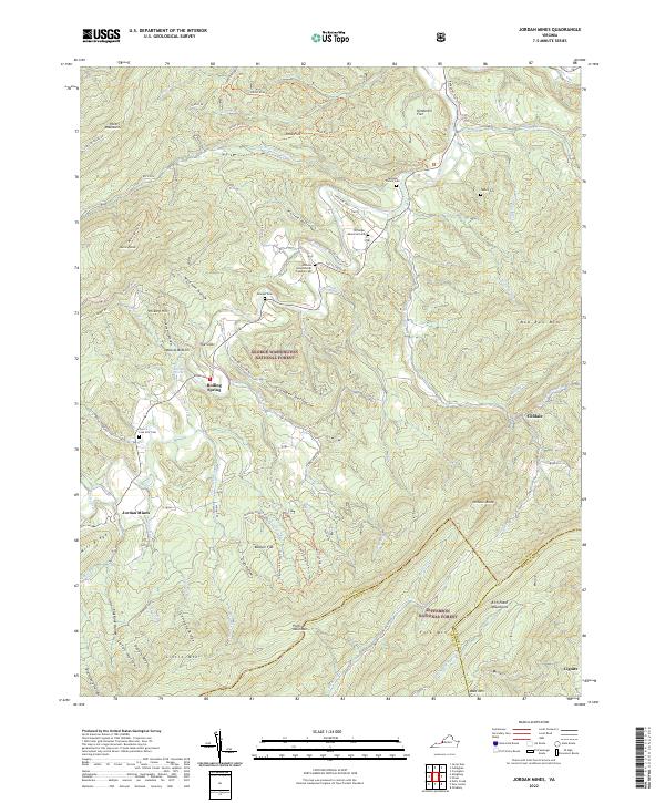 2022 Jordan Mines2022 Print · USGSThe Alleghany County mountains come alive in this survey, showcasing early industrial outposts and family homesteads. Genealogists can trace family lines through the Johnson Helmintoller Plymale Cem or locate historic sites at Jordan Mines and Lignite.
 - 2022 Map of Craig Springs, 2022 Print
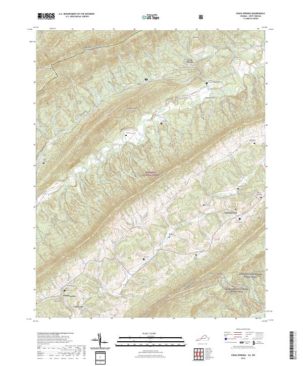 2022 Craig Springs2022 Print · USGSThe mountains of Craig County, Virginia, are captured here in the early twenty-first century, showing the ridges and gaps where families have lived for generations. Researchers can trace land ties at the Huffman Cem, Craig Springs, and the Appalachian National Scenic Trl.
 - 2022 Map of Paint Bank, 2022 Print
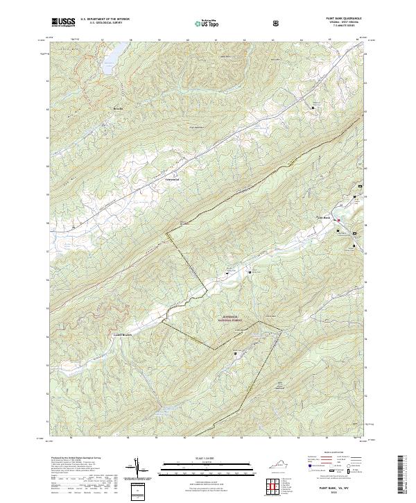 2022 Paint Bank2022 Print · USGSThe Virginia and West Virginia borderlands are revealed in this recent survey of the ridges and valleys near the Jefferson National Forest. Genealogists can locate several family landmarks, including the Rowan Family Cem, Bostic Cem, and the settlement of Paint Bank.
 - 2022 Map of Looney, 2022 Print
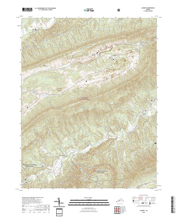 2022 Looney2022 Print · USGSWestern Virginia's ridge-and-valley landscape is documented here in the early twenty-first century, showing the intersection of mountain wilderness and deep family roots. Genealogists can locate family landmarks like Leffel Walker Family Cem and Paitzel Cem or trace the Appalachian National Scenic Trail through McAfee Gap.
 - 2022 Map of New Castle, 2022 Print
 2022 New Castle2022 Print · USGSNew Castle and the Craig Creek Valley are shown in detail during the early 2020s, highlighting the enduring rural character of this Virginia highland region. Researchers can locate numerous family burial sites like the Caldwell Cem and Blankenship Family Cem or trace the historic grounds of the Craig County Courthouse.
 - 2022 Map of McDonalds Mill, 2022 Print
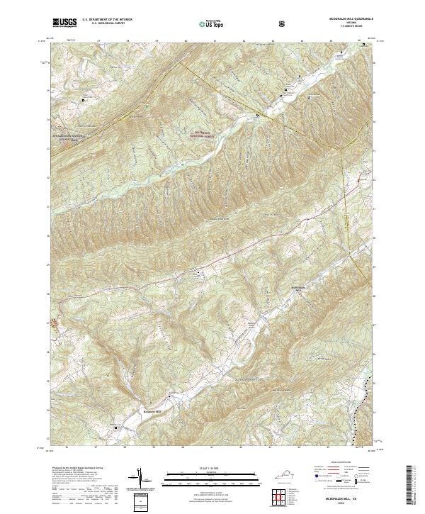 2022 McDonalds Mill2022 Print · USGSMontgomery County and the neighboring ridges of Craig and Roanoke counties are shown in this modern survey of the Blue Ridge foothills. Genealogists can trace family heritage through local landmarks like Bennetts Mill and family plots including McDonald Cem and Alls Cem.
 - 2022 Map of Newport, 2022 Print
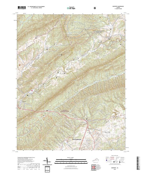 2022 Newport2022 Print · USGSThe northern reaches of the Blacksburg area appear here in the early twenty-first century, spanning the ridgelines of the Jefferson National Forest. Researchers can trace dozens of family burial sites like Shrader Family Cem and the small settlements of Newport and Huffman.
 - 2022 Map of Glenvar, 2022 Print
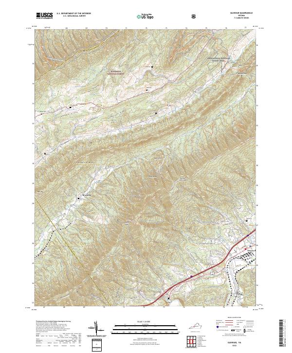 2022 Glenvar2022 Print · USGSThe Roanoke River valley and Jefferson National Forest meet in this 2020s survey of the Virginia highlands. Genealogists and hikers can trace numerous family burial sites like Custer Cem and Moore - Bain Cem or follow the Appalachian National Scenic Trail.
 - 2022 Map of Catawba, 2022 Print
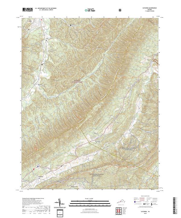 2022 Catawba2022 Print · USGSThe Catawba Valley and the high ridges of the Blue Ridge Mountains are captured here in the early twenty-first century. Researchers can trace family history through local sites like the Spessard Family Cem, explore the path of the Appalachian National Scenic Trail, or locate the site of The Murder Hole.
 - 2023 Map of Waiteville, 2023 Print
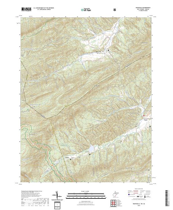 2023 Waiteville2023 Print · USGSThe Monroe County highlands are captured here during the 2020s, showing a landscape defined by the Jefferson National Forest and the Appalachian Trail. Family historians can locate several burial grounds, such as New Zion Cem, Bell Family Cem, and the settlement of Waiteville.
End of results
Showing maps 1-13 of 13
Top cities of Craig County
Frequently asked questions
- What are the different types of historical maps available for Craig County?
- What is the oldest map of Craig County?
- Where can I purchase historical maps of Craig County for my home or office?
- Where can I download high-res historical maps of Craig County?
- Are there historical topographic maps available for Craig County?
- Is there historical aerial imagery available for Craig County?
- Where are historical maps of Craig County sourced from?