Old Maps of New Baltimore, Virginia for Hiking & Exploration
Hike through history with 46 historic maps of New Baltimore. Explore old trails, ghost towns, and forgotten backroads — perfect for outdoor adventurers and local explorers.
- Rediscover forgotten places: Map out old mining camps, roads, and footpaths that no longer exist on modern maps.
- Layer with modern tools: Combine with LiDAR or satellite views to plan hikes through historical terrain.
- Made for exploration: Popular among hikers, overlanders, and local history lovers.
Use these maps to find adventure and explore the hidden past of New Baltimore.
New Baltimore, VA maps
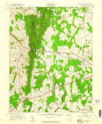
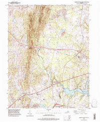
(46)- 1894 Map of Warrenton
 1894 Warrenton1894 Print · USGSVirginia's northern Piedmont and mountain gaps are mapped here in the late nineteenth century as the rail-and-river economy flourished. Genealogists can trace family names and small crossroads from Warrenton and Brentsville to White Sulphur Springs.9 unique versions available
 - 1894 Map of Warrenton, 1897 Print
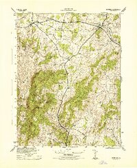
 1894 Warrenton1897 Print · USGSFauquier County and its neighbors are documented here in the late nineteenth century, showing a landscape defined by the Bull Run Mountains and the Rappahannock. Genealogists and historians can trace old homesteads and transport hubs like Warrenton, Thorofare Gap, and Sudley Spring.
 - 1927 Map of Remington
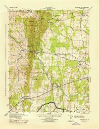
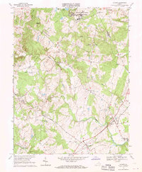
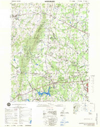
 1927 Remington1927 Print · USGSFauquier and Culpeper counties appear here in the late twenties, captured as a landscape of river-bottom farms and rail towns. Genealogists can trace family footprints at Fauquier Sulphur Springs, Westley Chapel, and the Luttrell Sch.4 unique versions available
 - 1930 Map of Warrenton
 1930 Warrenton1930 Print · USGSFauquier and Culpeper counties are captured here in the late twenties, showing a rural landscape organized around the Southern railroad and the Rappahannock River. Researchers can trace old school districts and river crossings like Hinson Ford and Litchfield Sch.2 unique versions available
 - 1933 Map of Middleburg
 1933 Middleburg1933 Print · USGSNorthern Virginia is captured here in the years following the Great War, showing a landscape defined by its ridges and historical milestones. Genealogists and historians can locate family landmarks like the Henry House, Beverly Mill, and rural centers such as Hickory Grove.
 - 1943 Map of Catlett, 1955 Print
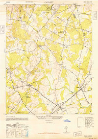
 1943 Catlett1955 Print · USGSMid-century Fauquier and Prince William counties center on the Southern Railway as it links rural hubs and farming estates. Genealogists can trace family footprints across dozens of local landmarks, from Vint Hill Farm to Dunkard Church and Balls Mill.2 unique versions available
 - 1943 Map of Thorofare Gap, 1960 Print
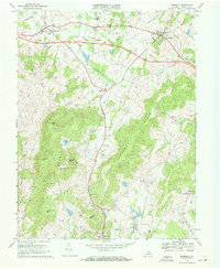
 1943 Thorofare Gap1960 Print · USGSNorthern Virginia at the height of the Second World War shows a landscape defined by the ridgeline of the Bull Run Mountains. Genealogists and local historians can trace the foundations of communities like Haymarket and Buckland or locate specific sites like Beverly Mills and Vint Hill Farm Military Reservation.
 - 1943 Map of Marshall, 1961 Print
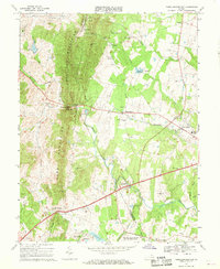
 1943 Marshall1961 Print · USGSUpper Fauquier County is captured during the early 1940s, showing the agricultural heartland between the Water Mountains and Pignut Mountain. Genealogists and historians can trace the foundations of Marshall and The Plains, locating local landmarks like School No 18 and the Fairgrounds.
 - 1944 Map of Thorofare Gap
 1944 Thorofare Gap1944 Print · USGSPrince William and Fauquier counties are shown here during the Second World War as the region’s strategic gaps and rail lines remained vital to Virginia's interior. Genealogists and researchers can trace rural landmarks from Vint Hill Farm to Beverly Mills and St Pauls Ch.
 - 1944 Map of Marshall
 1944 Marshall1944 Print · USGSFauquier County at the height of the Second World War remains a landscape of rail-connected villages and mountain ridges. Genealogists and local historians can trace rural school locations like Public School No 18 and Bethel School or landmarks like the Fair Grounds.
 - 1946 Map of Catlett
 1946 Catlett1946 Print · USGSFauquier County's rural landscape is captured here in the years following World War II, centered on the rail stops and country crossroads that defined local life. Trace the historic Southern Railway line through Casanova and Calverton or locate sites like the Rosenwald Sch and Vint Hill Farm.
 - 1948 Map of Washington
 1948 Washington1948 Print · USGSThe Potomac and Chesapeake regions in the late 1940s reveal a landscape of expanding military reach and deep-rooted Tidewater settlements. Trace old rail corridors like the Richmond Fredericksburg & Potomac RR or locate landmarks like the Wakefield Washington Monument and St. Marys College.2 unique versions available
 - 1957 Map of Washington, 1966 Print
 1957 Washington1966 Print · USGSThe mid-Atlantic region during the mid-fifties and early sixties reveals a landscape of growing suburbs and vital military outposts. Researchers can trace historic river towns and shorelines from Alexandria to the Hooper Islands and St Clements Island.5 unique versions available
 - 1961 Map of Washington
 1961 Washington1961 Print · USGSThe mid-Atlantic region in the late fifties is presented in remarkable detail, from the Blue Ridge foothills to the Chesapeake Eastern Shore. Researchers can trace historic river landings and military sites like Mount Vernon, Fort Belvoir, and Point Lookout.2 unique versions available
 - 1966 Map of Warrenton, 1968 Print
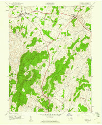
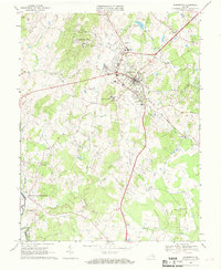 1966 Warrenton1968 Print · USGSWarrenton and its surrounding Fauquier County countryside appear here in the mid-sixties as a blend of traditional crossroads and emerging military infrastructure. Local historians can trace the Southern rail line to Meetze or find family landmarks like Fauquier White Sulphur Springs and Our Saviour Ch.4 unique versions available
 - 1966 Map of Thoroughfare Gap, 1969 Print
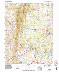
 1966 Thoroughfare Gap1969 Print · USGSPrince William and Fauquier counties are captured here in the mid-1960s as the railroad and highways thread through the Bull Run Mountains. Researchers can locate several rural landmarks including Beverley Mill, the Antioch-McCrae Sch, and the Vint Hill Farms Station Military Reservation.3 unique versions available
 - 1966 Map of Catlett, 1969 Print
 1966 Catlett1969 Print · USGSMid-century Fauquier and Prince William counties are shown here as a landscape of rural crossroads and military installations. Genealogists can trace family roots through numerous country sites like Oak Shade Ch, Balls Mill, and the settlement of Casanova.2 unique versions available
 - 1970 Map of Marshall, 1972 Print
 1970 Marshall1972 Print · USGSFauquier County’s horse country and Piedmont ridges are captured here in the early seventies as new infrastructure began to reshape the landscape. Local historians can trace family-named peaks like England Mtn and rural crossroads such as Brookes Corner and Meadowville.2 unique versions available
 - 1977 Map of Middleburg, 1979 Print
 1977 Middleburg1979 Print · USGSNorthern Virginia in the late seventies reveals a landscape transitioning from rural estate country to a growing suburban corridor. Researchers can locate significant Civil War sites at Manassas National Battlefield Park and trace family names through Buchannon Gap Cem or the Linton Hall Military Sch.
 - 1977 Map of Thoroughfare Gap, 1982 Print
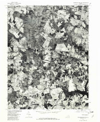 1977 Thoroughfare Gap1982 Print · USGSNorthern Virginia in the late seventies is captured in this aerial survey as rural tracts began to meet modern expansion. Genealogists and local historians can trace the property lines and road networks around Haymarket, Buckland, and Antioch.
 - 1982 Map of Washington West, 1983 Print
 1982 Washington West1983 Print · USGSThe Virginia and Maryland suburbs were undergoing intense development in the early eighties as the capital region expanded outward. Researchers can trace the footprint of Cold War-era defense sites like Fort Belvoir and Vint Hill Farms Station alongside growing academic centers like George Mason University.
 - 1986 Map of Washington West
 1986 Washington West1986 Print · USGSNorthern Virginia and the D.C. metro area are captured here in the mid-eighties as suburban growth began to meet rural Fauquier County. Trace the development of the corridor from Alexandria out to Dulles and the preserved lands of Prince William Forest Park.2 unique versions available
 - 1989 Map of Washington
 1989 Washington1989 Print · USGSThe Potomac River valley and Chesapeake Bay are shown in comprehensive detail during the late 1980s. Genealogists and historians can trace the transition from urban Alexandria to the rural Northern Neck, locating landmarks like Mount Vernon and Stratford Hall.
 - 1989 Map of Thoroughfare Gap, 1996 Print
 1989 Thoroughfare Gap1996 Print · USGSPrince William and Fauquier counties are seen here in the late eighties, just as suburban expansion began meeting the rural foothills. Researchers can trace historic mountain passages at Thoroughfare Gap or locate the Georgetown Cem and Vint Hill Farms Station.
 - 1994 Map of Thoroughfare Gap, 1998 Print
 1994 Thoroughfare Gap1998 Print · USGSThe Bull Run Mountains and Thoroughfare Gap define this Prince William County landscape during the mid-nineties. Genealogists and historians can trace old community centers like Haymarket and Buckland or the extent of Vint Hill Farms Station.
Showing maps 1-25 of 46
Top cities near New Baltimore
- Linton Hall historical maps
- South Riding historical maps
- Sudley historical maps
- Gainesville historical maps
- Bull Run historical maps
- Stone Ridge historical maps
See more
Top neighborhoods of New Baltimore
- Vint Hill Farms historical maps
- Jamison's Farm historical maps
- Lakewood historical maps
- Snow Hill historical maps
- Lakeway historical maps
- Brookside historical maps
See more
Frequently asked questions
- What are the different types of historical maps available for New Baltimore?
- What is the oldest map of New Baltimore?
- Where can I purchase historical maps of New Baltimore for my home or office?
- Where can I download high-res historical maps of New Baltimore?
- Are there historical topographic maps available for New Baltimore?
- Is there historical aerial imagery available for New Baltimore?
- Where are historical maps of New Baltimore sourced from?